 Plancio Pietro, Orbis Terrarum, 1534 Ver. D, Map on heavy cotton canvas, 22x27in. approx.
$41.37
Plancio Pietro, Orbis Terrarum, 1534 Ver. D, Map on heavy cotton canvas, 22x27in. approx.
$41.37
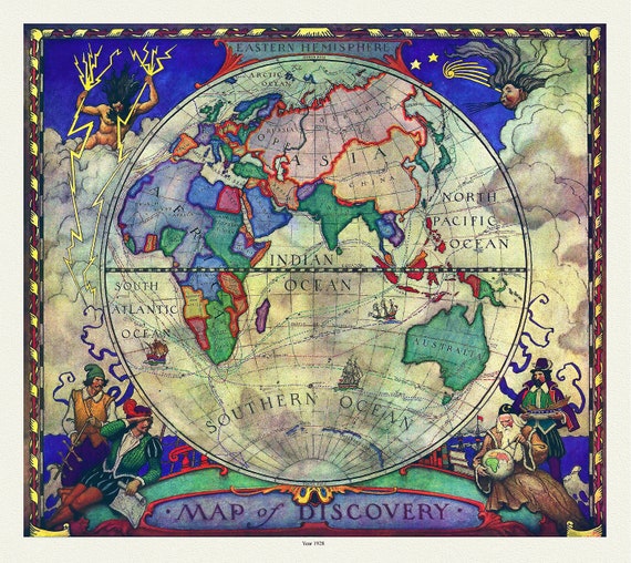 A Map of Discovery, Eastern Hemisphere, 1928, map on heavy cotton canvas, 20x25" approx.
$41.37
A Map of Discovery, Eastern Hemisphere, 1928, map on heavy cotton canvas, 20x25" approx.
$41.37
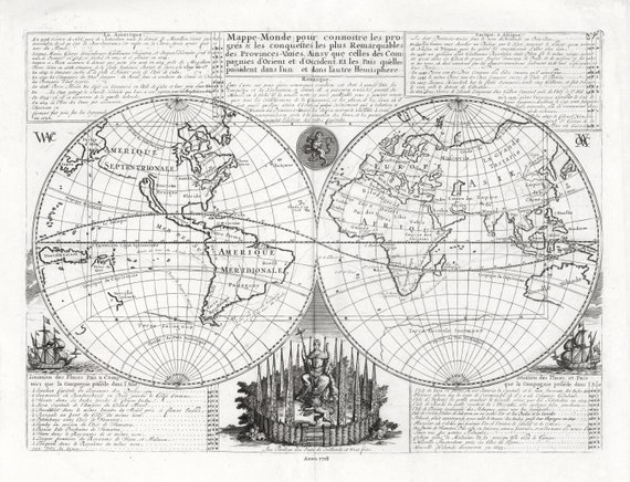
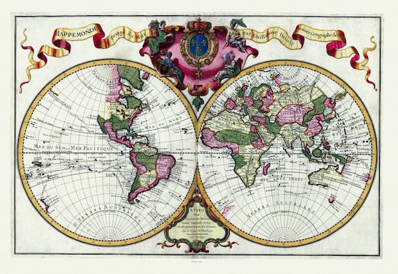 Guillaume Delisle, Mappemonde a l'usage du Roy, 1720 Ver. A, Map on heavy cotton canvas, 22x27in. approx.
$41.37
Guillaume Delisle, Mappemonde a l'usage du Roy, 1720 Ver. A, Map on heavy cotton canvas, 22x27in. approx.
$41.37
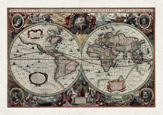
 Coronelli, Nova Totius Terrarum Orbis Geographica, 1606 Ver. D ,Map on heavy cotton canvas, 22x27in. approx.
$41.37
Coronelli, Nova Totius Terrarum Orbis Geographica, 1606 Ver. D ,Map on heavy cotton canvas, 22x27in. approx.
$41.37
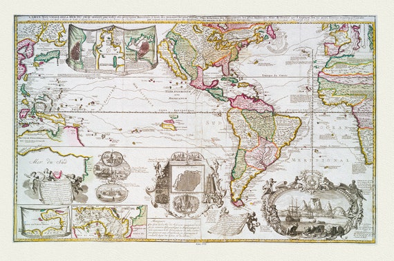 Leth, Carte Nouvelle de la Mer du Sud dressèe par ordre des principaux directeurs, 1730 ,Map on heavy cotton canvas, 22x27in. approx.
$41.37
Leth, Carte Nouvelle de la Mer du Sud dressèe par ordre des principaux directeurs, 1730 ,Map on heavy cotton canvas, 22x27in. approx.
$41.37
 J.W. Clement Co., The World, Mercator Projection,1943 ,Map on heavy cotton canvas, 22x27in. approx.
$41.37
J.W. Clement Co., The World, Mercator Projection,1943 ,Map on heavy cotton canvas, 22x27in. approx.
$41.37
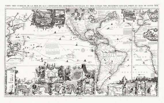 Henri Chatelain, Tome VI. No. 30. Page 117. Carte tres Curieuse de la Mer du Sud. North and South sheets, 1719
$41.37
Henri Chatelain, Tome VI. No. 30. Page 117. Carte tres Curieuse de la Mer du Sud. North and South sheets, 1719
$41.37
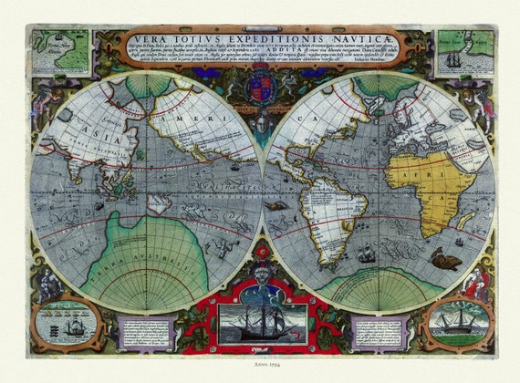 Hondius, Vera totius expeditionis nauticæ, descriptio D. Franc, 1595, Map on heavy cotton canvas, 22x27in. approx.
$41.37
Hondius, Vera totius expeditionis nauticæ, descriptio D. Franc, 1595, Map on heavy cotton canvas, 22x27in. approx.
$41.37
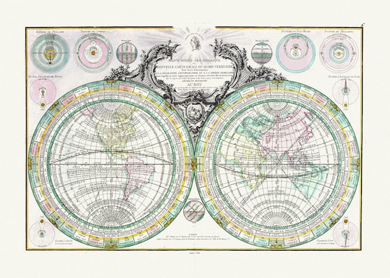 Lattre, (Jean, 1743 -1793), Mappe-Monde Geo Spherique, 1760, Map on heavy cotton canvas, 22x27in. approx.
$41.37
Lattre, (Jean, 1743 -1793), Mappe-Monde Geo Spherique, 1760, Map on heavy cotton canvas, 22x27in. approx.
$41.37
 Hondius, Terrarum Orbis, 1640, Map on heavy cotton canvas, 22x27in. approx.
$41.37
Hondius, Terrarum Orbis, 1640, Map on heavy cotton canvas, 22x27in. approx.
$41.37
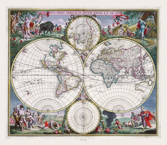 Wit, Nova Orbis Tabula, in Lucem Edita,1682, Map on heavy cotton canvas, 22x27in. approx.
$41.37
Wit, Nova Orbis Tabula, in Lucem Edita,1682, Map on heavy cotton canvas, 22x27in. approx.
$41.37
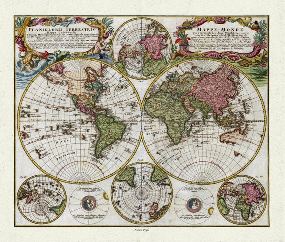 Homann, Mappe-Monde, 1746, Map on heavy cotton canvas, 22x27in. approx.
$41.37
Homann, Mappe-Monde, 1746, Map on heavy cotton canvas, 22x27in. approx.
$41.37
 Henri Chatelain-Tome I. No. 46. Mappe-monde, 1718, Map on heavy cotton canvas, 22x27in. approx.
$41.37
Henri Chatelain-Tome I. No. 46. Mappe-monde, 1718, Map on heavy cotton canvas, 22x27in. approx.
$41.37
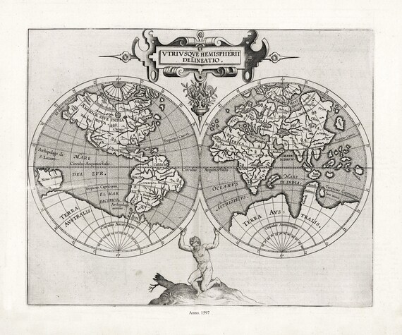 Wytfliet et Magini, Utriusque hemispherii delineatio, 1597, Map on heavy cotton canvas, 22x27in. approx.
$41.37
Wytfliet et Magini, Utriusque hemispherii delineatio, 1597, Map on heavy cotton canvas, 22x27in. approx.
$41.37
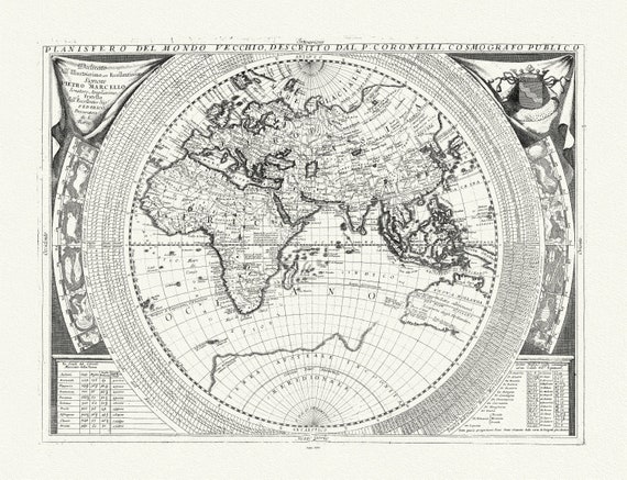 Coronelli, Planisfero del Mondo Vecchio, 1693, Map on heavy cotton canvas, 22x27in. approx.
$41.37
Coronelli, Planisfero del Mondo Vecchio, 1693, Map on heavy cotton canvas, 22x27in. approx.
$41.37
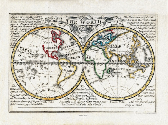 Bowen, The World, 1758, Map on heavy cotton canvas, 22x27in. approx.
$41.37
Bowen, The World, 1758, Map on heavy cotton canvas, 22x27in. approx.
$41.37
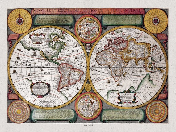 Boisseau, Nouvelle Exacte Description de la Terre Universelle, 1646 D, Map on heavy cotton canvas, 22x27in. approx.
$41.37
Boisseau, Nouvelle Exacte Description de la Terre Universelle, 1646 D, Map on heavy cotton canvas, 22x27in. approx.
$41.37
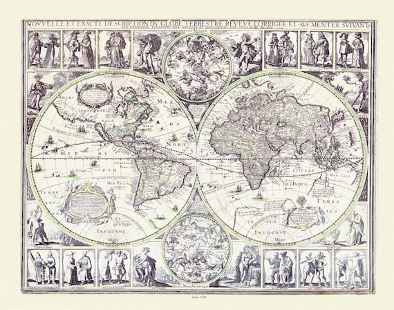 Blaue, Nouvelle et Exacte description du Globe Terrestre, 1645, Map on heavy cotton canvas, 22x27in. approx.
$41.37
Blaue, Nouvelle et Exacte description du Globe Terrestre, 1645, Map on heavy cotton canvas, 22x27in. approx.
$41.37
 Berey, Un Charte universelle de tout le monde, 1650, Map on heavy cotton canvas, 22x27in. approx.
$41.37
Berey, Un Charte universelle de tout le monde, 1650, Map on heavy cotton canvas, 22x27in. approx.
$41.37
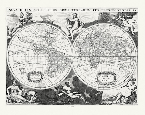 Aa, (Pieter va der, ), Nova Delineatio Totius Orbis Terrarum, 1703, Map on heavy cotton canvas, 22x27in. approx.
$41.37
Aa, (Pieter va der, ), Nova Delineatio Totius Orbis Terrarum, 1703, Map on heavy cotton canvas, 22x27in. approx.
$41.37