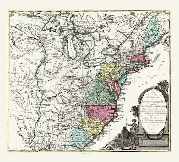
 Lotter, Carte de la nouvelle république de lʾAmérique ou les treize Provinces Unies, 1778 , map on heavy cotton canvas, 22x27" approx.
$45.54
Lotter, Carte de la nouvelle république de lʾAmérique ou les treize Provinces Unies, 1778 , map on heavy cotton canvas, 22x27" approx.
$45.54
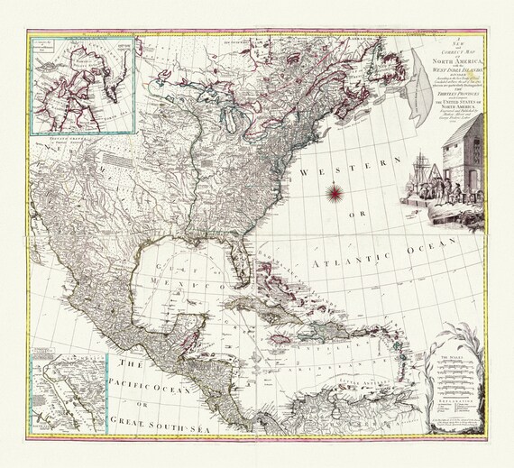 A map of North America with the West India Islands, Divided according to the Treaty of Peace, concluded at Paris Jan., 1783,canvas 22x27"
$45.54
A map of North America with the West India Islands, Divided according to the Treaty of Peace, concluded at Paris Jan., 1783,canvas 22x27"
$45.54
 Mercator, Atlas Cosmographicae, Americae Nova Tabula, 1574 ,Map on heavy cotton canvas, 22x27in. approx.
$45.54
Mercator, Atlas Cosmographicae, Americae Nova Tabula, 1574 ,Map on heavy cotton canvas, 22x27in. approx.
$45.54
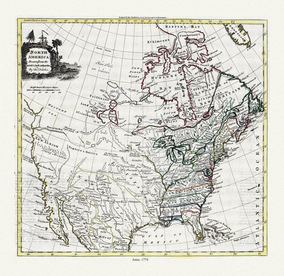 Guthrie et Kitchin, North America, 1774 , map on heavy cotton canvas, 22x27" approx.
$45.54
Guthrie et Kitchin, North America, 1774 , map on heavy cotton canvas, 22x27" approx.
$45.54
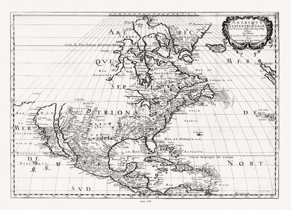
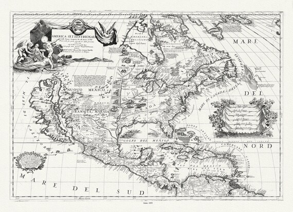 Coronelli (Vicenzo 1650-1718), America Settentrionale, 1693, map on heavy cotton canvas, 22x27" approx.
$45.54
Coronelli (Vicenzo 1650-1718), America Settentrionale, 1693, map on heavy cotton canvas, 22x27" approx.
$45.54
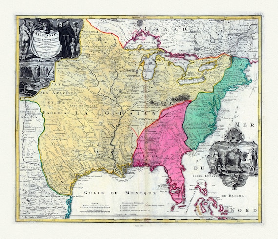 Hennepin, Amplissima regionis Mississipi, Francisc Riviere Mississippi in America septentrionali, 1687, map on heavy cotton canvas, 22x27"
$45.54
Hennepin, Amplissima regionis Mississipi, Francisc Riviere Mississippi in America septentrionali, 1687, map on heavy cotton canvas, 22x27"
$45.54
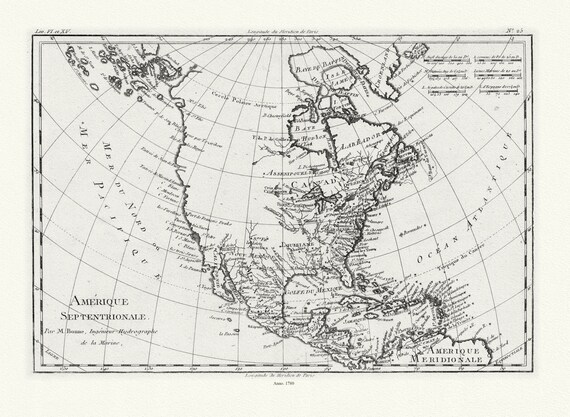
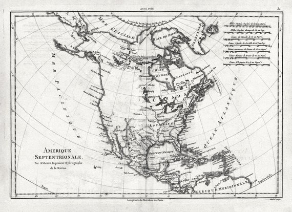 Bonne, Amérique septentrionale, 1788 , map on heavy cotton canvas, 22x27" approx.
$45.54
Bonne, Amérique septentrionale, 1788 , map on heavy cotton canvas, 22x27" approx.
$45.54
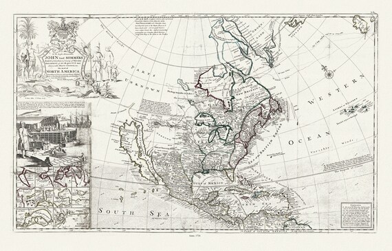
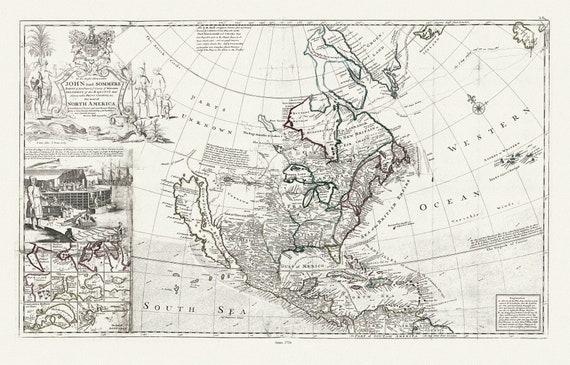 Bowles, Moll et Virtue, This map of North America, according to ye newest and most exact observations, 1712 , map on heavy canvas, 22x27"
$45.54
Bowles, Moll et Virtue, This map of North America, according to ye newest and most exact observations, 1712 , map on heavy canvas, 22x27"
$45.54
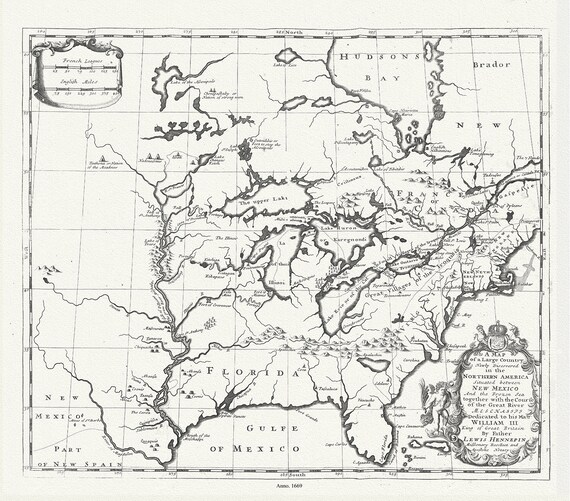 Map of a Large Country Newly Discovered in the Northern America Situated between New Mexico And the Frozen Sea, Hennepin,1698
$45.54
Map of a Large Country Newly Discovered in the Northern America Situated between New Mexico And the Frozen Sea, Hennepin,1698
$45.54
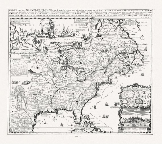 Henri Chatelain, Carte de la Nouvelle France, ou se voit le cours des grandes rivieres de S. Laurens & de Mississipi, 1719 ,canvas, 22x27"
$45.54
Henri Chatelain, Carte de la Nouvelle France, ou se voit le cours des grandes rivieres de S. Laurens & de Mississipi, 1719 ,canvas, 22x27"
$45.54
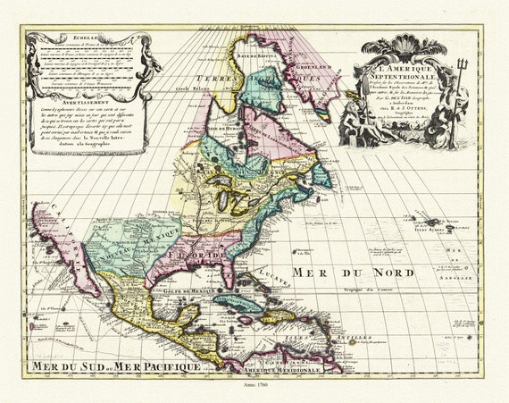 L'Amérique septentrionale. Dressée sur les observations de mrs. de l'Academie royale des sciences. & quelques autres, 1760, on canvas,22x27"
$45.54
L'Amérique septentrionale. Dressée sur les observations de mrs. de l'Academie royale des sciences. & quelques autres, 1760, on canvas,22x27"
$45.54
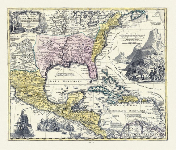 Regni Mexicani seu Novæ Hispaniæ, Ludovicianæ, N. Angliæ, Carolinæ, Virginæ et Pensylvaniæ in America Septentrionali, 1759 canvas 22x27"
$45.54
Regni Mexicani seu Novæ Hispaniæ, Ludovicianæ, N. Angliæ, Carolinæ, Virginæ et Pensylvaniæ in America Septentrionali, 1759 canvas 22x27"
$45.54
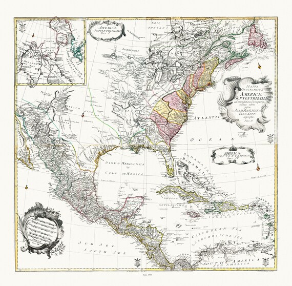 Euler, Sauerbrey et Rhode, Composite map Mappa geographica Americae Septentrionalis pars I-IV, 1753 , on heavy cotton canvas, 22x27" approx.
$45.54
Euler, Sauerbrey et Rhode, Composite map Mappa geographica Americae Septentrionalis pars I-IV, 1753 , on heavy cotton canvas, 22x27" approx.
$45.54
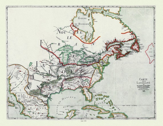 Franquelin (1850), Carte de la Louisiane ou des voyages du Sr. De La Salle, 1684 Ver. 1 , map on heavy cotton canvas, 22x27" approx.
$45.54
Franquelin (1850), Carte de la Louisiane ou des voyages du Sr. De La Salle, 1684 Ver. 1 , map on heavy cotton canvas, 22x27" approx.
$45.54
 Mariette et Sanson, Amérique septentrionale, 1650 , map on heavy cotton canvas, 22x27" approx
$45.54
Mariette et Sanson, Amérique septentrionale, 1650 , map on heavy cotton canvas, 22x27" approx
$45.54
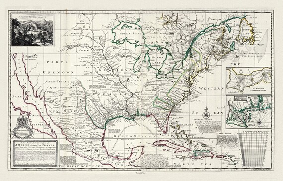 Moll, Parts of America Claimed by France, 1720, map on heavy cotton canvas, 22x27" approx.
$45.54
Moll, Parts of America Claimed by France, 1720, map on heavy cotton canvas, 22x27" approx.
$45.54
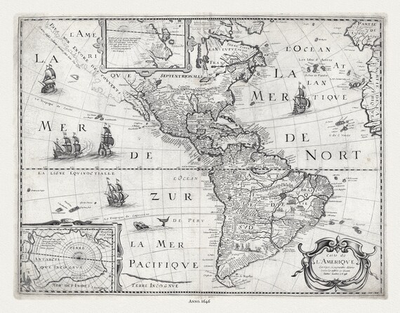 Pierre-Jean Mariette, Carte de l'Amerique, 1646
$45.54
Pierre-Jean Mariette, Carte de l'Amerique, 1646
$45.54
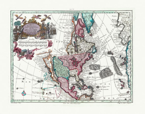 Blaeu et Weyermann, Novus Orbis Sive America Meridionalis Et Septentrionalis, 1744, map on heavy cotton canvas, 22x27" approx.
$45.54
Blaeu et Weyermann, Novus Orbis Sive America Meridionalis Et Septentrionalis, 1744, map on heavy cotton canvas, 22x27" approx.
$45.54
 Bonne, Amérique septentrionale, 1780, map on heavy cotton canvas, 22x27" approx.
$45.54
Bonne, Amérique septentrionale, 1780, map on heavy cotton canvas, 22x27" approx.
$45.54
 Bowles, This map of North America, according to ye newest and most exact observations, 1712 , map on heavy cotton canvas, 22x27" approx.
$45.54
Bowles, This map of North America, according to ye newest and most exact observations, 1712 , map on heavy cotton canvas, 22x27" approx.
$45.54