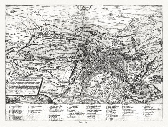
 Gastaldi, Rome, Italy, 1561, map on heavy cotton canvas, 22x27" approx.
$33.98
Gastaldi, Rome, Italy, 1561, map on heavy cotton canvas, 22x27" approx.
$33.98
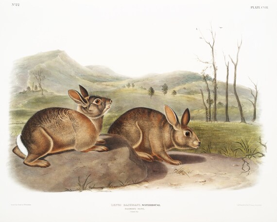 J.J. Audobon, Bachman's Hare (Lepus Bachmani) from the viviparous quadrupeds of North America (1845) , print , 50 x 70 cm, 20 x 25" approx.
$33.98
J.J. Audobon, Bachman's Hare (Lepus Bachmani) from the viviparous quadrupeds of North America (1845) , print , 50 x 70 cm, 20 x 25" approx.
$33.98
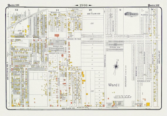 Plate 106, Toronto East, Leslieville and North, 1910 , map on heavy cotton canvas, 20 x 30" approx.
$33.98
Plate 106, Toronto East, Leslieville and North, 1910 , map on heavy cotton canvas, 20 x 30" approx.
$33.98
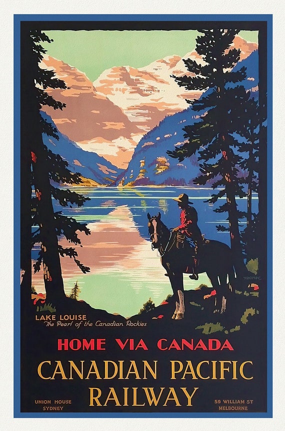 Lake Louise, Heart of the Canadian Rockies, travel poster on heavy cotton canvas, 50 x 70 cm, 20 x 25" approx.
$33.98
Lake Louise, Heart of the Canadian Rockies, travel poster on heavy cotton canvas, 50 x 70 cm, 20 x 25" approx.
$33.98
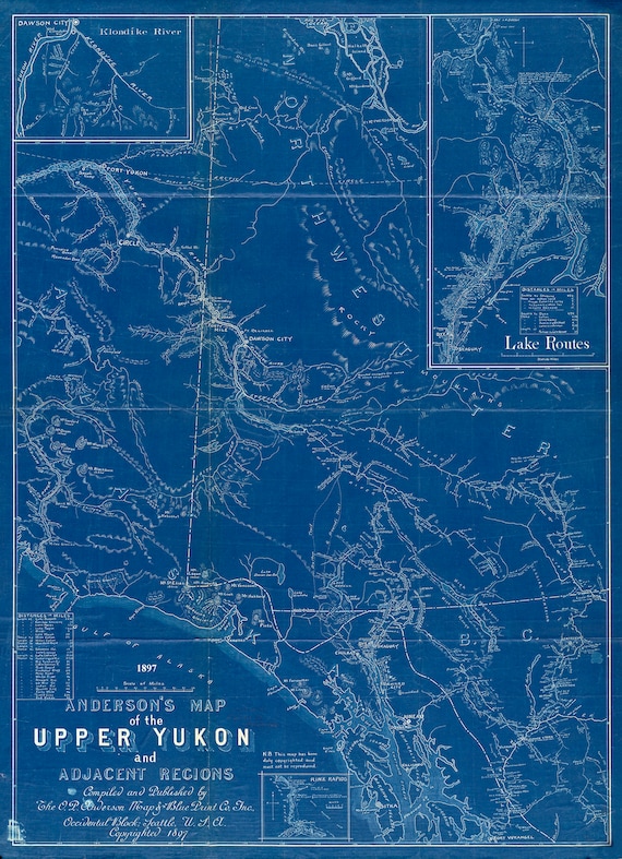 Anderson's map of the Upper Yukon and adjacent regions, 1897, Cyanotype map on durable cotton canvas, 50 x 70 cm, 20 x 25" approx.
$33.98
Anderson's map of the Upper Yukon and adjacent regions, 1897, Cyanotype map on durable cotton canvas, 50 x 70 cm, 20 x 25" approx.
$33.98
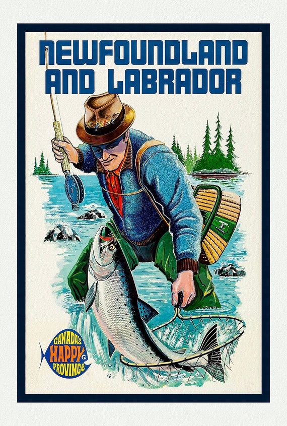 Newfoundland and Labrador, Canada's Happy Province, Ver. I , vintage print on canvas, 50 x 70 cm, 20 x 25" approx.
$33.98
Newfoundland and Labrador, Canada's Happy Province, Ver. I , vintage print on canvas, 50 x 70 cm, 20 x 25" approx.
$33.98
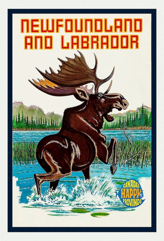 Newfoundland and Labrador, Canada's Happy Province, Ver. II, vintage print on canvas, 50 x 70 cm, 20 x 25" approx.
$33.98
Newfoundland and Labrador, Canada's Happy Province, Ver. II, vintage print on canvas, 50 x 70 cm, 20 x 25" approx.
$33.98
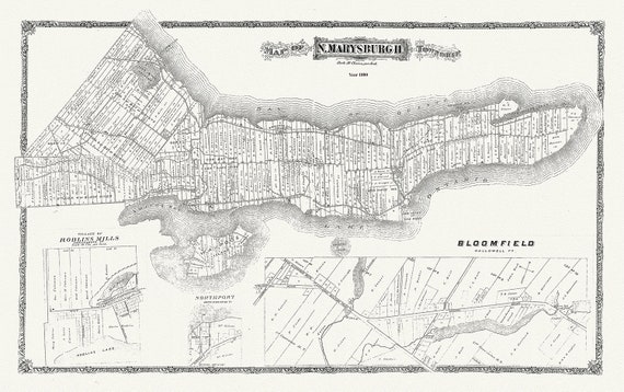 Map of Marysburgh Township, Prince Edward County, 1880 , map on heavy cotton canvas, 45 x 65 cm, 18 x 24" approx.
$33.98
Map of Marysburgh Township, Prince Edward County, 1880 , map on heavy cotton canvas, 45 x 65 cm, 18 x 24" approx.
$33.98
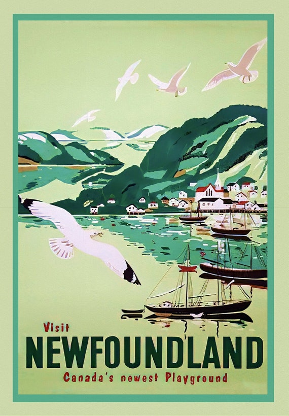 Visit Newfoundland Canada, 1965, vintage print on canvas, 50 x 70 cm, 20 x 25" approx.
$33.98
Visit Newfoundland Canada, 1965, vintage print on canvas, 50 x 70 cm, 20 x 25" approx.
$33.98
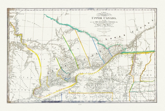 Ontario: Upper Canada describing new settlements, townships, countries from Quebec to Lake Huron, Wyld auth., 1838 ,canvas, 20 x 25" approx.
$33.98
Ontario: Upper Canada describing new settlements, townships, countries from Quebec to Lake Huron, Wyld auth., 1838 ,canvas, 20 x 25" approx.
$33.98
 Plate 131, Toronto North of Blythewood, 1923, Map on heavy cotton canvas, 18x27in. approx.
$33.98
Plate 131, Toronto North of Blythewood, 1923, Map on heavy cotton canvas, 18x27in. approx.
$33.98
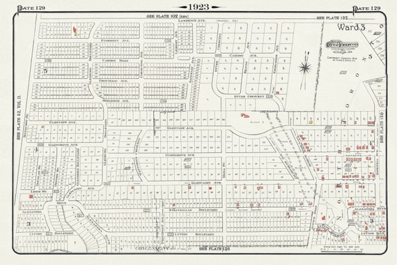 Plate 129, Toronto North, South of Lawrence Ave., 1923, Map on heavy cotton canvas, 18x27in. approx.
$33.98
Plate 129, Toronto North, South of Lawrence Ave., 1923, Map on heavy cotton canvas, 18x27in. approx.
$33.98
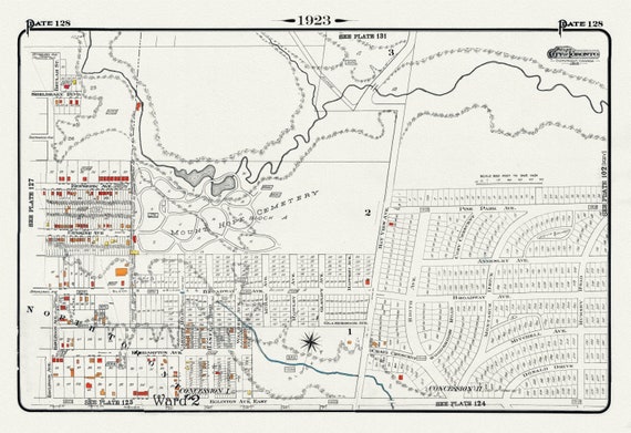 Plate 128, Toronto Uptown East, Leaside, Mount Hope Cemetery, 1923, Map on heavy cotton canvas, 18x27in. approx.
$33.98
Plate 128, Toronto Uptown East, Leaside, Mount Hope Cemetery, 1923, Map on heavy cotton canvas, 18x27in. approx.
$33.98
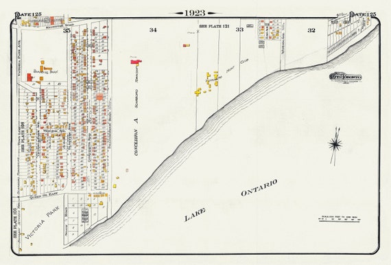 Plate 125, Toronto East, Waterfront, Beach & Hunt Club, 1923, Map on heavy cotton canvas, 18x27in. approx.
$33.98
Plate 125, Toronto East, Waterfront, Beach & Hunt Club, 1923, Map on heavy cotton canvas, 18x27in. approx.
$33.98
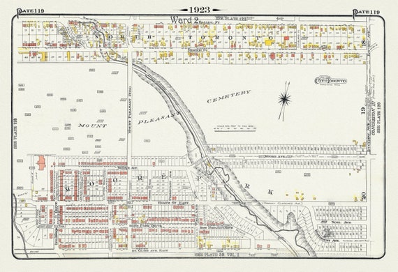 Plate 119, Toronto Uptown, Moore Park & Mount Pleasant, 1923, Map on heavy cotton canvas, 18x27in. approx.
$33.98
Plate 119, Toronto Uptown, Moore Park & Mount Pleasant, 1923, Map on heavy cotton canvas, 18x27in. approx.
$33.98
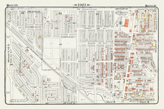 Plate 122, Toronto North, South of Eglinton Avenue, 1923, Map on heavy cotton canvas, 18x27in. approx.
$33.98
Plate 122, Toronto North, South of Eglinton Avenue, 1923, Map on heavy cotton canvas, 18x27in. approx.
$33.98
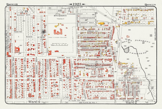 Plate 118, Toronto Uptown, Upper Canada College, Mount Pleasant, 1923, Map on heavy cotton canvas, 18x27in. approx.
$33.98
Plate 118, Toronto Uptown, Upper Canada College, Mount Pleasant, 1923, Map on heavy cotton canvas, 18x27in. approx.
$33.98
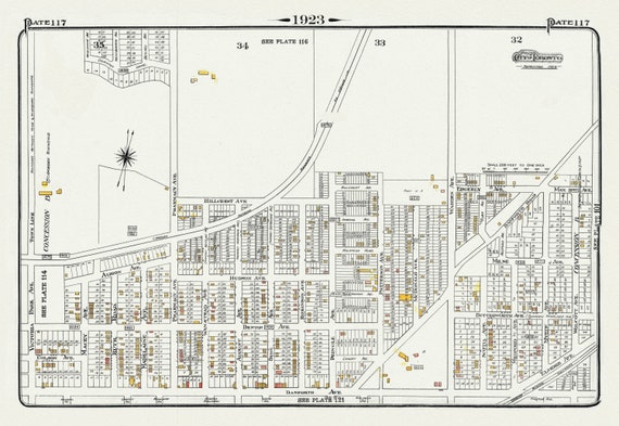 Plate 117, Toronto East, Scarborough, Pharmacy Avenue North of Danforth Avenue, 1923, Map on heavy cotton canvas, 18x27in. approx.
$33.98
Plate 117, Toronto East, Scarborough, Pharmacy Avenue North of Danforth Avenue, 1923, Map on heavy cotton canvas, 18x27in. approx.
$33.98
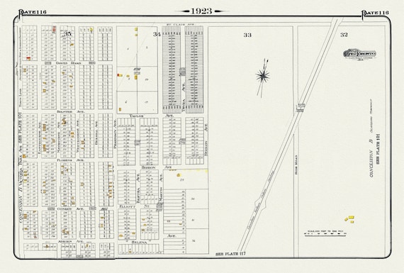 Plate 116, Toronto East, Scarborough, Pharmacy Ave., South of St. Clair, 1923, Map on heavy cotton canvas, 18x27in. approx.
$33.98
Plate 116, Toronto East, Scarborough, Pharmacy Ave., South of St. Clair, 1923, Map on heavy cotton canvas, 18x27in. approx.
$33.98
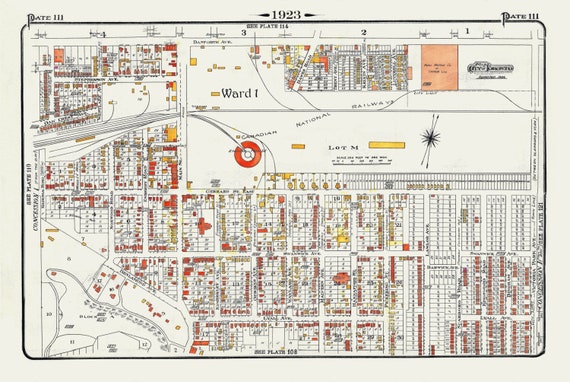 Plate 111, Toronto East York, Main St. South of Danforth Ave., 1923, Map on heavy cotton canvas, 18x27in. approx.
$33.98
Plate 111, Toronto East York, Main St. South of Danforth Ave., 1923, Map on heavy cotton canvas, 18x27in. approx.
$33.98