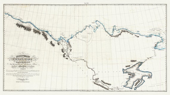
 Discoveries of the expedition under the command of Captain Franklin R.N. near the mouth of the Mackenzie River, 1828 map, 20 x 36" approx.
$33.98
Discoveries of the expedition under the command of Captain Franklin R.N. near the mouth of the Mackenzie River, 1828 map, 20 x 36" approx.
$33.98
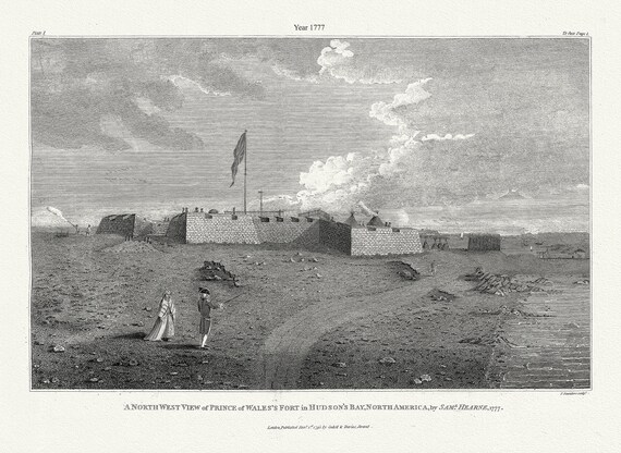 A north west view of Prince of Wales's Fort in Hudson's Bay, North America, Saml. Hearne auth., 1777, .50 x 70 cm, 20 x 25" approx.
$33.98
A north west view of Prince of Wales's Fort in Hudson's Bay, North America, Saml. Hearne auth., 1777, .50 x 70 cm, 20 x 25" approx.
$33.98
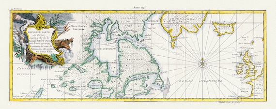 Nouvelle carte des parties, oul'on a cherche le passage de nord-ouest dans les anneees 1746 et 1747, Ellis auth 20x50" approx.
$52.85
Nouvelle carte des parties, oul'on a cherche le passage de nord-ouest dans les anneees 1746 et 1747, Ellis auth 20x50" approx.
$52.85
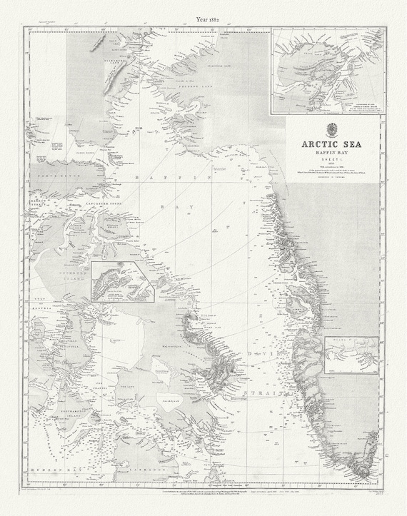 Arctic Sea. Baffin Bay, sheet 1 to 1853, with corrections to 1881, map on durable cotton canvas, 50 x 70 cm, 20 x 25" approx.
$33.98
Arctic Sea. Baffin Bay, sheet 1 to 1853, with corrections to 1881, map on durable cotton canvas, 50 x 70 cm, 20 x 25" approx.
$33.98
 Outline to shew the Connected Discoveries of Captains Ross, Parry & Franklin, in the years 1818, 19, 20 and 21.20x35, 20 x 25" approx.
$33.98
Outline to shew the Connected Discoveries of Captains Ross, Parry & Franklin, in the years 1818, 19, 20 and 21.20x35, 20 x 25" approx.
$33.98
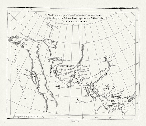 The communication of the lakes and the rivers between Lake Superior and Slave Lake in North America,1790, Pond auth.20x25" approx
$33.98
The communication of the lakes and the rivers between Lake Superior and Slave Lake in North America,1790, Pond auth.20x25" approx
$33.98
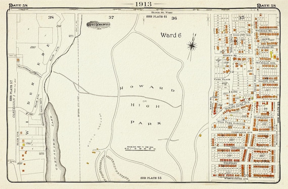 Plate 58, Toronto West, High Park, 1913, map on heavy cotton canvas, 20 x 30" approx.
$33.98
Plate 58, Toronto West, High Park, 1913, map on heavy cotton canvas, 20 x 30" approx.
$33.98
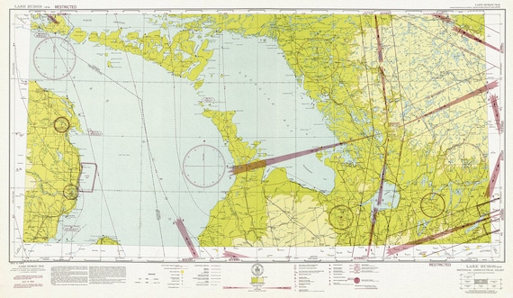 Aeronautical Chart, Ontario, Lake Huron Section, 1942, map on heavy cotton canvas, 20 x 27" approx.
$33.98
Aeronautical Chart, Ontario, Lake Huron Section, 1942, map on heavy cotton canvas, 20 x 27" approx.
$33.98
 Canada, by Air France, Travel Poster on heavy cotton canvas, 22x27" approx.
$33.98
Canada, by Air France, Travel Poster on heavy cotton canvas, 22x27" approx.
$33.98
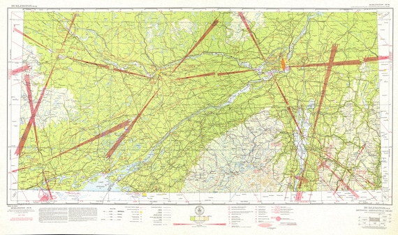 Aeronautical Chart, Ontario, South Eastern Section, 1942 , map on heavy cotton canvas, 20 x 27" approx.
$33.98
Aeronautical Chart, Ontario, South Eastern Section, 1942 , map on heavy cotton canvas, 20 x 27" approx.
$33.98
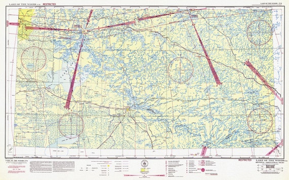 Aeronautical Chart, Ontario, Lake of the Woods Section, 1942, map on heavy cotton canvas, 20 x 27" approx.
$33.98
Aeronautical Chart, Ontario, Lake of the Woods Section, 1942, map on heavy cotton canvas, 20 x 27" approx.
$33.98
 Aeronautical Chart, Ontario, Lake Superior Section, 1942 , map on heavy cotton canvas, 20 x 27" approx.
$33.98
Aeronautical Chart, Ontario, Lake Superior Section, 1942 , map on heavy cotton canvas, 20 x 27" approx.
$33.98
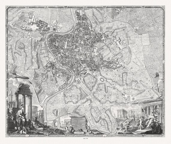 Nolli et Pozzi, Nuova Topografia Di Roma, 1748map on heavy cotton canvas, 25x27" approx.
$33.98
Nolli et Pozzi, Nuova Topografia Di Roma, 1748map on heavy cotton canvas, 25x27" approx.
$33.98
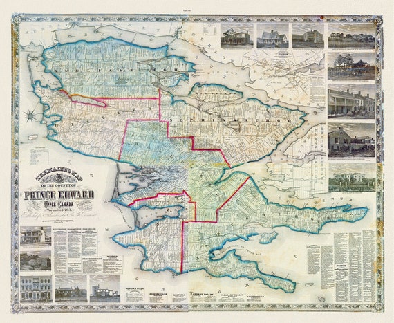 Prince Edward County, 1863, Tremaine auth., 1863, map on heavy cotton canvas, 50 x 70cm, 20 x 25" approx.
$33.98
Prince Edward County, 1863, Tremaine auth., 1863, map on heavy cotton canvas, 50 x 70cm, 20 x 25" approx.
$33.98
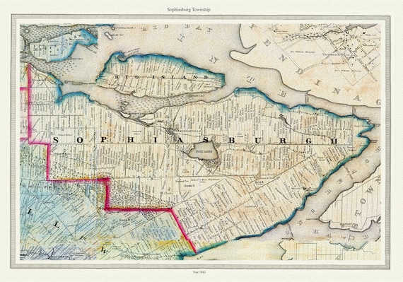 Township of Sophiasburg in Prince Edward County, Tremaine auth., 1863, map on heavy cotton canvas, 45 x 65 cm, 18 x 24" approx.
$33.98
Township of Sophiasburg in Prince Edward County, Tremaine auth., 1863, map on heavy cotton canvas, 45 x 65 cm, 18 x 24" approx.
$33.98
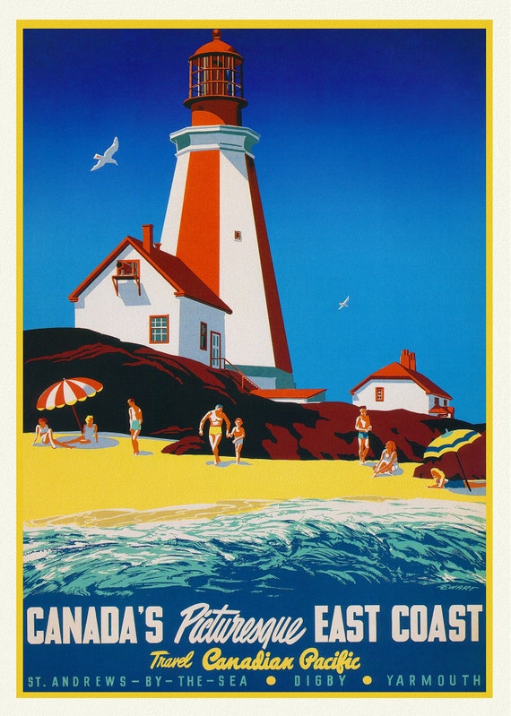 Canada's Picturesque East Coast, Travel Canadian Pacific , travel poster on heavy cotton canvas, 20x25" approx.
$33.98
Canada's Picturesque East Coast, Travel Canadian Pacific , travel poster on heavy cotton canvas, 20x25" approx.
$33.98
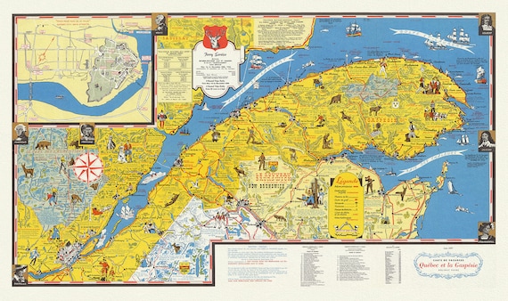 Quebec: Carte de vacanes, Quebec et la Gaspesie Holiday guide, 1959, map on heavy cotton canvas, 22x27" approx.
$33.98
Quebec: Carte de vacanes, Quebec et la Gaspesie Holiday guide, 1959, map on heavy cotton canvas, 22x27" approx.
$33.98
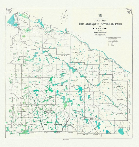 Historic Algonquin Park Map, 1914, map on heavy cotton canvas, 20x27" approx
$33.98
Historic Algonquin Park Map, 1914, map on heavy cotton canvas, 20x27" approx
$33.98
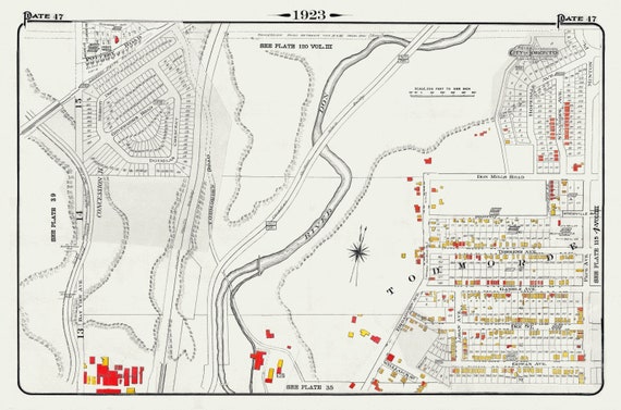 Plate 47, Toronto East York, Todmorden, 1923, Map on heavy cotton canvas, 18x27in. approx.
$33.98
Plate 47, Toronto East York, Todmorden, 1923, Map on heavy cotton canvas, 18x27in. approx.
$33.98
 Plate 41, Toronto West, Junction Triangle, 1903, map on heavy cotton canvas, 20 x 30", 50 x 76cm, approx.
$33.98
Plate 41, Toronto West, Junction Triangle, 1903, map on heavy cotton canvas, 20 x 30", 50 x 76cm, approx.
$33.98