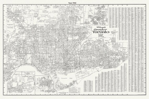
 Lloyd's Map of Greater Toronto, 1942, Lloyd's Map, , map on durable cotton canvas, 50 x 70 cm, 20 x 25" approx.
$33.94
Lloyd's Map of Greater Toronto, 1942, Lloyd's Map, , map on durable cotton canvas, 50 x 70 cm, 20 x 25" approx.
$33.94
 Toronto Island, Plan of Park Improvement, 1903
$33.94
Toronto Island, Plan of Park Improvement, 1903
$33.94
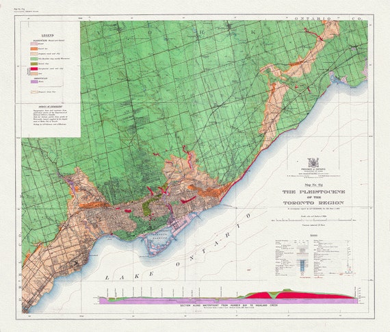 Toronto: Map of the Pleistocene of the Toronto Region, 1932 , map on heavy cotton canvas, 22x27" approx.
$33.94
Toronto: Map of the Pleistocene of the Toronto Region, 1932 , map on heavy cotton canvas, 22x27" approx.
$33.94
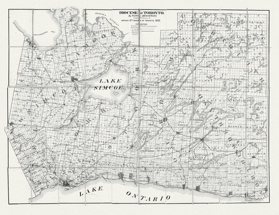 Toronto: Diocese of Toronto, 1883 , map on heavy cotton canvas, 22x27" approx.
$33.94
Toronto: Diocese of Toronto, 1883 , map on heavy cotton canvas, 22x27" approx.
$33.94
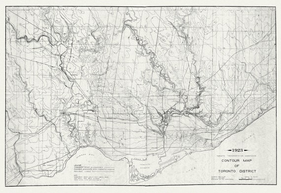 Toronto: Contour Map , 1923 , map on heavy cotton canvas, 22x27" approx.
$33.94
Toronto: Contour Map , 1923 , map on heavy cotton canvas, 22x27" approx.
$33.94
 Toronto: White et Canada Department of Interior, Toronto, 1906
$33.94
Toronto: White et Canada Department of Interior, Toronto, 1906
$33.94
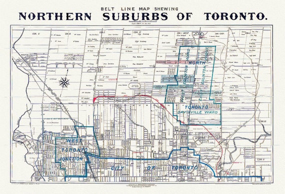 Toronto: Unwin Foster & Proudfoot, Beltline Map of Toronto, 1890
$33.94
Toronto: Unwin Foster & Proudfoot, Beltline Map of Toronto, 1890
$33.94
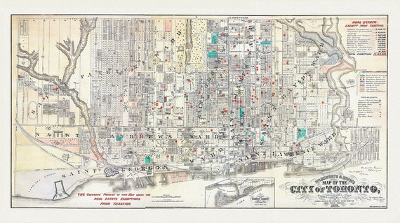 Toronto, Areas Exempt from Real Estate Taxation, 1878, map on heavy cotton canvas, 22x27" approx.
$33.94
Toronto, Areas Exempt from Real Estate Taxation, 1878, map on heavy cotton canvas, 22x27" approx.
$33.94
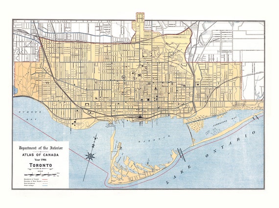
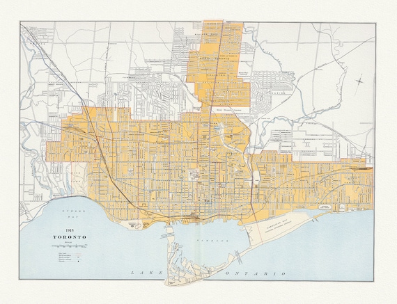 Toronto: Chalifour et Canada Department of the Interior, 1915 , map on heavy cotton canvas, 22x27" approx.
$33.94
Toronto: Chalifour et Canada Department of the Interior, 1915 , map on heavy cotton canvas, 22x27" approx.
$33.94
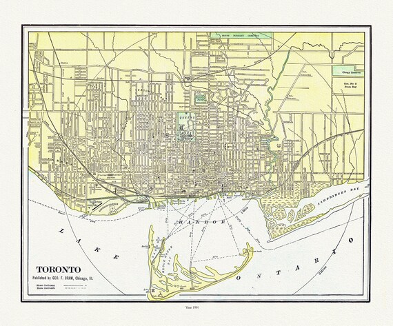 Toronto: Cram et Murray, 1901 , map on heavy cotton canvas, 22x27" approx.
$33.94
Toronto: Cram et Murray, 1901 , map on heavy cotton canvas, 22x27" approx.
$33.94
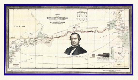 Map of The Submarine Atlantic Telegraph, on heavy canvas, 22x27" approx.
$33.94
Map of The Submarine Atlantic Telegraph, on heavy canvas, 22x27" approx.
$33.94
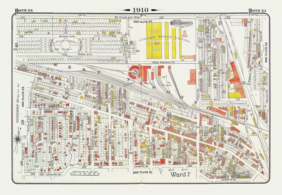 Plate 64, Toronto West, The Junction & Stockyards, 1910 , map on heavy cotton canvas, 20 x 30" approx.
$33.94
Plate 64, Toronto West, The Junction & Stockyards, 1910 , map on heavy cotton canvas, 20 x 30" approx.
$33.94
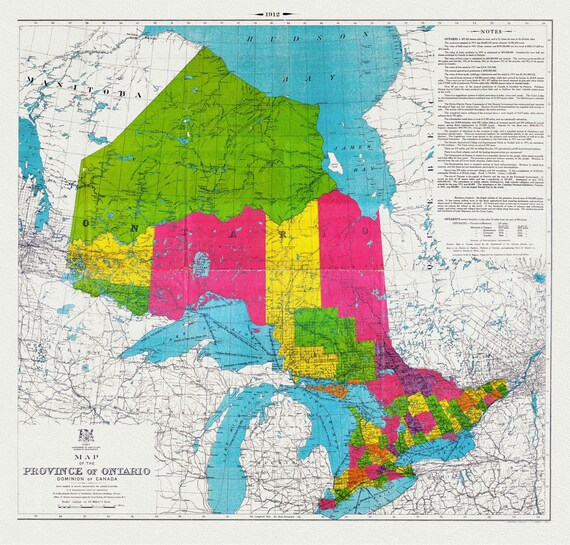 Map of the Province of Ontario, Dominion of Canada, 1912, map on heavy cotton canvas, 22x27" approx.
$33.94
Map of the Province of Ontario, Dominion of Canada, 1912, map on heavy cotton canvas, 22x27" approx.
$33.94
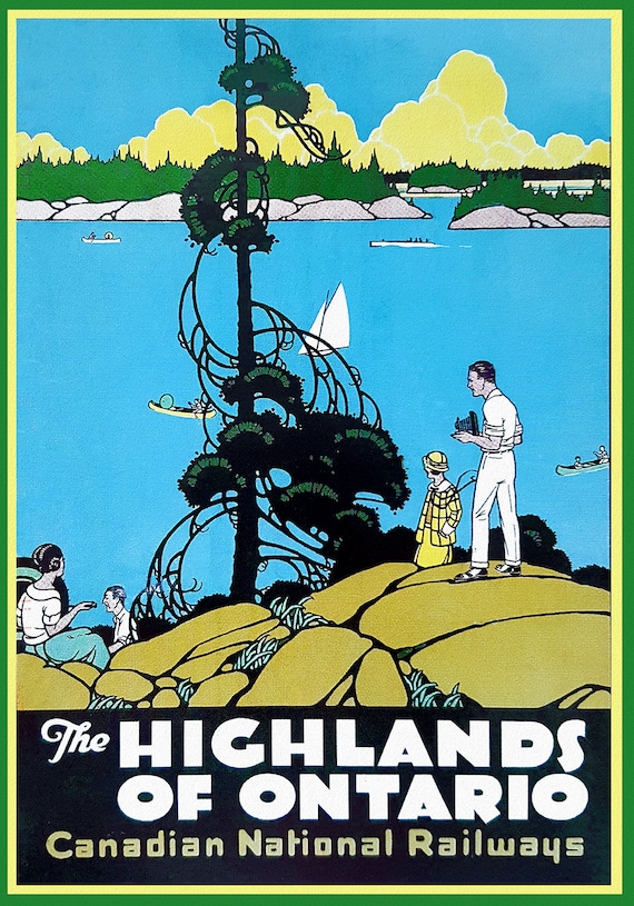 Highlands of Ontario, Travel Poster, Canadian National Railways, on heavy cotton canvas, 22x27" approx.
$33.94
Highlands of Ontario, Travel Poster, Canadian National Railways, on heavy cotton canvas, 22x27" approx.
$33.94
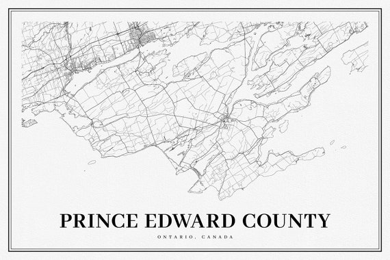 Ontario, Prince Edward County, A Modern Map, map on heavy cotton canvas, 50 x 70cm, 20 x 25" approx.
$33.94
Ontario, Prince Edward County, A Modern Map, map on heavy cotton canvas, 50 x 70cm, 20 x 25" approx.
$33.94
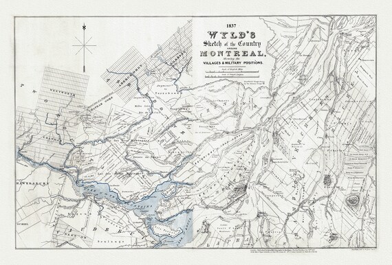 Wyld, A Sketch Map of the Country Around Montreal, 1837, , map on heavy cotton canvas, 20x27" approx
$33.94
Wyld, A Sketch Map of the Country Around Montreal, 1837, , map on heavy cotton canvas, 20x27" approx
$33.94
 The Great Lakes, Lodge, 1778, map on durable cotton canvas, 50 x 70 cm, 20 x 25" approx.
$33.94
The Great Lakes, Lodge, 1778, map on durable cotton canvas, 50 x 70 cm, 20 x 25" approx.
$33.94
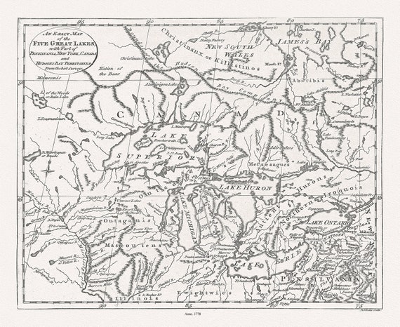
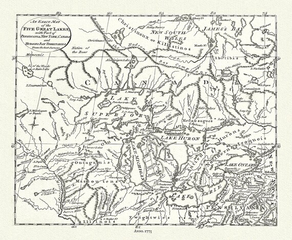 The 5 Great Lakes, Pincus auth.,1777, map on durable cotton canvas, 50 x 70 cm, 20 x 25" approx.
$33.94
The 5 Great Lakes, Pincus auth.,1777, map on durable cotton canvas, 50 x 70 cm, 20 x 25" approx.
$33.94
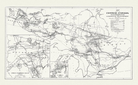 Map of Central Canada Showing Transportation and Commercial Development, 1927, map on durable cotton canvas, 50 x 70 cm, 20 x 25" approx.
$33.94
Map of Central Canada Showing Transportation and Commercial Development, 1927, map on durable cotton canvas, 50 x 70 cm, 20 x 25" approx.
$33.94
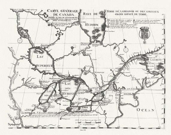 Carte Générale de Canada, Lahontan auth.,1703, map on durable cotton canvas, 50 x 70 cm, 20 x 25" approx.
$33.94
Carte Générale de Canada, Lahontan auth.,1703, map on durable cotton canvas, 50 x 70 cm, 20 x 25" approx.
$33.94