 Rand McNally & Company, Commercial Atlas, Newfoundland, 1924, Printed on Heavy Natural Cotton Canvas, approx. 20x24"
$30.17
Rand McNally & Company, Commercial Atlas, Newfoundland, 1924, Printed on Heavy Natural Cotton Canvas, approx. 20x24"
$30.17
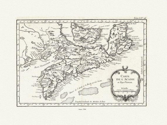 Bellin, Carte De L'Acadie et Pays Voisins, 1764 Ver. II , map on durable cotton canvas, 50 x 70 cm, 20 x 25" approx.
$33.94
Bellin, Carte De L'Acadie et Pays Voisins, 1764 Ver. II , map on durable cotton canvas, 50 x 70 cm, 20 x 25" approx.
$33.94
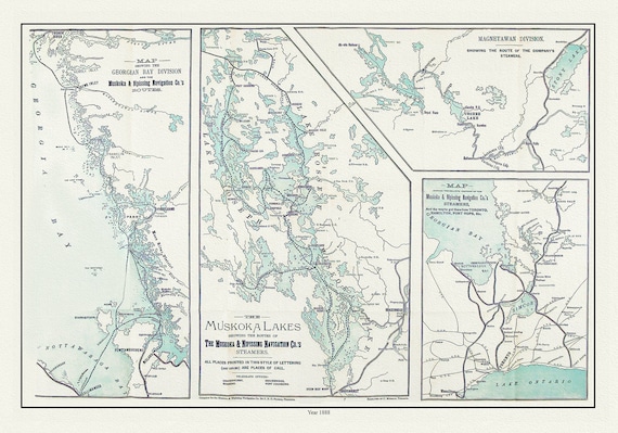 Muskoka Lakes, Guide to Steamer Routes, 1888 , map on durable cotton canvas, 50 x 70 cm, 20 x 25" approx.
$33.94
Muskoka Lakes, Guide to Steamer Routes, 1888 , map on durable cotton canvas, 50 x 70 cm, 20 x 25" approx.
$33.94
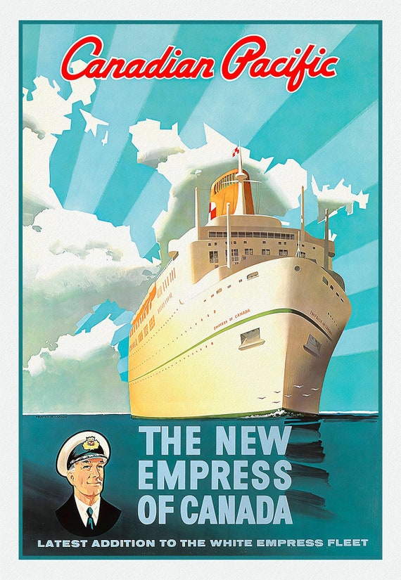 Canadian Pacific, The New Empress of Canada, travel poster reprinted on durable cotton canvas, 50 x 70 cm, 20 x 25" approx.
$33.94
Canadian Pacific, The New Empress of Canada, travel poster reprinted on durable cotton canvas, 50 x 70 cm, 20 x 25" approx.
$33.94
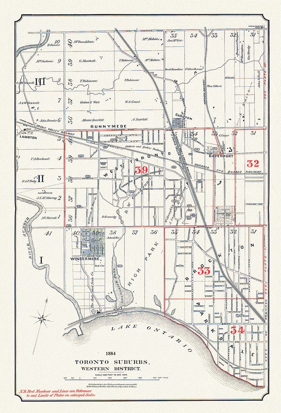 Toronto Suburbs, Western District, 1884, map on heavy cotton canvas, 20 x 30" or 50 x 75cm. approx.
$33.94
Toronto Suburbs, Western District, 1884, map on heavy cotton canvas, 20 x 30" or 50 x 75cm. approx.
$33.94
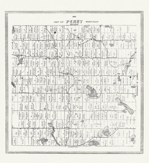 Muskoka-Haliburton, Perry Township, 1893, map on heavy cotton canvas, 20 x 25" approx.
$33.94
Muskoka-Haliburton, Perry Township, 1893, map on heavy cotton canvas, 20 x 25" approx.
$33.94
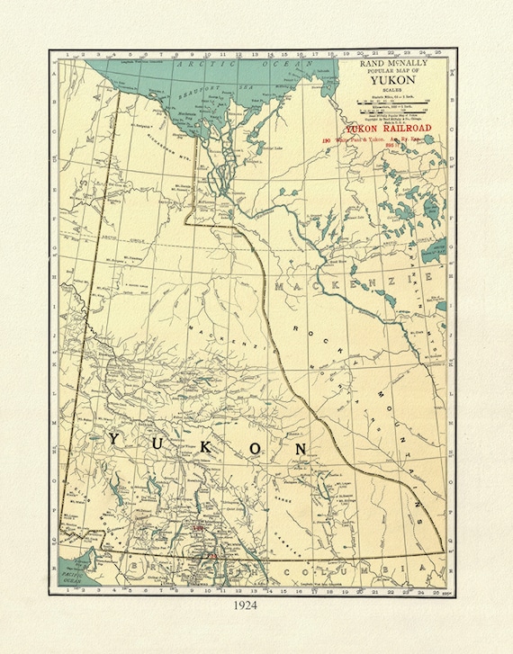 Map on heavy cotton canvas, Yukon, 1924, 27x22" approx.
$30.17
Map on heavy cotton canvas, Yukon, 1924, 27x22" approx.
$30.17
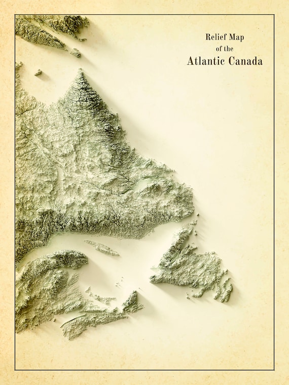 Relief Map of Atlantic Canada, 1924 Ver. IV , map on heavy cotton canvas, 50 x 70 cm, 20 x 25" approx.
$33.94
Relief Map of Atlantic Canada, 1924 Ver. IV , map on heavy cotton canvas, 50 x 70 cm, 20 x 25" approx.
$33.94
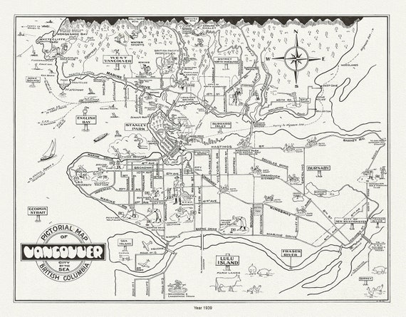 Vancouver, City by the Sea, A Pictorial Map, 1939 , on heavy cotton canvas, 45 x 65 cm, 18 x 24" approx.
$33.94
Vancouver, City by the Sea, A Pictorial Map, 1939 , on heavy cotton canvas, 45 x 65 cm, 18 x 24" approx.
$33.94
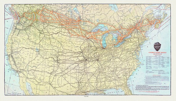 Map of Canadian Pacific Railway and Connecting Lines, 1912, on heavy cotton canvas, 20x27" approx.
$33.94
Map of Canadian Pacific Railway and Connecting Lines, 1912, on heavy cotton canvas, 20x27" approx.
$33.94
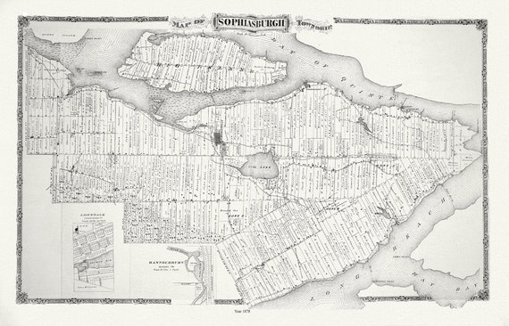 Sophiasburgh Township, Ont., 1878 , map on durable cotton canvas, 50 x 70 cm, 20 x 25" approx.
$33.94
Sophiasburgh Township, Ont., 1878 , map on durable cotton canvas, 50 x 70 cm, 20 x 25" approx.
$33.94
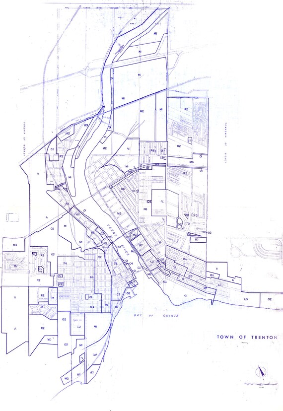 Trenton. Ont. A Planning and Development Map. 1960 , map on durable cotton canvas, 50 x 70 cm, 20 x 25" approx.
$33.94
Trenton. Ont. A Planning and Development Map. 1960 , map on durable cotton canvas, 50 x 70 cm, 20 x 25" approx.
$33.94
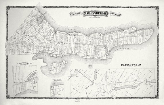 E Marysburg Township, Ontario, 1878 , map on durable cotton canvas, 50 x 70 cm, 20 x 25" approx.
$33.94
E Marysburg Township, Ontario, 1878 , map on durable cotton canvas, 50 x 70 cm, 20 x 25" approx.
$33.94
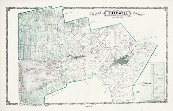 Hallowell Township, Ont., 1878 , map on durable cotton canvas, 50 x 70 cm, 20 x 25" approx.
$33.94
Hallowell Township, Ont., 1878 , map on durable cotton canvas, 50 x 70 cm, 20 x 25" approx.
$33.94
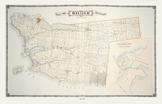 Hillier Township, Ont., 1878 , map on durable cotton canvas, 50 x 70 cm, 20 x 25" approx.
$33.94
Hillier Township, Ont., 1878 , map on durable cotton canvas, 50 x 70 cm, 20 x 25" approx.
$33.94
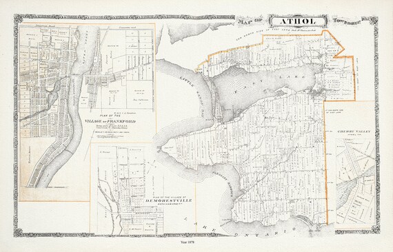 Athol Township, Ont., 1878, map on durable cotton canvas, 50 x 70 cm, 20 x 25" approx.
$33.94
Athol Township, Ont., 1878, map on durable cotton canvas, 50 x 70 cm, 20 x 25" approx.
$33.94
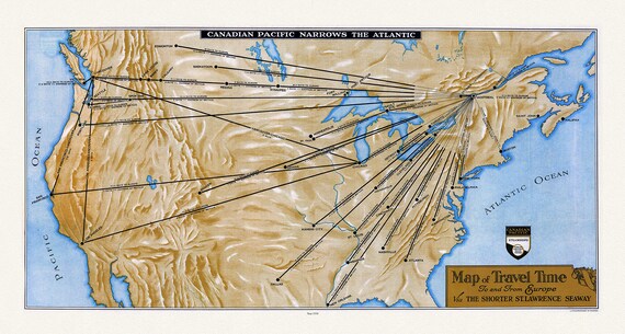 Canadian Pacific, Map of Travel Time To and From Europe Via the Shorter St. Lawrence Seaway, 1938, 20x27", Map on heavy cotton canvas
$33.94
Canadian Pacific, Map of Travel Time To and From Europe Via the Shorter St. Lawrence Seaway, 1938, 20x27", Map on heavy cotton canvas
$33.94
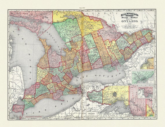 Rand, McNally & Co., Province of Ontario, 1892, map on heavy cotton canvas, 22x27" approx.
$33.94
Rand, McNally & Co., Province of Ontario, 1892, map on heavy cotton canvas, 22x27" approx.
$33.94
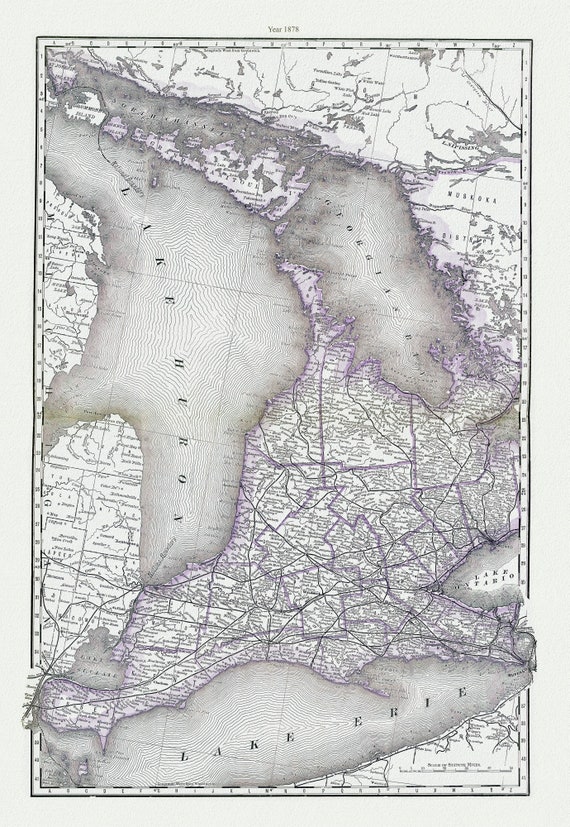 Rand, McNally & Co., Map of Western Ontario, 1878, map on heavy cotton canvas, 22x27" approx.
$33.94
Rand, McNally & Co., Map of Western Ontario, 1878, map on heavy cotton canvas, 22x27" approx.
$33.94
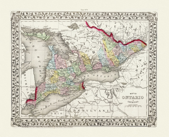 Mitchell, Map of Ontario in Counties, 1874, map on heavy cotton canvas, 22x27" approx.
$33.94
Mitchell, Map of Ontario in Counties, 1874, map on heavy cotton canvas, 22x27" approx.
$33.94