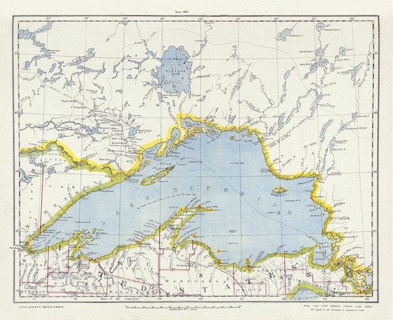
 Letts, North Shore, Lake Superior, Canada, 1883 , map on heavy cotton canvas, 22x27" approx.
$33.94
Letts, North Shore, Lake Superior, Canada, 1883 , map on heavy cotton canvas, 22x27" approx.
$33.94
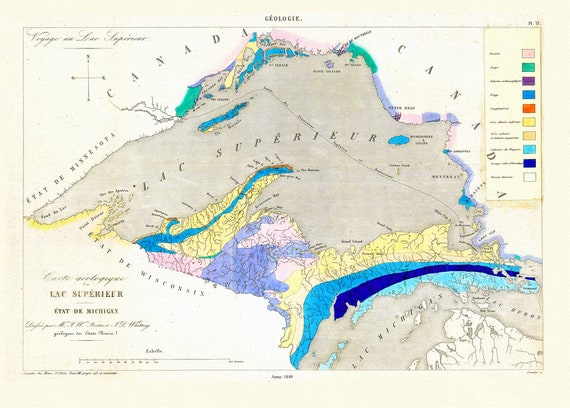 Fostes et Whitney, Carte geologique du Lac Superieur, 1849 , map on heavy cotton canvas, 22x27" approx.
$33.94
Fostes et Whitney, Carte geologique du Lac Superieur, 1849 , map on heavy cotton canvas, 22x27" approx.
$33.94
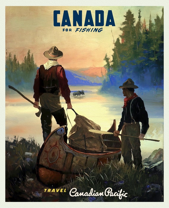 Canada For Fishing, Canadian Pacific Ver. 16, travel poster on durable cotton canvas, 50 x 70 cm, 20 x 25" approx
$33.94
Canada For Fishing, Canadian Pacific Ver. 16, travel poster on durable cotton canvas, 50 x 70 cm, 20 x 25" approx
$33.94
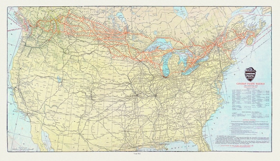 Canadian Pacific Railway and Connecting Lines, 1912, map on heavy cotton canvas, 22x27" approx.
$33.94
Canadian Pacific Railway and Connecting Lines, 1912, map on heavy cotton canvas, 22x27" approx.
$33.94
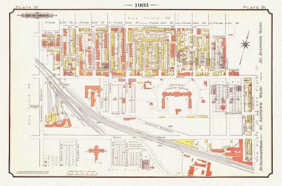 Plate 21, Toronto West, Parkdale, Liberty Village, 1903, map on heavy cotton canvas, 20 x 30" or 50 x 75cm. approx.
$33.94
Plate 21, Toronto West, Parkdale, Liberty Village, 1903, map on heavy cotton canvas, 20 x 30" or 50 x 75cm. approx.
$33.94
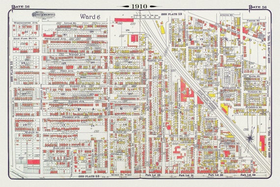 Plate 56, Toronto West, High Park East, Parkdale & Brockton, 1910 , map on heavy cotton canvas, 20 x 30" approx.
$33.94
Plate 56, Toronto West, High Park East, Parkdale & Brockton, 1910 , map on heavy cotton canvas, 20 x 30" approx.
$33.94
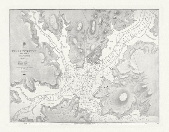 Nautical Chart, Prince Edward Island, Charlottetown Harbour, 1861 , map on heavy cotton canvas, 20 x 25" approx.
$33.94
Nautical Chart, Prince Edward Island, Charlottetown Harbour, 1861 , map on heavy cotton canvas, 20 x 25" approx.
$33.94
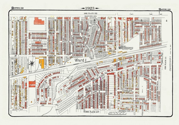 Plate 110, Toronto East, Danforth and Woodbine South, 1923, Map on heavy cotton canvas, 18x27in. approx.
$33.94
Plate 110, Toronto East, Danforth and Woodbine South, 1923, Map on heavy cotton canvas, 18x27in. approx.
$33.94
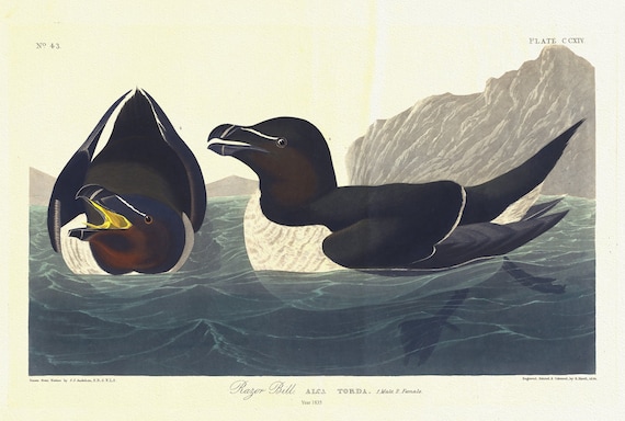 J.J. Audubon, Razor bill. Alca torda. 1. Male. 2. Female, 1835, vintage nature print on canvas, 50 x 70 cm, 20 x 25" approx.
$33.94
J.J. Audubon, Razor bill. Alca torda. 1. Male. 2. Female, 1835, vintage nature print on canvas, 50 x 70 cm, 20 x 25" approx.
$33.94
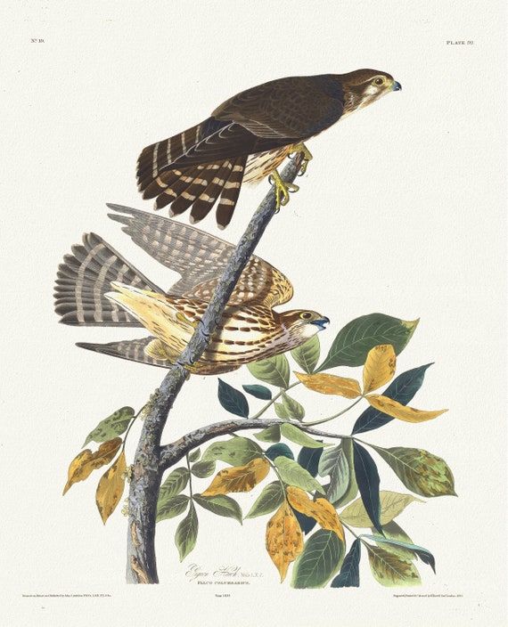 J.J. Audubon, Pigeon hawk. Male, 1. F, 2. Falco columbarius, 1835, vintage nature print on canvas, 50 x 70 cm, 20 x 25" approx.
$33.94
J.J. Audubon, Pigeon hawk. Male, 1. F, 2. Falco columbarius, 1835, vintage nature print on canvas, 50 x 70 cm, 20 x 25" approx.
$33.94
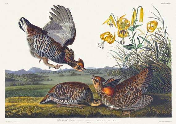 E.J. Audubon, Pinnated grous. Tetrao cupido, Lin. Males, 1, 2. Females, 3. Lilium superbum, 1835, on canvas, 50 x 70 cm, 20 x 25" approx.
$33.94
E.J. Audubon, Pinnated grous. Tetrao cupido, Lin. Males, 1, 2. Females, 3. Lilium superbum, 1835, on canvas, 50 x 70 cm, 20 x 25" approx.
$33.94
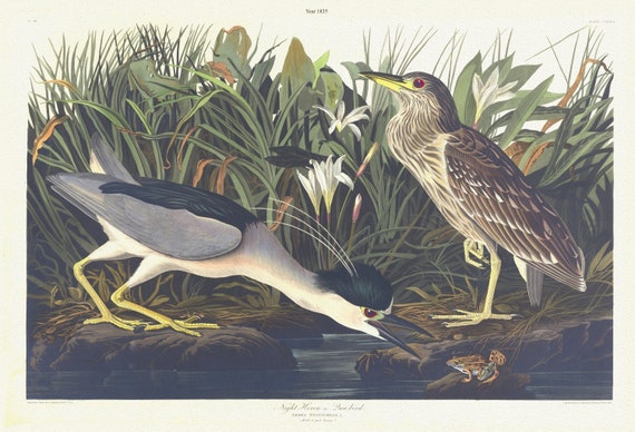 J.J. Audubon, Night heron or qua bird. Ardea nycticorax, L. Adult 1 and young 2, 1835, print on canvas, 50 x 70 cm, 20 x 25" approx.
$33.94
J.J. Audubon, Night heron or qua bird. Ardea nycticorax, L. Adult 1 and young 2, 1835, print on canvas, 50 x 70 cm, 20 x 25" approx.
$33.94
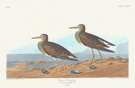 J.J. Audubon, Pectoral sandpiper. Tringa pectoralis. 1. Male. 2. Female, 1835 , nature print on canvas, 50 x 70 cm, 20 x 25" approx.
$33.94
J.J. Audubon, Pectoral sandpiper. Tringa pectoralis. 1. Male. 2. Female, 1835 , nature print on canvas, 50 x 70 cm, 20 x 25" approx.
$33.94
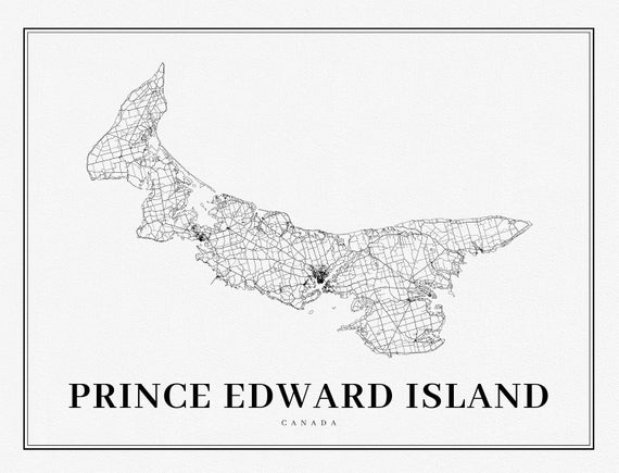 PEI: Prince Edward Island, A Modern Map
$33.94
PEI: Prince Edward Island, A Modern Map
$33.94
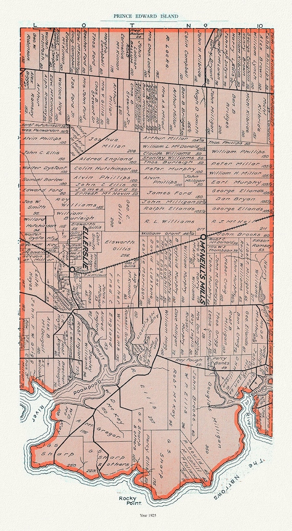 PEI: Map 12, Prince County, Prince Edward Island, 1925 , vintage map reprinted on durable cotton canvas, 50 x 70 cm or 20x25" approx.
$33.94
PEI: Map 12, Prince County, Prince Edward Island, 1925 , vintage map reprinted on durable cotton canvas, 50 x 70 cm or 20x25" approx.
$33.94
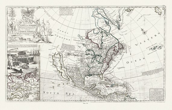 Bowles, This map of North America, according to ye newest and most exact observations, 1712 , map on heavy cotton canvas, 22x27" approx.
$33.94
Bowles, This map of North America, according to ye newest and most exact observations, 1712 , map on heavy cotton canvas, 22x27" approx.
$33.94
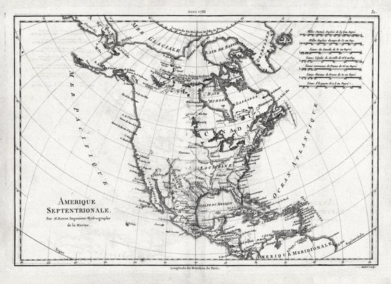 Bonne, Amérique septentrionale, 1788 , map on heavy cotton canvas, 22x27" approx
$33.94
Bonne, Amérique septentrionale, 1788 , map on heavy cotton canvas, 22x27" approx
$33.94
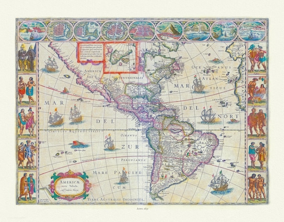 Blaue, Americae Nova Tabula, 1635, map on heavy cotton canvas, 22x27" approx.
$33.94
Blaue, Americae Nova Tabula, 1635, map on heavy cotton canvas, 22x27" approx.
$33.94
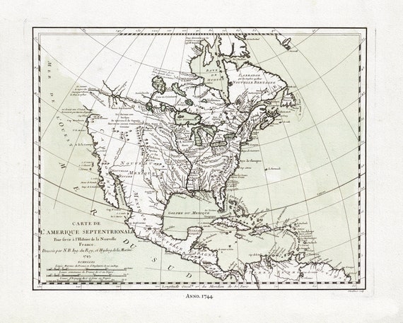 Bellin, Carte de L'Amerique Septentrionale, 1744, map on heavy cotton canvas, 22x27" approx.
$33.94
Bellin, Carte de L'Amerique Septentrionale, 1744, map on heavy cotton canvas, 22x27" approx.
$33.94
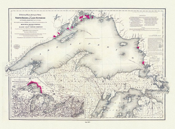 Colton, Preliminary map to a geological survey of the north shore of Lake Superior, Ontario, 1871 ,map on cotton canvas, 20 x 25" approx.
$33.94
Colton, Preliminary map to a geological survey of the north shore of Lake Superior, Ontario, 1871 ,map on cotton canvas, 20 x 25" approx.
$33.94