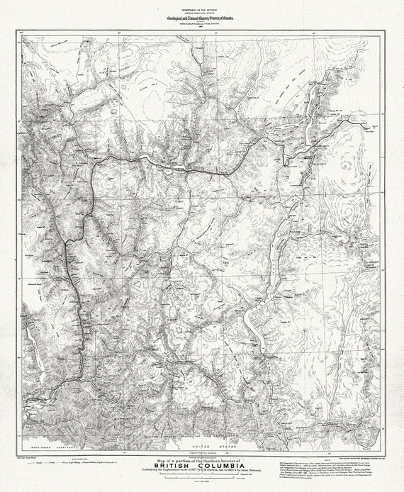
 Map of portion of Southern Interior of British Columbia ,the explorations in 1877, Dawson, , map on heavy cotton canvas, 20 x 25" approx.
$33.94
Map of portion of Southern Interior of British Columbia ,the explorations in 1877, Dawson, , map on heavy cotton canvas, 20 x 25" approx.
$33.94
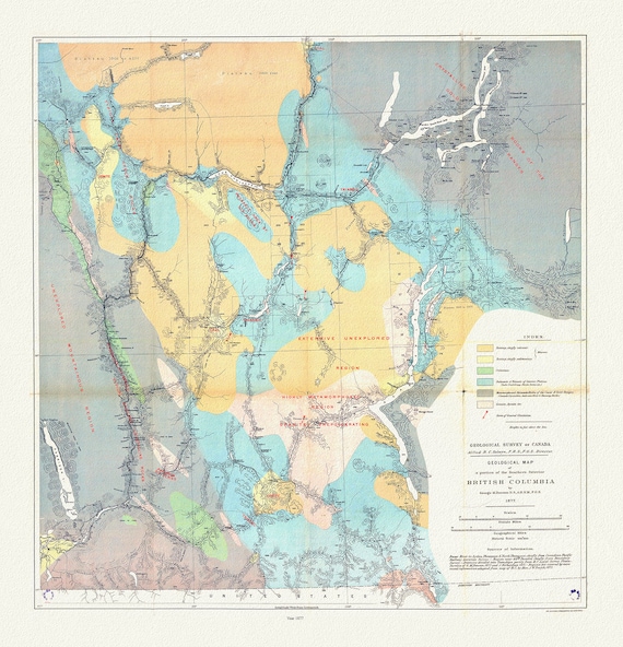 Geological map of a portion of the Southern Interior of British Columbia, George Dawson ,1877, map on cotton canvas, 20 x 25" approx.
$33.94
Geological map of a portion of the Southern Interior of British Columbia, George Dawson ,1877, map on cotton canvas, 20 x 25" approx.
$33.94
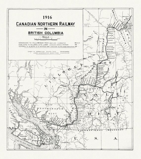 Canadian Northern Railway in British Columbia, 1916 , map on heavy cotton canvas, 50 x 70cm, 20 x 25" approx.
$33.94
Canadian Northern Railway in British Columbia, 1916 , map on heavy cotton canvas, 50 x 70cm, 20 x 25" approx.
$33.94
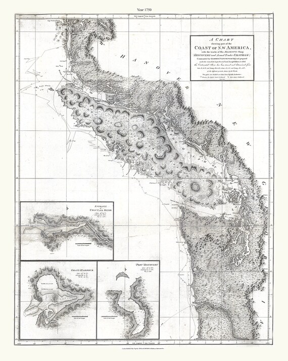 Part of the coast of N.W. America , with tracks of His Majesty's sloop Discovery and armed tender Chatham, 1798, canvas map, 20x25" approx.
$33.94
Part of the coast of N.W. America , with tracks of His Majesty's sloop Discovery and armed tender Chatham, 1798, canvas map, 20x25" approx.
$33.94
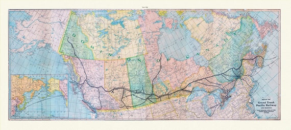 Map of the Grand Trunk Pacific Railway and branches, also showing lines of the Grand Trunk Railway System, 1906, on heavy canvas, 22x27"
$33.94
Map of the Grand Trunk Pacific Railway and branches, also showing lines of the Grand Trunk Railway System, 1906, on heavy canvas, 22x27"
$33.94
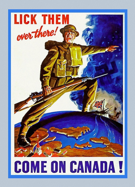 Come on Canada!, Lick Them Over there! , vintage war poster on heavy cotton canvas, 50 x 70 cm, 20 x 25" approx.
$33.94
Come on Canada!, Lick Them Over there! , vintage war poster on heavy cotton canvas, 50 x 70 cm, 20 x 25" approx.
$33.94
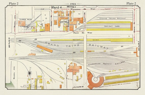 Plate 02, Toronto Downtown, Railway Lands, 1924, map on heavy cotton canvas, 20 x 30" or 50 x 75cm. approx.
$33.94
Plate 02, Toronto Downtown, Railway Lands, 1924, map on heavy cotton canvas, 20 x 30" or 50 x 75cm. approx.
$33.94
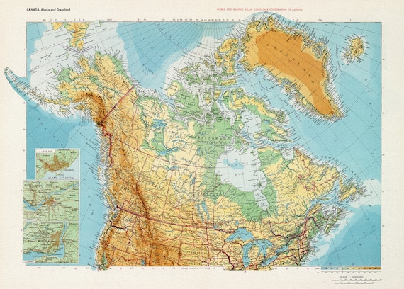 Canada. Alaska. Greenland, 1953,map on heavy cotton canvas, 22x27" approx.
$33.94
Canada. Alaska. Greenland, 1953,map on heavy cotton canvas, 22x27" approx.
$33.94
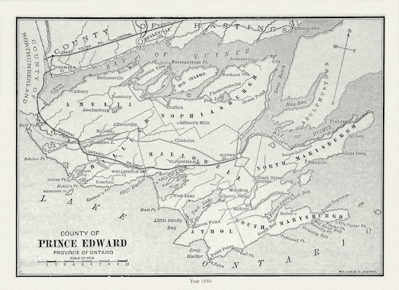 Prince Edward County, Ontario, Gage's county atlas, 1886, map on durable cotton canvas, 50 x 70 cm, 20 x 25" approx.
$33.94
Prince Edward County, Ontario, Gage's county atlas, 1886, map on durable cotton canvas, 50 x 70 cm, 20 x 25" approx.
$33.94
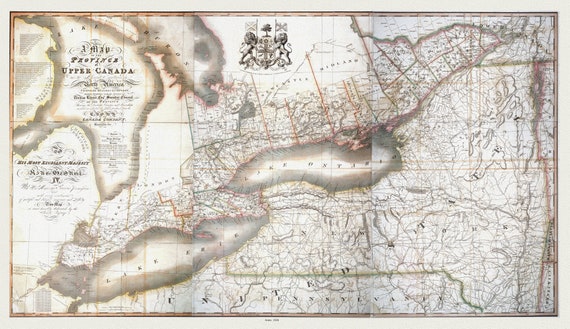 Map of the province of Upper Canada and the adjacent territories in North America, 1826 , map on heavy cotton canvas, 22x27" approx.
$33.94
Map of the province of Upper Canada and the adjacent territories in North America, 1826 , map on heavy cotton canvas, 22x27" approx.
$33.94
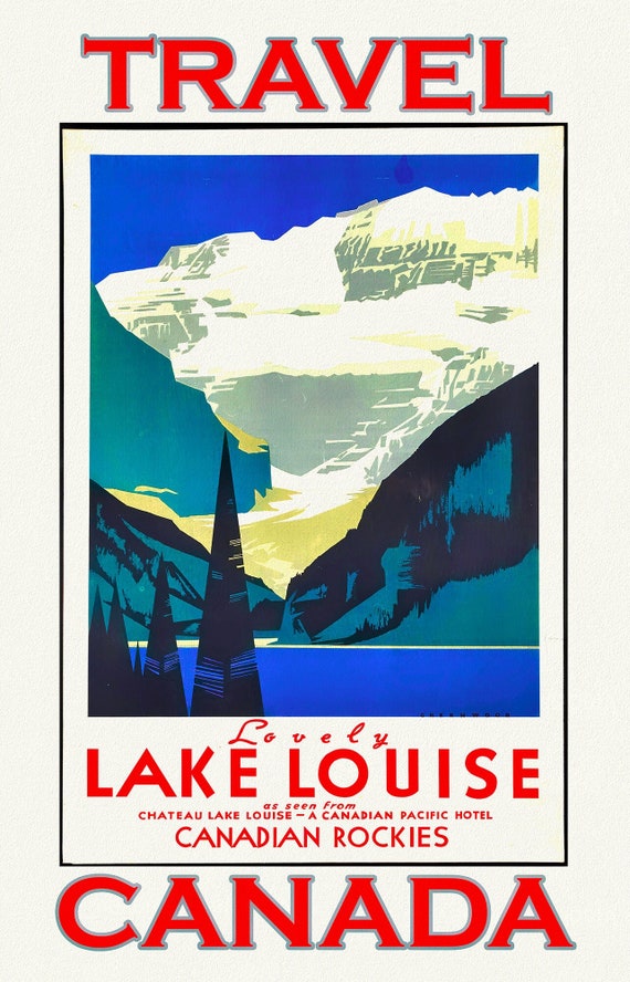 Canadian Pacific, Travel Lake Louise, Canada, vintage print on canvas, 50 x 70 cm, 20 x 25" approx.
$33.94
Canadian Pacific, Travel Lake Louise, Canada, vintage print on canvas, 50 x 70 cm, 20 x 25" approx.
$33.94
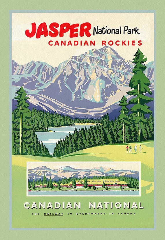 Jasper National Park, CNR Ver. III, vintage travel poster reprinted on heavy cotton canvas, 50 x 70 cm, 20 x 25" approx.
$33.94
Jasper National Park, CNR Ver. III, vintage travel poster reprinted on heavy cotton canvas, 50 x 70 cm, 20 x 25" approx.
$33.94
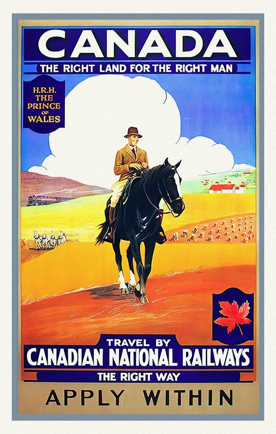 Canada, The Right Land, CNR, vintage travel poster reprinted on durable cotton canvas, 50 x 70 cm, 20 x 25" approx.
$33.94
Canada, The Right Land, CNR, vintage travel poster reprinted on durable cotton canvas, 50 x 70 cm, 20 x 25" approx.
$33.94
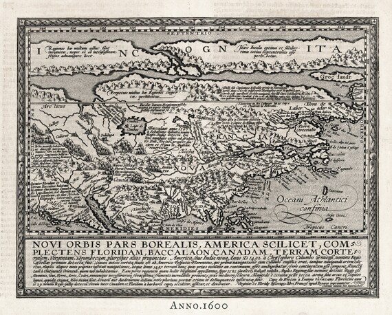 North America, 1600, Quad auth., map on durable cotton canvas, 50 x 70 cm or 20x25" approx.
$33.94
North America, 1600, Quad auth., map on durable cotton canvas, 50 x 70 cm or 20x25" approx.
$33.94
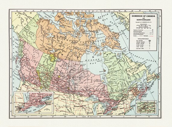 Dominion of Canada and Newfoundland-1948, Hammond auth., vintage map reprinted on durable cotton canvas, 50 x 70 cm, 20 x 25" approx.
$33.94
Dominion of Canada and Newfoundland-1948, Hammond auth., vintage map reprinted on durable cotton canvas, 50 x 70 cm, 20 x 25" approx.
$33.94
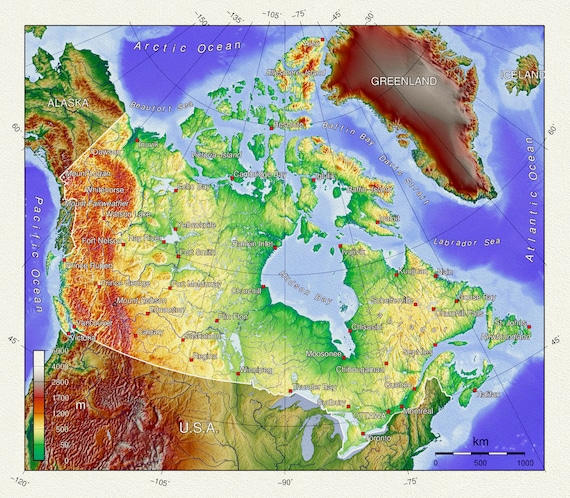 Topographical Map of Canada, vintage map reprinted on durable cotton canvas, 50 x 70 cm, 20 x 25" approx.
$33.94
Topographical Map of Canada, vintage map reprinted on durable cotton canvas, 50 x 70 cm, 20 x 25" approx.
$33.94
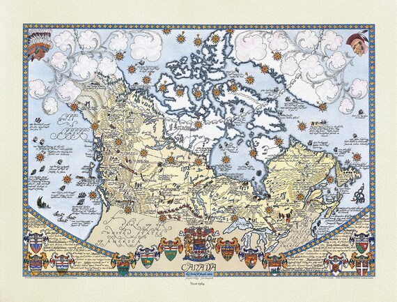 Furse, Canada, 1964 , map on durable cotton canvas, 50 x 70 cm or 20x25" approx.
$33.94
Furse, Canada, 1964 , map on durable cotton canvas, 50 x 70 cm or 20x25" approx.
$33.94
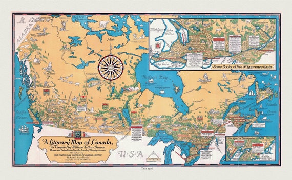 Canada, A Literary Map, 1936 , vintage map reprinted on durable cotton canvas, 50 x 70 cm, 20 x 25" approx.
$33.94
Canada, A Literary Map, 1936 , vintage map reprinted on durable cotton canvas, 50 x 70 cm, 20 x 25" approx.
$33.94
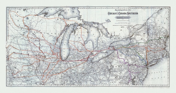 Map showing the route of the Chicago and Canada Southern Railway and its connecting lines, Colton auth., 1872 on canvas, 20 x 25" approx
$33.94
Map showing the route of the Chicago and Canada Southern Railway and its connecting lines, Colton auth., 1872 on canvas, 20 x 25" approx
$33.94
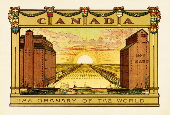 Canada, The Granary of the World
$33.94
Canada, The Granary of the World
$33.94