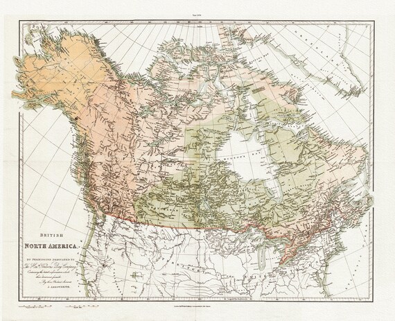
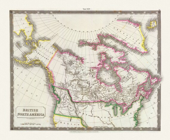
 Arrowsmith, British North America by permission of The Hudsons Bay Company, 1854 , map on heavy cotton canvas, 20 x 25" approx.
$39.96
Arrowsmith, British North America by permission of The Hudsons Bay Company, 1854 , map on heavy cotton canvas, 20 x 25" approx.
$39.96
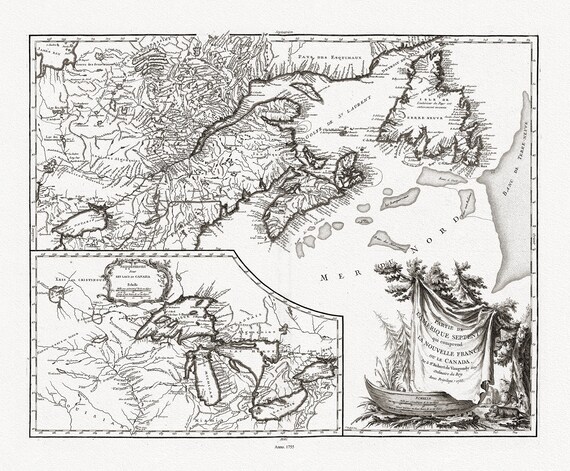 Vaugondy (Robert de, Gilles, 1688-1766), Nouvelle France ou le Canada, 1755 , map on heavy cotton canvas, 22x27" approx.
$39.96
Vaugondy (Robert de, Gilles, 1688-1766), Nouvelle France ou le Canada, 1755 , map on heavy cotton canvas, 22x27" approx.
$39.96
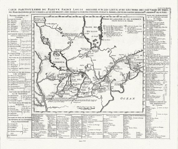 Henri Chatelain, Le Canada, 1719, map on heavy cotton canvas, 22x27" approx.
$39.96
Henri Chatelain, Le Canada, 1719, map on heavy cotton canvas, 22x27" approx.
$39.96
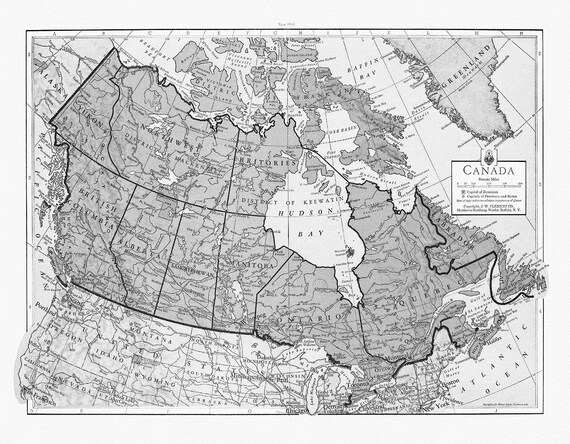 J.W. Clement Co., Canada, 1943 Ver. BW, map on heavy cotton canvas, 22x27" approx.
$39.96
J.W. Clement Co., Canada, 1943 Ver. BW, map on heavy cotton canvas, 22x27" approx.
$39.96
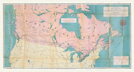
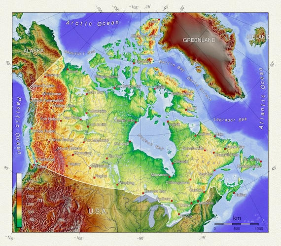 Topographical Map of Canada, vintage map reprinted on durable cotton canvas, 50 x 70 cm, 20 x 25" approx.
$39.96
Topographical Map of Canada, vintage map reprinted on durable cotton canvas, 50 x 70 cm, 20 x 25" approx.
$39.96
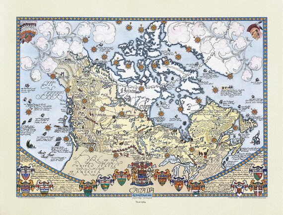 Furse, Canada, 1964 , map on durable cotton canvas, 50 x 70 cm or 20x25" approx.
$39.96
Furse, Canada, 1964 , map on durable cotton canvas, 50 x 70 cm or 20x25" approx.
$39.96
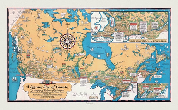 Canada, A Literary Map, 1936 , vintage map reprinted on durable cotton canvas, 50 x 70 cm, 20 x 25" approx.
$39.96
Canada, A Literary Map, 1936 , vintage map reprinted on durable cotton canvas, 50 x 70 cm, 20 x 25" approx.
$39.96
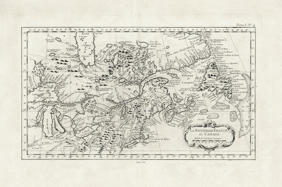 La Nouvelle France où Canada, ,Bellin, 1764 Ver. II, vintage map reprinted on durable cotton canvas, 50 x 70 cm, 20 x 25" approx.
$39.96
La Nouvelle France où Canada, ,Bellin, 1764 Ver. II, vintage map reprinted on durable cotton canvas, 50 x 70 cm, 20 x 25" approx.
$39.96
 Rand McNally & Company, Commercial Atlas, Canada, 1924 Ver. I , map on heavy cotton canvas, 20 x 25" approx.
$39.96
Rand McNally & Company, Commercial Atlas, Canada, 1924 Ver. I , map on heavy cotton canvas, 20 x 25" approx.
$39.96
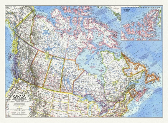 Canada, National Geographic, 1972, map on heavy cotton canvas, 50 x 70 cm, 21 x 25" approx.
$39.96
Canada, National Geographic, 1972, map on heavy cotton canvas, 50 x 70 cm, 21 x 25" approx.
$39.96
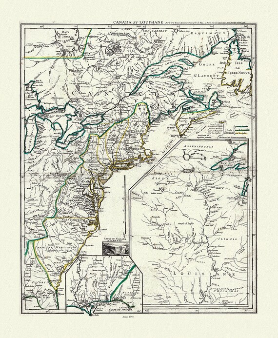 LaRouge, Canada et Louisiana, 1793, map on heavy cotton canvas, 50 x 70 cm, 20 x 25" approx.
$39.96
LaRouge, Canada et Louisiana, 1793, map on heavy cotton canvas, 50 x 70 cm, 20 x 25" approx.
$39.96
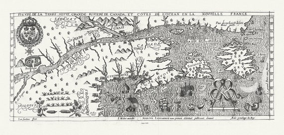 Figure de la Terre Neuve, le grande riviere de Canada, et côtes de l'ocean en la Nouvelle France, Les Carbot auth.,1609, 20 x 25" approx.
$39.96
Figure de la Terre Neuve, le grande riviere de Canada, et côtes de l'ocean en la Nouvelle France, Les Carbot auth.,1609, 20 x 25" approx.
$39.96
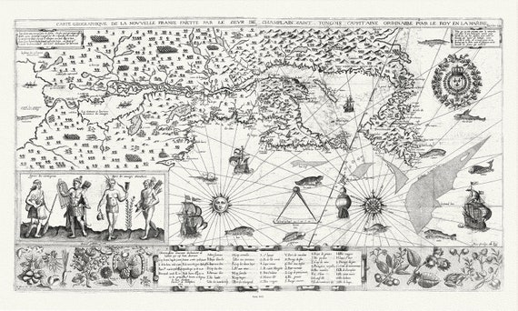 Carte geographiqve de la Nouvelle France, St Tongois cappitaine ordinaire pour le roy , Champlain.auth., 1612,,canvas, 20 x 25" approx.
$39.96
Carte geographiqve de la Nouvelle France, St Tongois cappitaine ordinaire pour le roy , Champlain.auth., 1612,,canvas, 20 x 25" approx.
$39.96
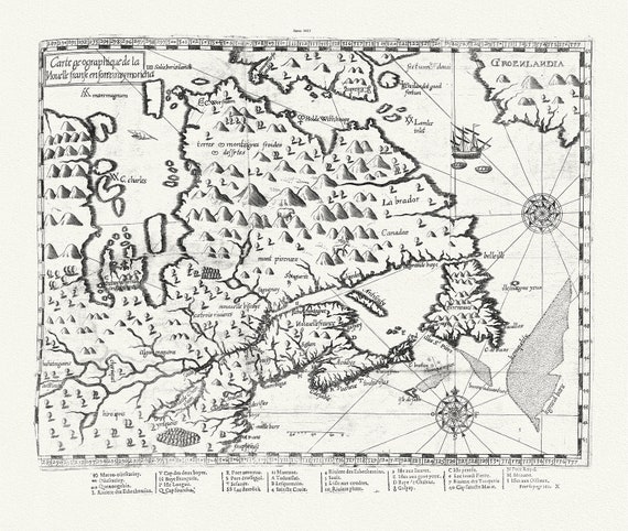 Carte geographique de la Nouelle franse en son vray moricha, Champlain auth., 1613, map on heavy cotton canvas, 50 x 70 cm, 20 x 25" approx.
$39.96
Carte geographique de la Nouelle franse en son vray moricha, Champlain auth., 1613, map on heavy cotton canvas, 50 x 70 cm, 20 x 25" approx.
$39.96
 Canada, Hall auth., 1829, map on heavy cotton canvas, 50 x 70 cm, 20 x 25" approx.
$39.96
Canada, Hall auth., 1829, map on heavy cotton canvas, 50 x 70 cm, 20 x 25" approx.
$39.96
 Canada, its history, productions and natural resources, prepared under the direction of Honourable John Carling, 1886, map on canvas, 20x25"
$39.96
Canada, its history, productions and natural resources, prepared under the direction of Honourable John Carling, 1886, map on canvas, 20x25"
$39.96