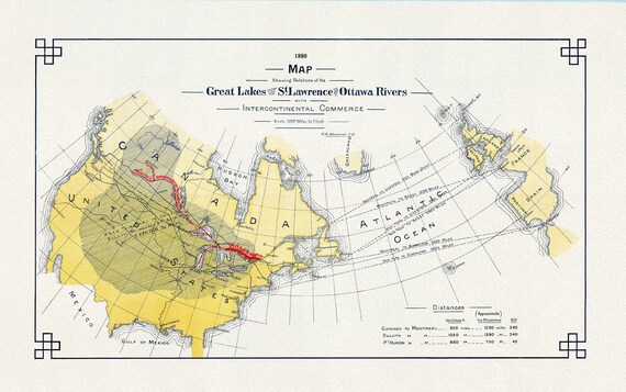
 Great Lakes St. Lawrence, Ottawa Rivers and InterContinental Commerce, 1880, map on heavy cotton canvas, 50x70cm (20 x 25") approx.
$45.54
Great Lakes St. Lawrence, Ottawa Rivers and InterContinental Commerce, 1880, map on heavy cotton canvas, 50x70cm (20 x 25") approx.
$45.54
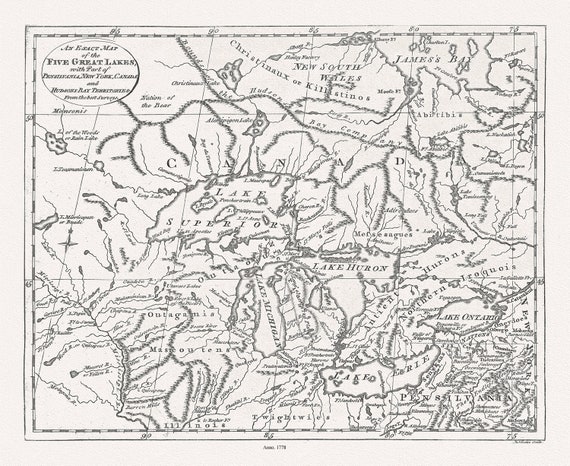 The Great Lakes, Lodge, 1778, map on durable cotton canvas, 50 x 70 cm, 20 x 25" approx.
$45.54
The Great Lakes, Lodge, 1778, map on durable cotton canvas, 50 x 70 cm, 20 x 25" approx.
$45.54
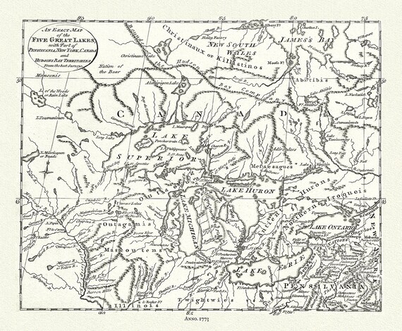 The 5 Great Lakes, Pincus auth.,1777, map on durable cotton canvas, 50 x 70 cm, 20 x 25" approx.
$45.54
The 5 Great Lakes, Pincus auth.,1777, map on durable cotton canvas, 50 x 70 cm, 20 x 25" approx.
$45.54
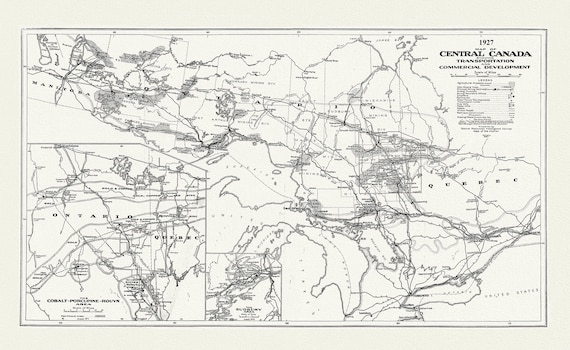 Map of Central Canada Showing Transportation and Commercial Development, 1927, map on durable cotton canvas, 50 x 70 cm, 20 x 25" approx.
$45.54
Map of Central Canada Showing Transportation and Commercial Development, 1927, map on durable cotton canvas, 50 x 70 cm, 20 x 25" approx.
$45.54
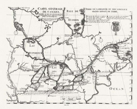 Carte Générale de Canada, Lahontan auth.,1703, map on durable cotton canvas, 50 x 70 cm, 20 x 25" approx.
$45.54
Carte Générale de Canada, Lahontan auth.,1703, map on durable cotton canvas, 50 x 70 cm, 20 x 25" approx.
$45.54
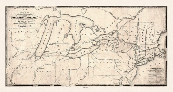 Map showing the most direct commercial route from the Atlantic, 1836 Ver. II, Price auth., on canvas, 50 x 70 cm, 20 x 25" approx.
$45.54
Map showing the most direct commercial route from the Atlantic, 1836 Ver. II, Price auth., on canvas, 50 x 70 cm, 20 x 25" approx.
$45.54
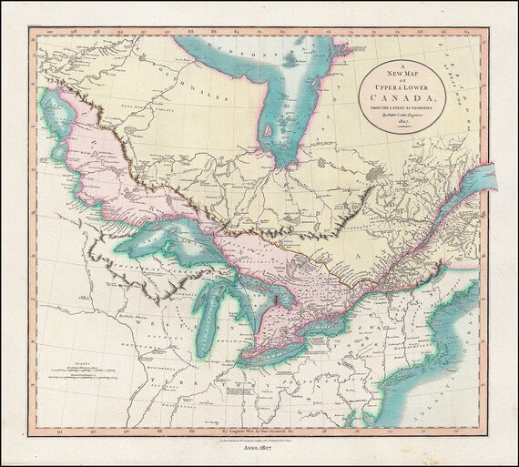 A New Map of Upper & Lower Canada, From the Latest Authorities, 1807, John Cary auth., cotton canvas, 50 x 70 cm, 20 x 25" approx.
$45.54
A New Map of Upper & Lower Canada, From the Latest Authorities, 1807, John Cary auth., cotton canvas, 50 x 70 cm, 20 x 25" approx.
$45.54
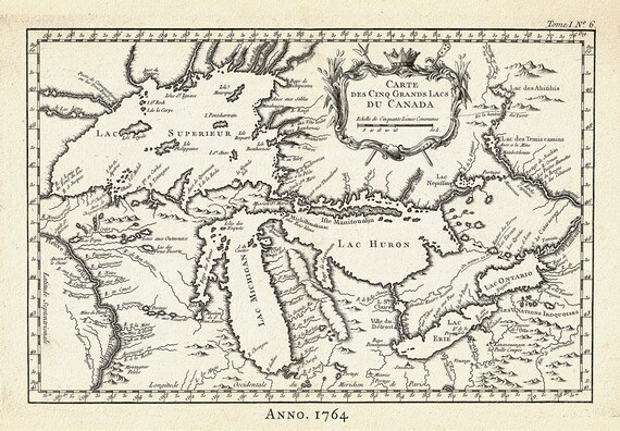 Carte des Cinq Grand Lacs du Canada, Bellin auth.,1764 Ver. II, map on durable cotton canvas, 50 x 70 cm, 20 x 25" approx.
$45.54
Carte des Cinq Grand Lacs du Canada, Bellin auth.,1764 Ver. II, map on durable cotton canvas, 50 x 70 cm, 20 x 25" approx.
$45.54
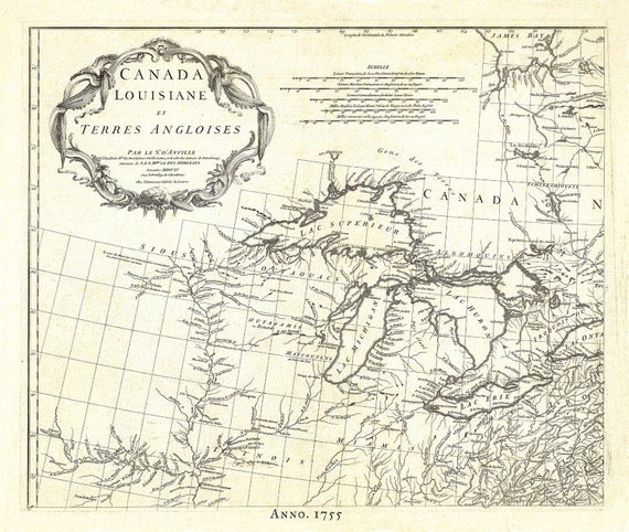 Canada, Louisiane et Terres Angloises, 1755, map on durable cotton canvas, 50 x 70 cm, 20 x 25" approx.
$45.54
Canada, Louisiane et Terres Angloises, 1755, map on durable cotton canvas, 50 x 70 cm, 20 x 25" approx.
$45.54
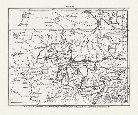 The Five Great Lakes with part of Pensilvania, New York, Canada and Hudsons Bay territories &c.,1755 , canvas, 50 x 70 cm, 20 x 25" approx.
$45.54
The Five Great Lakes with part of Pensilvania, New York, Canada and Hudsons Bay territories &c.,1755 , canvas, 50 x 70 cm, 20 x 25" approx.
$45.54
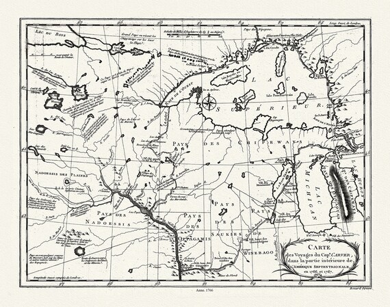 Carte des voyages du Cape. Carver, dans la partie intérieure de l'Amérique septentrionale en 1766, et 1767., 50 x 70 cm, 20 x 25" approx.
$45.54
Carte des voyages du Cape. Carver, dans la partie intérieure de l'Amérique septentrionale en 1766, et 1767., 50 x 70 cm, 20 x 25" approx.
$45.54
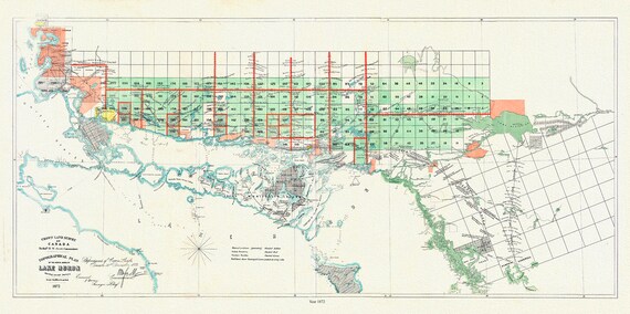 Lake Huron, North Shore, A Topographical plan of the north shore of shewing recent surveys, 1872, on canvas, 50 x 70 cm, 20 x 25" approx.
$45.54
Lake Huron, North Shore, A Topographical plan of the north shore of shewing recent surveys, 1872, on canvas, 50 x 70 cm, 20 x 25" approx.
$45.54
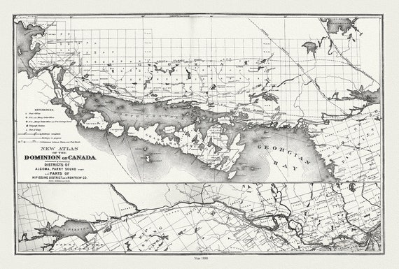 Lake Huron, North Shore, Algoma, Manitoulin, Parry Sound, 1880 , map on durable cotton canvas, 50 x 70 cm, 20 x 25" approx.
$45.54
Lake Huron, North Shore, Algoma, Manitoulin, Parry Sound, 1880 , map on durable cotton canvas, 50 x 70 cm, 20 x 25" approx.
$45.54
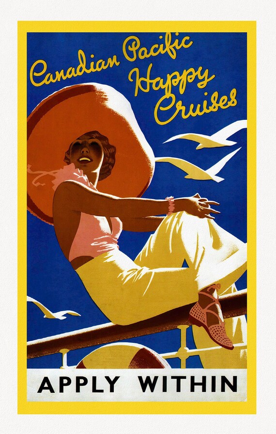 Canadian Pacific, Happy Cruises, c. 1962, travel poster on heavy cotton canvas, 22x27" approx.
$45.54
Canadian Pacific, Happy Cruises, c. 1962, travel poster on heavy cotton canvas, 22x27" approx.
$45.54
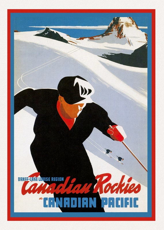 Canadian Pacific, Canadian Rockies, Banff-Lake Louise, c.1950, travel poster on heavy cotton canvas, 22x27" approx.
$45.54
Canadian Pacific, Canadian Rockies, Banff-Lake Louise, c.1950, travel poster on heavy cotton canvas, 22x27" approx.
$45.54
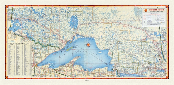 Shell Oil of Canada, Northern Ontario, 1959, Map on canvas, 16 x 27" approx.
$45.54
Shell Oil of Canada, Northern Ontario, 1959, Map on canvas, 16 x 27" approx.
$45.54
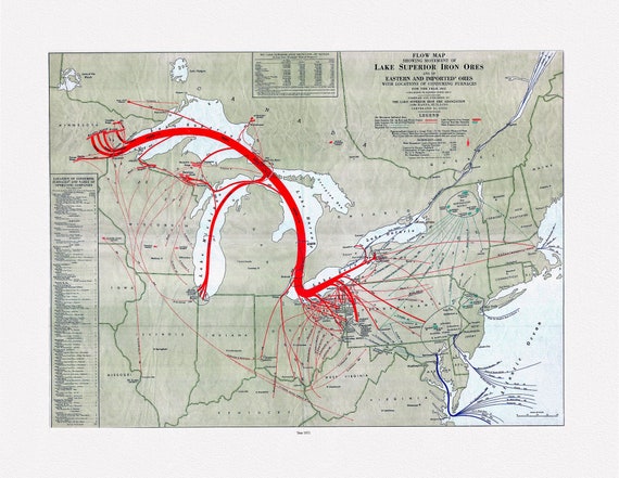 Flow map showing movement of Lake Superior iron ores with locations of consuming furnaces, 1951 , map on heavy cotton canvas, 22x27" approx.
$37.95
Flow map showing movement of Lake Superior iron ores with locations of consuming furnaces, 1951 , map on heavy cotton canvas, 22x27" approx.
$37.95
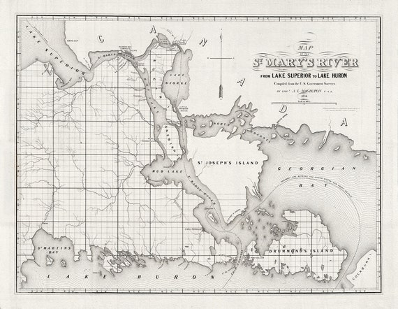 Colton, Magilton et Whitney, St. Mary's River From Lake Superior To Lake Huron, 1855 , map on heavy cotton canvas, 22x27" approx.
$45.54
Colton, Magilton et Whitney, St. Mary's River From Lake Superior To Lake Huron, 1855 , map on heavy cotton canvas, 22x27" approx.
$45.54
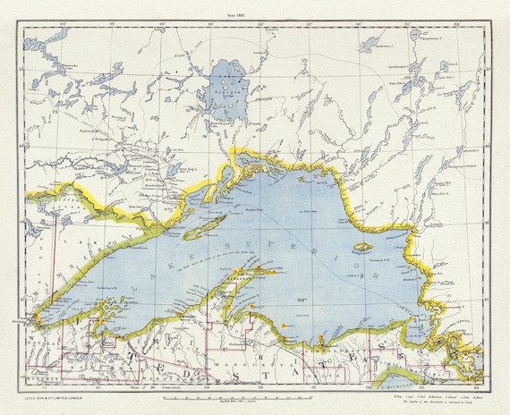 Letts, North Shore, Lake Superior, Canada, 1883 , map on heavy cotton canvas, 22x27" approx.
$45.54
Letts, North Shore, Lake Superior, Canada, 1883 , map on heavy cotton canvas, 22x27" approx.
$45.54
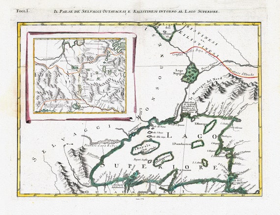 Zatta, Zuiliani, Novelli et Pitteri-Il Paese de' Selvaggi Outauacesi, e Kilistinesi Intorno al Lago Superiore, 1778, on cotton canvas,22x27"
$45.54
Zatta, Zuiliani, Novelli et Pitteri-Il Paese de' Selvaggi Outauacesi, e Kilistinesi Intorno al Lago Superiore, 1778, on cotton canvas,22x27"
$45.54