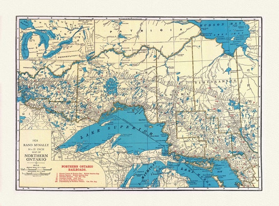
 Rand McNally & Company, Commercial Atlas, Northern Ontario, 1924 , map on heavy cotton canvas, 22x27" approx.
$41.37
Rand McNally & Company, Commercial Atlas, Northern Ontario, 1924 , map on heavy cotton canvas, 22x27" approx.
$41.37
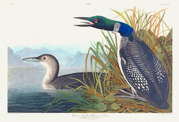 J.J. Audobon, Great Northern Diver or loon. Colymbus glacialis, 1835, bird print on durable cotton canvas, 19x27inches(50x70cm) approx.
$41.37
J.J. Audobon, Great Northern Diver or loon. Colymbus glacialis, 1835, bird print on durable cotton canvas, 19x27inches(50x70cm) approx.
$41.37
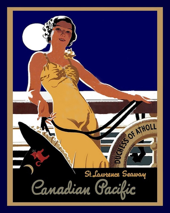 Canadian Pacific, St. Lawrence Seaway, travel poster on heavy cotton canvas, 22x27" approx.
$41.37
Canadian Pacific, St. Lawrence Seaway, travel poster on heavy cotton canvas, 22x27" approx.
$41.37
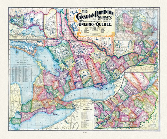 Canadian Dominion Survey, A New Railway, Post-Office, Township and Precinct Map Of Ontario and Quebec, 1899, on heavy cotton canvas, 22x27"
$41.37
Canadian Dominion Survey, A New Railway, Post-Office, Township and Precinct Map Of Ontario and Quebec, 1899, on heavy cotton canvas, 22x27"
$41.37
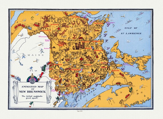 An Animated Map of New Brunswick, 1929, on heavy cotton canvas, 22x27" approx.
$41.37
An Animated Map of New Brunswick, 1929, on heavy cotton canvas, 22x27" approx.
$41.37
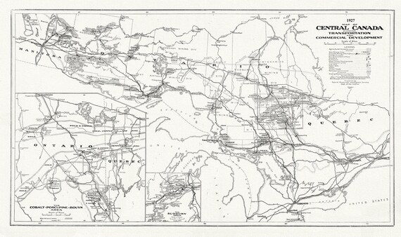 Central Canada Showing Transportation and Commercial Development, 1927, map on heavy cotton canvas, 22x27" approx.
$41.37
Central Canada Showing Transportation and Commercial Development, 1927, map on heavy cotton canvas, 22x27" approx.
$41.37
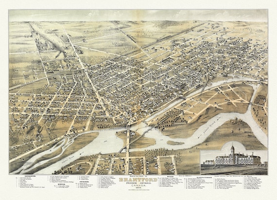 Bird's eye view of Brantford, Province of Ontario, Canada, 1875, Map on heavy cotton canvas, 22x27" approx.
$41.37
Bird's eye view of Brantford, Province of Ontario, Canada, 1875, Map on heavy cotton canvas, 22x27" approx.
$41.37
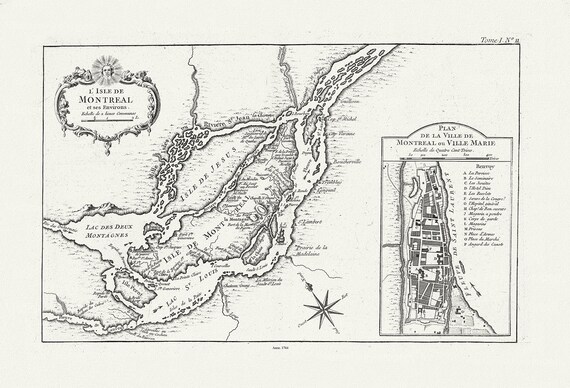 Bellin, L'Isle de Montreal, et ses environs, 1764 , map on heavy cotton canvas, 22x27" approx.
$41.37
Bellin, L'Isle de Montreal, et ses environs, 1764 , map on heavy cotton canvas, 22x27" approx.
$41.37
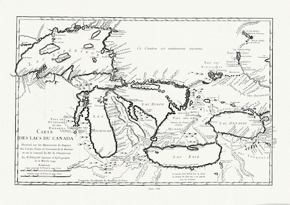 Bellin, Carte des lacs du Canada, Dressée sur les manuscrits du depost des cartes,1744, map on heavy cotton canvas, 50x70cm approx.
$41.37
Bellin, Carte des lacs du Canada, Dressée sur les manuscrits du depost des cartes,1744, map on heavy cotton canvas, 50x70cm approx.
$41.37
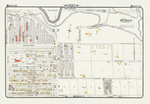 Plate 115, Toronto East York, Donlands & O'Connor Ave., 1923, Map on heavy cotton canvas, 18x27in. approx.
$41.37
Plate 115, Toronto East York, Donlands & O'Connor Ave., 1923, Map on heavy cotton canvas, 18x27in. approx.
$41.37
 Aborigines of Canada, Alaska and Greenland, 1906, map on durable cotton canvas, 50 x 70 cm, 20 x 25" approx.
$41.37
Aborigines of Canada, Alaska and Greenland, 1906, map on durable cotton canvas, 50 x 70 cm, 20 x 25" approx.
$41.37
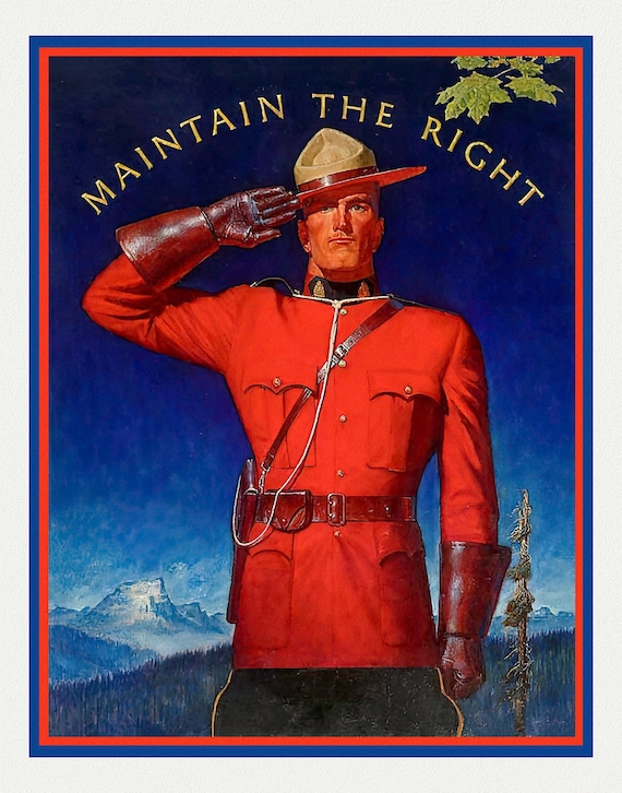 RCMP, Maintain the Right! Ver. I, vintage poster on heavy cotton canvas, 50 x 70 cm, 20 x 25" approx.
$41.37
RCMP, Maintain the Right! Ver. I, vintage poster on heavy cotton canvas, 50 x 70 cm, 20 x 25" approx.
$41.37
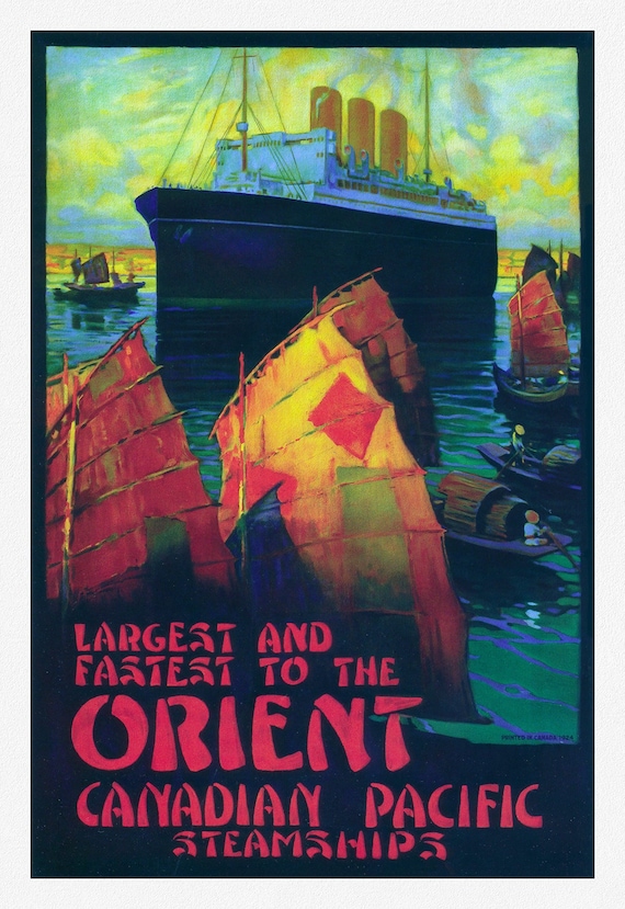 Canadian Pacific, Largest and Fastest to the Orient, 1924, travel poster reprinted on durable cotton canvas, 50 x 70 cm, 20 x 25" approx.
$41.37
Canadian Pacific, Largest and Fastest to the Orient, 1924, travel poster reprinted on durable cotton canvas, 50 x 70 cm, 20 x 25" approx.
$41.37
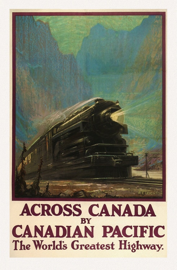 Across Canada, with Canadian Pacific, 1930, travel poster on heavy cotton canvas, 50 x 70 cm, 20 x 25" approx.
$41.37
Across Canada, with Canadian Pacific, 1930, travel poster on heavy cotton canvas, 50 x 70 cm, 20 x 25" approx.
$41.37
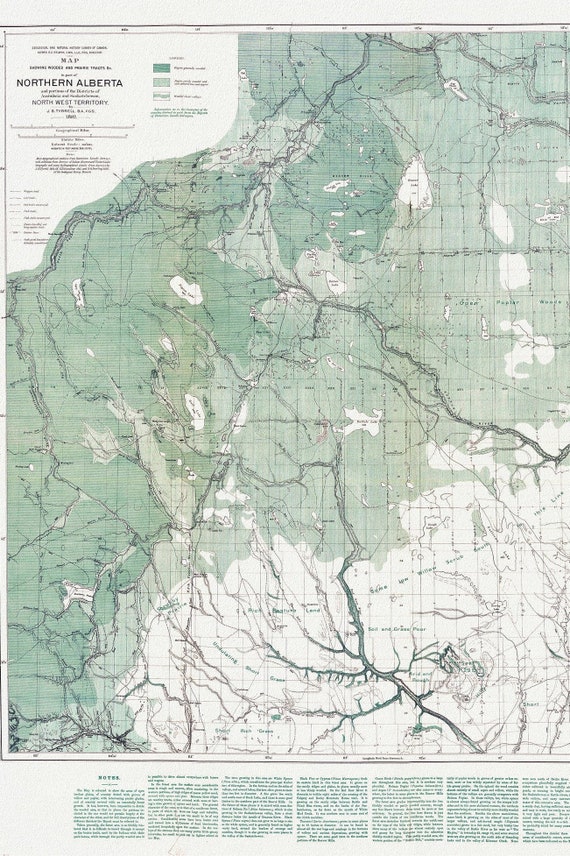 Northern Alberta, Map showing wooded and prairie tracts, etc.,by J.B. Tyrrell, 1884 , map on heavy cotton canvas, 20x27" approx.
$41.37
Northern Alberta, Map showing wooded and prairie tracts, etc.,by J.B. Tyrrell, 1884 , map on heavy cotton canvas, 20x27" approx.
$41.37
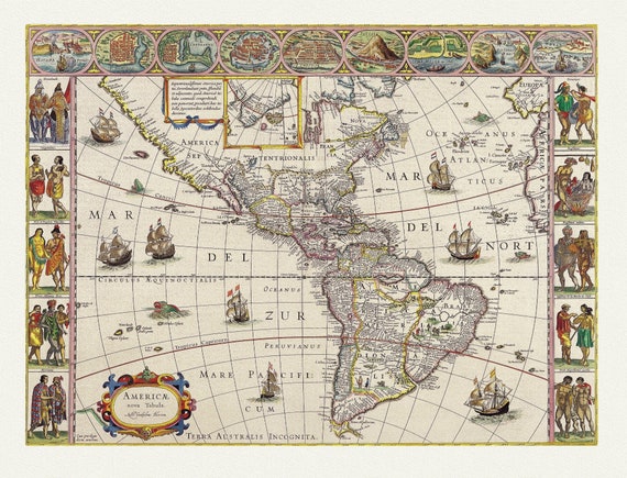 America with those known parts in that unknowne worlde both people and manner of buildings, 1662, map on heavy cotton canvas, 22x27" approx.
$41.37
America with those known parts in that unknowne worlde both people and manner of buildings, 1662, map on heavy cotton canvas, 22x27" approx.
$41.37
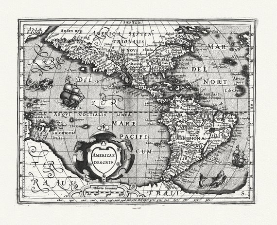 Mercator et Hondius, Americae descrip., 1607, map on heavy cotton canvas, 22x27" approx.
$41.37
Mercator et Hondius, Americae descrip., 1607, map on heavy cotton canvas, 22x27" approx.
$41.37
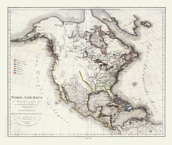 Liechtenstern et Hartl, Nord America, 1805 , map on heavy cotton canvas, 22x27" approx.
$41.37
Liechtenstern et Hartl, Nord America, 1805 , map on heavy cotton canvas, 22x27" approx.
$41.37
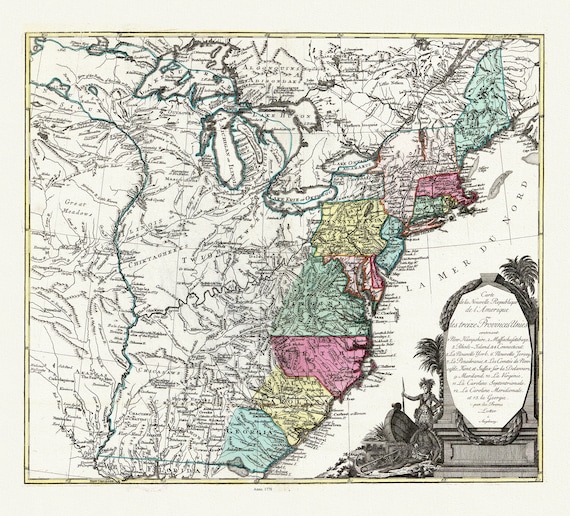 Lotter, Carte de la nouvelle république de lʾAmérique ou les treize Provinces Unies, 1778, map on heavy cotton canvas, 22x27" approx.
$41.37
Lotter, Carte de la nouvelle république de lʾAmérique ou les treize Provinces Unies, 1778, map on heavy cotton canvas, 22x27" approx.
$41.37
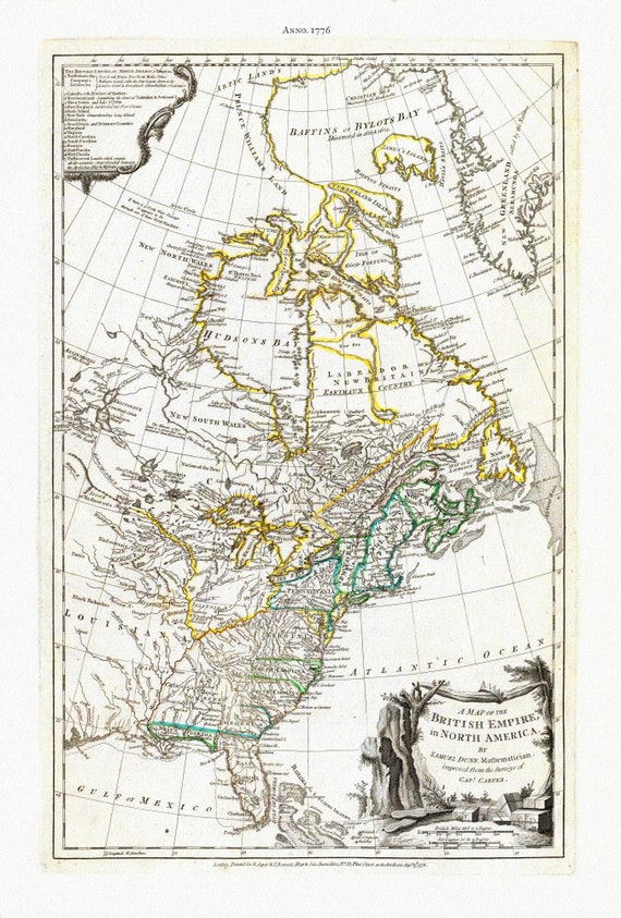 Jefferys, A Map of The British Empire in North America, 1776 , map on heavy cotton canvas, 22x27" approx.
$41.37
Jefferys, A Map of The British Empire in North America, 1776 , map on heavy cotton canvas, 22x27" approx.
$41.37