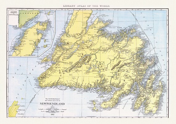
 Newfoundland,1912, Rand McNally and Company
$41.48
Newfoundland,1912, Rand McNally and Company
$41.48
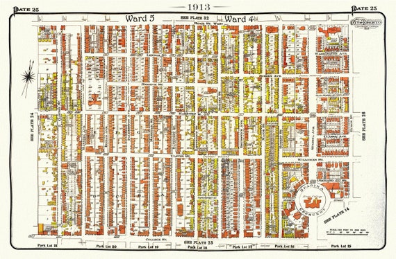 Plate 25, Toronto Central West, Annex South, 1913, map on heavy cotton canvas, 20 x 30" approx.
$41.48
Plate 25, Toronto Central West, Annex South, 1913, map on heavy cotton canvas, 20 x 30" approx.
$41.48
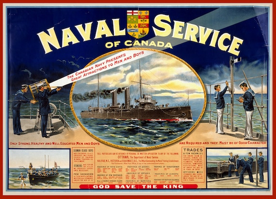 Naval service of Canada. Only strong, healthy and well educated men and boys are required, 1915, on heavy cotton canvas, 22x27in. approx.
$41.48
Naval service of Canada. Only strong, healthy and well educated men and boys are required, 1915, on heavy cotton canvas, 22x27in. approx.
$41.48
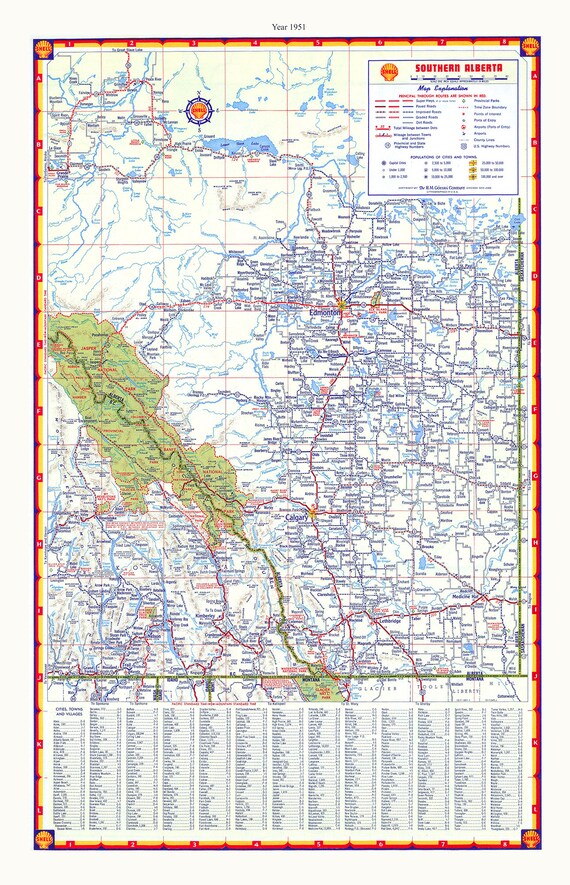 Southern Alberta, Shell Road Map, 1951, map on durable cotton canvas, 50 x 70 cm, 20 x 25" approx.
$41.48
Southern Alberta, Shell Road Map, 1951, map on durable cotton canvas, 50 x 70 cm, 20 x 25" approx.
$41.48
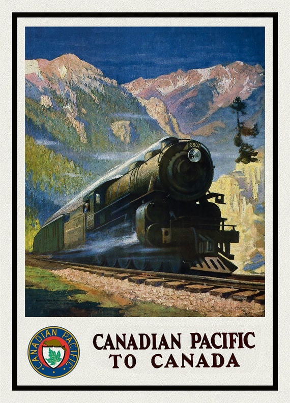 Canadian Pacific to Canada
$41.48
Canadian Pacific to Canada
$41.48
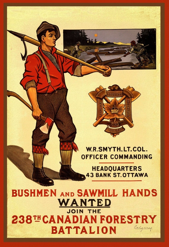 Canada WW I Poster, Bushmen and Sawmill Hands Wanted. Join the 238th Canadian Forestry Battalion,1915, canvas, 50 x 70 cm or 20x25" approx.
$41.48
Canada WW I Poster, Bushmen and Sawmill Hands Wanted. Join the 238th Canadian Forestry Battalion,1915, canvas, 50 x 70 cm or 20x25" approx.
$41.48
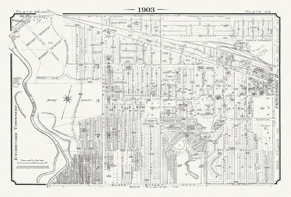 Plate 44, Toronto West, Baby Estate & Junction West, 1903, map on heavy cotton canvas, 20 x 30" or 50 x 75cm. approx.
$41.48
Plate 44, Toronto West, Baby Estate & Junction West, 1903, map on heavy cotton canvas, 20 x 30" or 50 x 75cm. approx.
$41.48
 Rand McNally & Company, Commercial Atlas, Canada, 1924 Ver. I , map on heavy cotton canvas, 20 x 25" approx.
$41.48
Rand McNally & Company, Commercial Atlas, Canada, 1924 Ver. I , map on heavy cotton canvas, 20 x 25" approx.
$41.48
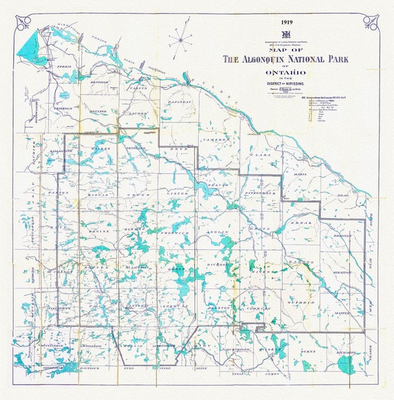 Historic Algonquin Park Map, Lands, Forests, Mines, 1919, map on heavy cotton canvas, 20 x 25" approx.
$41.48
Historic Algonquin Park Map, Lands, Forests, Mines, 1919, map on heavy cotton canvas, 20 x 25" approx.
$41.48
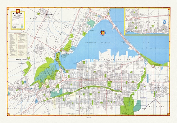 Hamilton and surrounding area, showing waterways, streets, railways, and an index, 1966, map on heavy cotton canvas, 20 x 25" approx.
$41.48
Hamilton and surrounding area, showing waterways, streets, railways, and an index, 1966, map on heavy cotton canvas, 20 x 25" approx.
$41.48
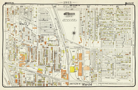 Plate 65, Toronto West, The Junction Triangle North, 1913, map on heavy cotton canvas, 20 x 30" or 50 x 75cm. approx.
$41.48
Plate 65, Toronto West, The Junction Triangle North, 1913, map on heavy cotton canvas, 20 x 30" or 50 x 75cm. approx.
$41.48
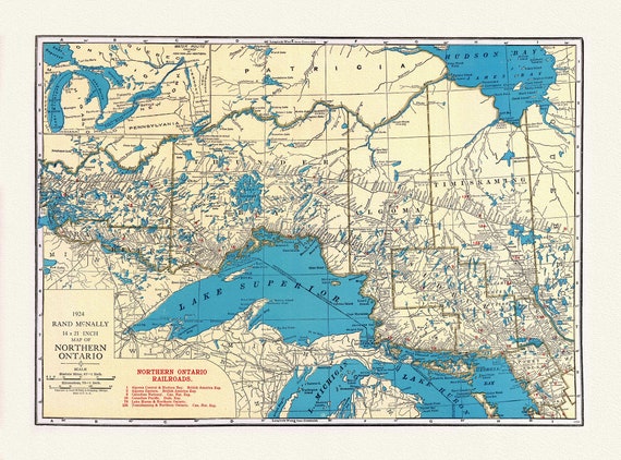 Rand McNally & Company, Commercial Atlas, Northern Ontario, 1924 , map on heavy cotton canvas, 22x27" approx.
$41.48
Rand McNally & Company, Commercial Atlas, Northern Ontario, 1924 , map on heavy cotton canvas, 22x27" approx.
$41.48
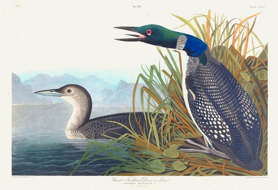 J.J. Audobon, Great Northern Diver or loon. Colymbus glacialis, 1835, bird print on durable cotton canvas, 19x27inches(50x70cm) approx.
$41.48
J.J. Audobon, Great Northern Diver or loon. Colymbus glacialis, 1835, bird print on durable cotton canvas, 19x27inches(50x70cm) approx.
$41.48
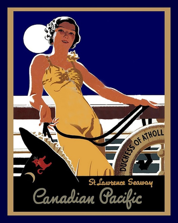 Canadian Pacific, St. Lawrence Seaway, travel poster on heavy cotton canvas, 22x27" approx.
$41.48
Canadian Pacific, St. Lawrence Seaway, travel poster on heavy cotton canvas, 22x27" approx.
$41.48
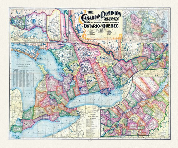 Canadian Dominion Survey, A New Railway, Post-Office, Township and Precinct Map Of Ontario and Quebec, 1899, on heavy cotton canvas, 22x27"
$41.48
Canadian Dominion Survey, A New Railway, Post-Office, Township and Precinct Map Of Ontario and Quebec, 1899, on heavy cotton canvas, 22x27"
$41.48
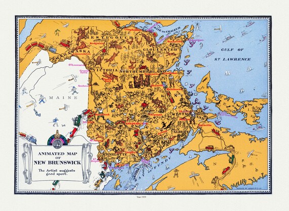 An Animated Map of New Brunswick, 1929, on heavy cotton canvas, 22x27" approx.
$41.48
An Animated Map of New Brunswick, 1929, on heavy cotton canvas, 22x27" approx.
$41.48
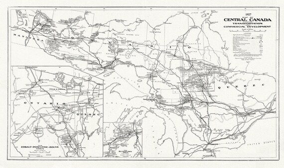 Central Canada Showing Transportation and Commercial Development, 1927, map on heavy cotton canvas, 22x27" approx.
$41.48
Central Canada Showing Transportation and Commercial Development, 1927, map on heavy cotton canvas, 22x27" approx.
$41.48
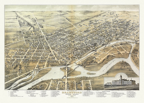 Bird's eye view of Brantford, Province of Ontario, Canada, 1875, Map on heavy cotton canvas, 22x27" approx.
$41.48
Bird's eye view of Brantford, Province of Ontario, Canada, 1875, Map on heavy cotton canvas, 22x27" approx.
$41.48
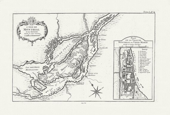 Bellin, L'Isle de Montreal, et ses environs, 1764 , map on heavy cotton canvas, 22x27" approx.
$41.48
Bellin, L'Isle de Montreal, et ses environs, 1764 , map on heavy cotton canvas, 22x27" approx.
$41.48
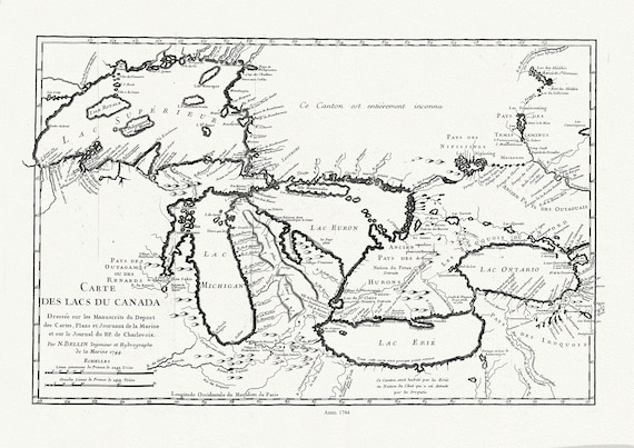 Bellin, Carte des lacs du Canada, Dressée sur les manuscrits du depost des cartes,1744, map on heavy cotton canvas, 50x70cm approx.
$41.48
Bellin, Carte des lacs du Canada, Dressée sur les manuscrits du depost des cartes,1744, map on heavy cotton canvas, 50x70cm approx.
$41.48