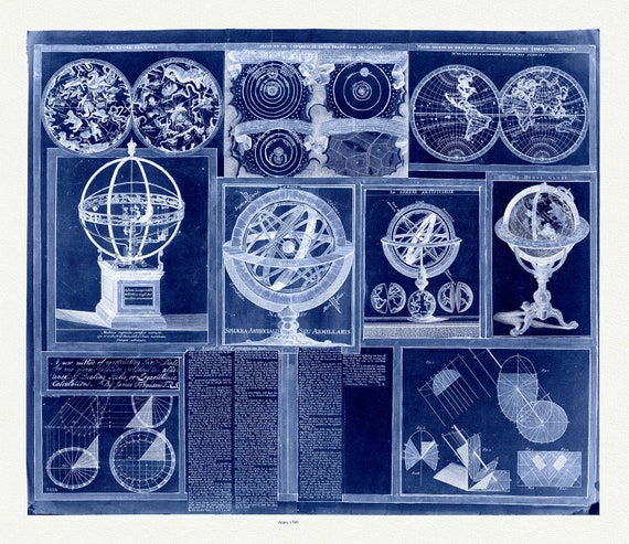
 Ferguson, A Collection of nine images including astronomical instruments, celestial charts, and a world map, cyanotype, 1769, canvas, 22x27"
$41.48
Ferguson, A Collection of nine images including astronomical instruments, celestial charts, and a world map, cyanotype, 1769, canvas, 22x27"
$41.48
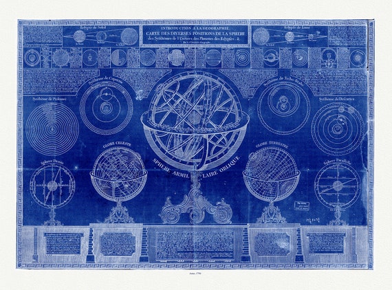 la geographie carte des diverses positions de la sphere, des systhemes de Univers, des planettes, des eclypses, cyanotype, 1798, 22x27
$41.48
la geographie carte des diverses positions de la sphere, des systhemes de Univers, des planettes, des eclypses, cyanotype, 1798, 22x27
$41.48
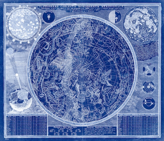 Allard, Planisphaerii coelestis hemisphaerium meridionale calculatum ad finem, pro aevo XVIII praesente, Cyanotype, 1700, canvas 22x27"
$41.48
Allard, Planisphaerii coelestis hemisphaerium meridionale calculatum ad finem, pro aevo XVIII praesente, Cyanotype, 1700, canvas 22x27"
$41.48
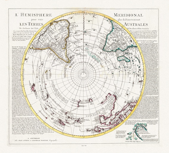 Visscher, Schenk, L'isle et Mortier, L' Hemisphere meridional pour voir plus distinctement les Terres Arctiques, 1740, on canvas, 22x27in
$41.48
Visscher, Schenk, L'isle et Mortier, L' Hemisphere meridional pour voir plus distinctement les Terres Arctiques, 1740, on canvas, 22x27in
$41.48
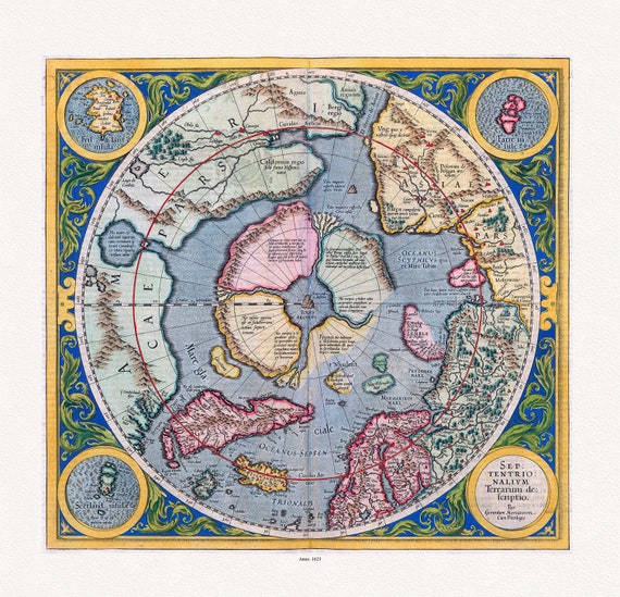 Mercator et Hondius, Septentrionalium Terrarum descriptio. Per Gerardum Mercatorem Cum Privilegio, 1623, on heavy cotton canvas, 22x27in.
$41.48
Mercator et Hondius, Septentrionalium Terrarum descriptio. Per Gerardum Mercatorem Cum Privilegio, 1623, on heavy cotton canvas, 22x27in.
$41.48
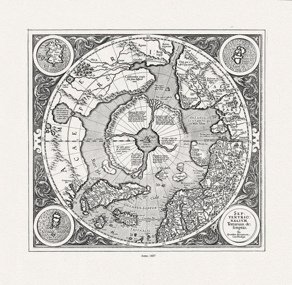 Mercator et Hondius, Septentrionalium Terrarum descriptio. Per Gerardum Mercatorem , 1607, Map on heavy cotton canvas, 22x27in. approx.
$41.48
Mercator et Hondius, Septentrionalium Terrarum descriptio. Per Gerardum Mercatorem , 1607, Map on heavy cotton canvas, 22x27in. approx.
$41.48
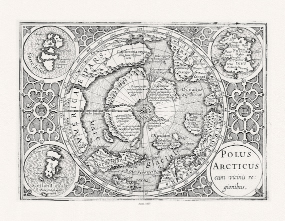 Mercator et Hondius, Polus Arcticus cum vicinis regionibus, 1607, Map printed on to heavy cotton canvas, 22x27in. approx.
$41.48
Mercator et Hondius, Polus Arcticus cum vicinis regionibus, 1607, Map printed on to heavy cotton canvas, 22x27in. approx.
$41.48
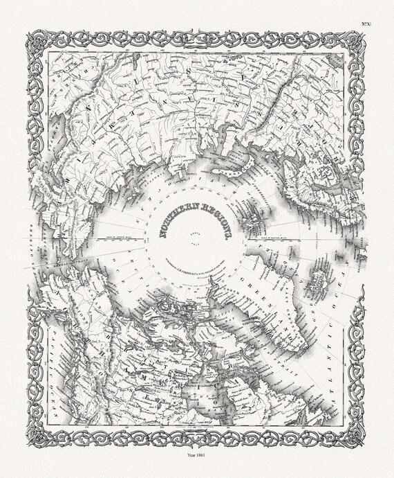 G.W. Colton, Northern Regions, 1861, Map printed on to heavy cotton canvas, 22x27in. approx.
$41.48
G.W. Colton, Northern Regions, 1861, Map printed on to heavy cotton canvas, 22x27in. approx.
$41.48
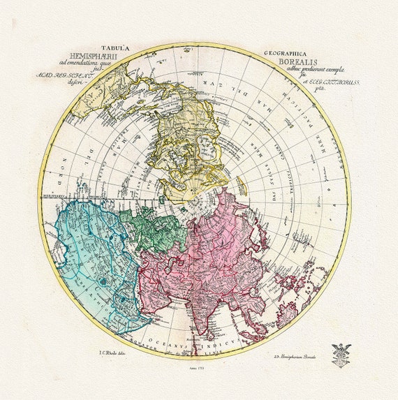 Euler, Sauerbrey et Rhode, Tabula Geographica Hemisphaerii Borealis, 1753, Map printed on to heavy cotton canvas, 22x27in. approx.
$41.48
Euler, Sauerbrey et Rhode, Tabula Geographica Hemisphaerii Borealis, 1753, Map printed on to heavy cotton canvas, 22x27in. approx.
$41.48
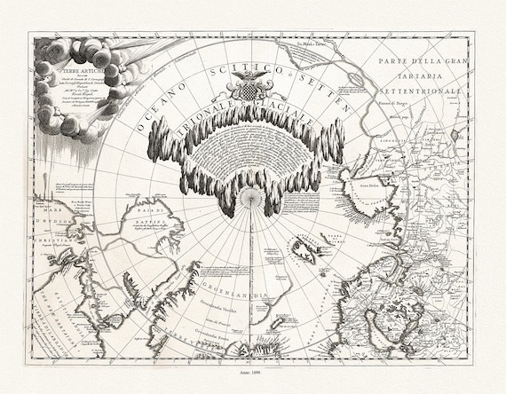 Coronelli, Terre Artiche, 1690, Map printed on to heavy cotton canvas, 22x27in. approx.
$41.48
Coronelli, Terre Artiche, 1690, Map printed on to heavy cotton canvas, 22x27in. approx.
$41.48
 Cassinni & Aa, Planisphere Terrestre, suivant les nouvelles observations des astronomes, 1713, printed on to heavy cotton canvas, 22x27in.
$41.48
Cassinni & Aa, Planisphere Terrestre, suivant les nouvelles observations des astronomes, 1713, printed on to heavy cotton canvas, 22x27in.
$41.48
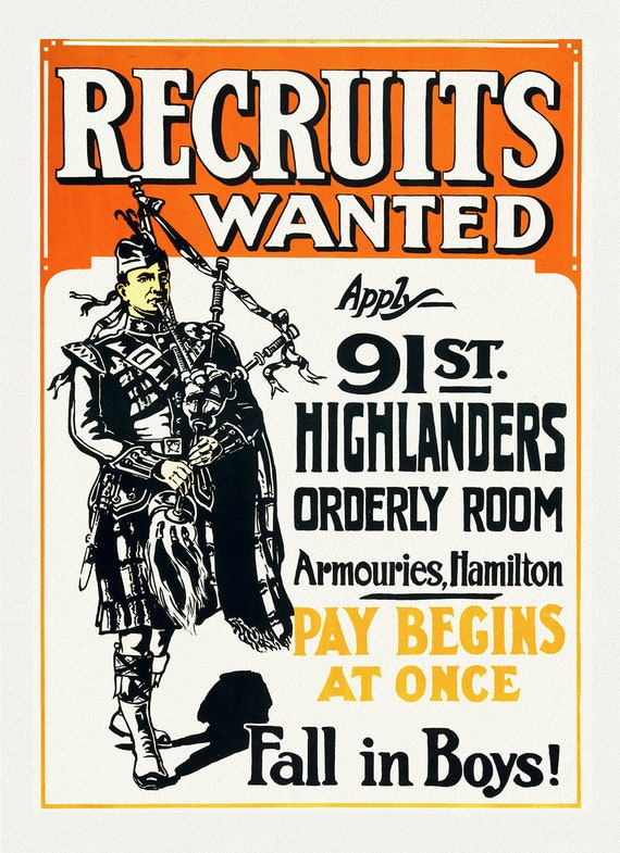 Recruits Wanted, Fall in boys!, Hamilton, Canada, 1914, vintage war poster on durable cotton canvas, 50 x 70 cm, 20 x 25" approx.
$41.48
Recruits Wanted, Fall in boys!, Hamilton, Canada, 1914, vintage war poster on durable cotton canvas, 50 x 70 cm, 20 x 25" approx.
$41.48
 Franquelin-Carte de l'Amerique Septentrionnale, hydrographe du roy, à Québec en Canada, 1688, map on heavy cotton canvas, 20 x 25" approx.
$41.48
Franquelin-Carte de l'Amerique Septentrionnale, hydrographe du roy, à Québec en Canada, 1688, map on heavy cotton canvas, 20 x 25" approx.
$41.48
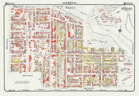 Plate 27, Toronto Downtown East, St. James, Cabbagetown, 1923, Map on heavy cotton canvas, 18x27in. approx.
$41.48
Plate 27, Toronto Downtown East, St. James, Cabbagetown, 1923, Map on heavy cotton canvas, 18x27in. approx.
$41.48
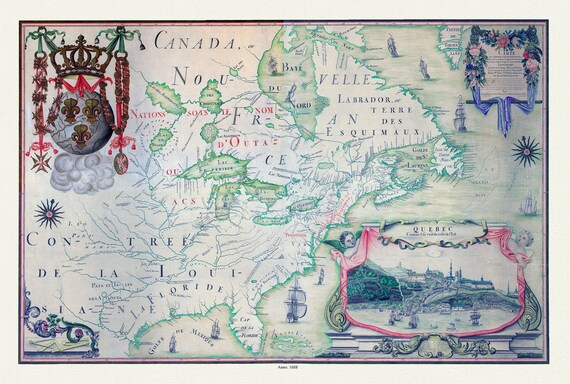
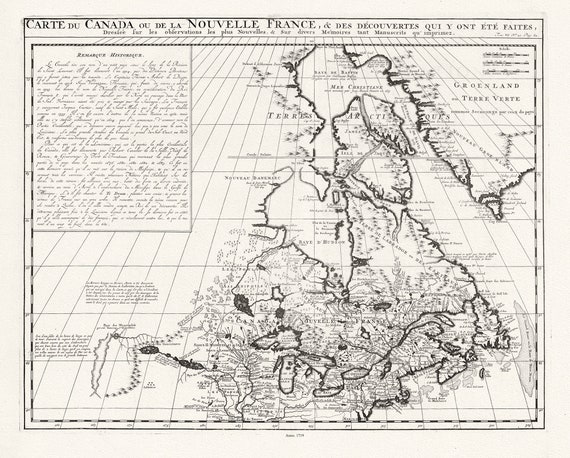 Carte du Canada ou de la Nouvelle France, 1719, Map on heavy cotton canvas, 22x27" approx.
$41.48
Carte du Canada ou de la Nouvelle France, 1719, Map on heavy cotton canvas, 22x27" approx.
$41.48
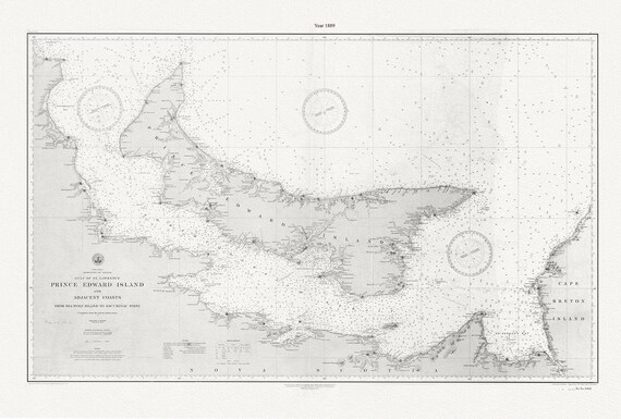 PEI: Prince Edward Island and adjacent coasts, from Sea Wolf Island to Escuminac Point, 1889, Nautical chart on canvas 20x25" approx.
$41.48
PEI: Prince Edward Island and adjacent coasts, from Sea Wolf Island to Escuminac Point, 1889, Nautical chart on canvas 20x25" approx.
$41.48
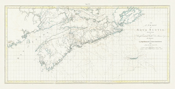 A chart of Nova Scotia, 1775, Des Barres auth., map on durable cotton canvas, 50 x 90 cm, 20 x 30" approx.
$41.48
A chart of Nova Scotia, 1775, Des Barres auth., map on durable cotton canvas, 50 x 90 cm, 20 x 30" approx.
$41.48
 Be Kind to Animals, Support Your Local Humane Society Ver. V , vintage poster on heavy cotton canvas, 20x25" approx.
$45.25
Be Kind to Animals, Support Your Local Humane Society Ver. V , vintage poster on heavy cotton canvas, 20x25" approx.
$45.25
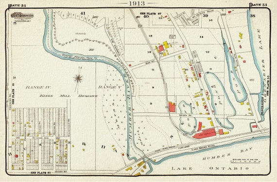 Plate 54, Toronto West, High Park, Swansea, 1913, map on heavy cotton canvas, 20 x 30" approx.
$41.48
Plate 54, Toronto West, High Park, Swansea, 1913, map on heavy cotton canvas, 20 x 30" approx.
$41.48
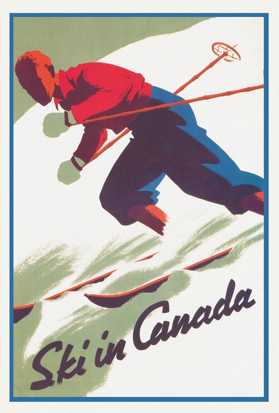 Ski in Canada! Ver. II , travel poster on heavy cotton canvas, 20x25" approx.
$41.48
Ski in Canada! Ver. II , travel poster on heavy cotton canvas, 20x25" approx.
$41.48