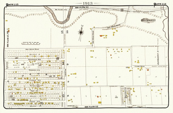
 Plate 115, Toronto East, Danforth, Todmorden, 1913, map on heavy cotton canvas, 20 x 30" or 50 x 75cm. approx.
$41.48
Plate 115, Toronto East, Danforth, Todmorden, 1913, map on heavy cotton canvas, 20 x 30" or 50 x 75cm. approx.
$41.48
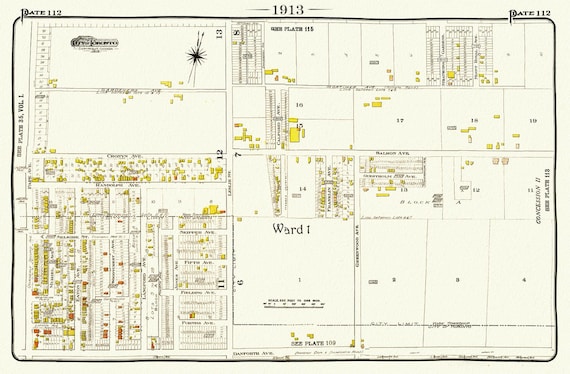 Plate 112, Toronto East, Danforth Pape, Leslie North, 1913, map on heavy cotton canvas, 20 x 30" or 50 x 75cm. approx.
$41.48
Plate 112, Toronto East, Danforth Pape, Leslie North, 1913, map on heavy cotton canvas, 20 x 30" or 50 x 75cm. approx.
$41.48
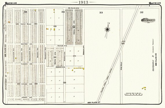 Plate 116, Toronto East, Scarborough, Pharmacy, St. Clair E.,1913, map on heavy cotton canvas, 20 x 30" or 50 x 75cm. approx.
$41.48
Plate 116, Toronto East, Scarborough, Pharmacy, St. Clair E.,1913, map on heavy cotton canvas, 20 x 30" or 50 x 75cm. approx.
$41.48
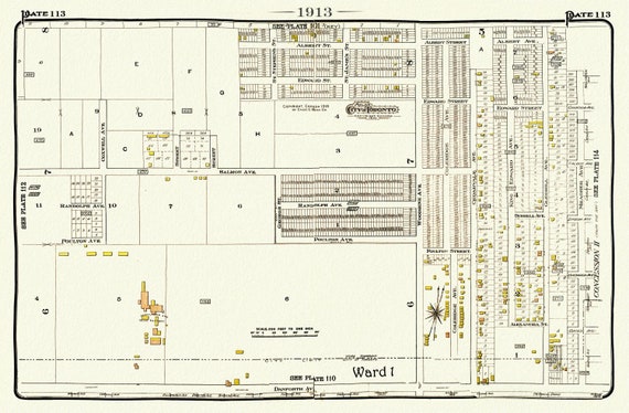 Plate 113, Toronto East, Danforth & Woodbine North, 1913, map on heavy cotton canvas, 20 x 30" or 50 x 75cm. approx.
$41.48
Plate 113, Toronto East, Danforth & Woodbine North, 1913, map on heavy cotton canvas, 20 x 30" or 50 x 75cm. approx.
$41.48
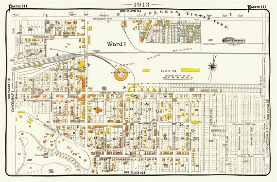 Plate 111, Toronto East, Danforth& Main, Little York, 1913, map on heavy cotton canvas, 20 x 30" or 50 x 75cm. approx.
$41.48
Plate 111, Toronto East, Danforth& Main, Little York, 1913, map on heavy cotton canvas, 20 x 30" or 50 x 75cm. approx.
$41.48
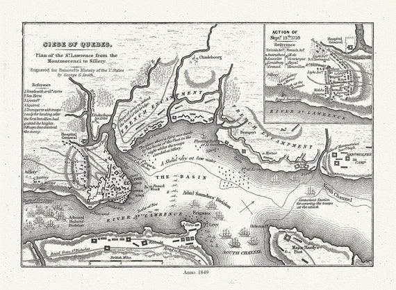 Smith, Siege of Quebec Plan of the St. Lawrence from the Montmorenci to Sillery, 1849 , map on heavy cotton canvas, 20 x 25" approx.
$41.48
Smith, Siege of Quebec Plan of the St. Lawrence from the Montmorenci to Sillery, 1849 , map on heavy cotton canvas, 20 x 25" approx.
$41.48
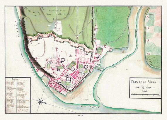 Plan de la ville de Québec, 1750 , map on heavy cotton canvas, 20 x 25" approx.
$41.48
Plan de la ville de Québec, 1750 , map on heavy cotton canvas, 20 x 25" approx.
$41.48
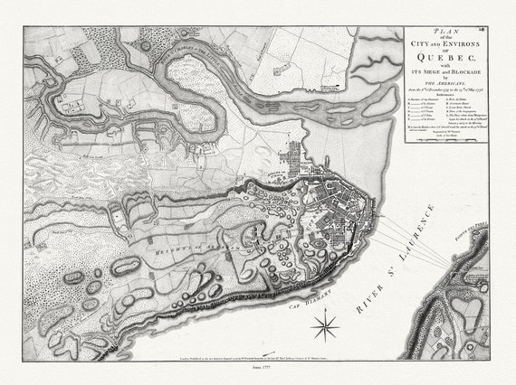 Plan of the city and environs of Quebec with its siege and blockade by the Americans, from 1775 to 1776 Ver. I, 22x27" canvas
$41.48
Plan of the city and environs of Quebec with its siege and blockade by the Americans, from 1775 to 1776 Ver. I, 22x27" canvas
$41.48
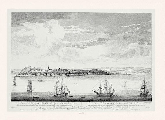 Pitt, Vue de la ville du Québec, capitale du Canada, 1760, map on heavy cotton canvas, 20x27" approx.
$41.48
Pitt, Vue de la ville du Québec, capitale du Canada, 1760, map on heavy cotton canvas, 20x27" approx.
$41.48
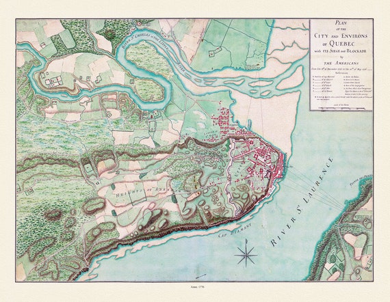 Plan of the city and environs of Quebec, with its siege and blockade by the Americans from 1775-1776,, map on cotton canvas, 20x27" approx.
$41.48
Plan of the city and environs of Quebec, with its siege and blockade by the Americans from 1775-1776,, map on cotton canvas, 20x27" approx.
$41.48
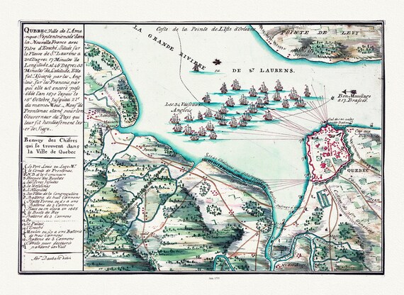 Qubbec, ville de l'Amerique septentrionale dans la Nouvelle France, 1755, map on heavy cotton canvas, 20x27" approx.
$41.48
Qubbec, ville de l'Amerique septentrionale dans la Nouvelle France, 1755, map on heavy cotton canvas, 20x27" approx.
$41.48
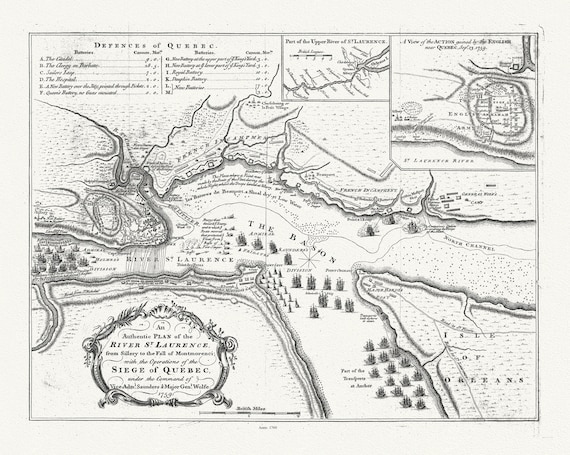 Plan of the River St. Laurence, from Sillery Montmorenci Falls etc...., 1760, map on heavy cotton canvas, 20x27" approx.
$41.48
Plan of the River St. Laurence, from Sillery Montmorenci Falls etc...., 1760, map on heavy cotton canvas, 20x27" approx.
$41.48
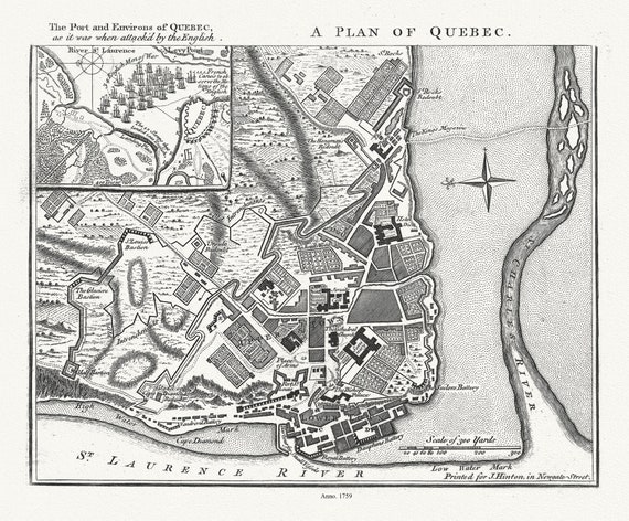 A Plan of Quebec the port and environs of Quebec, as it was when attack'd by the English, 1759, map on heavy cotton canvas, 20x27" approx.
$41.48
A Plan of Quebec the port and environs of Quebec, as it was when attack'd by the English, 1759, map on heavy cotton canvas, 20x27" approx.
$41.48
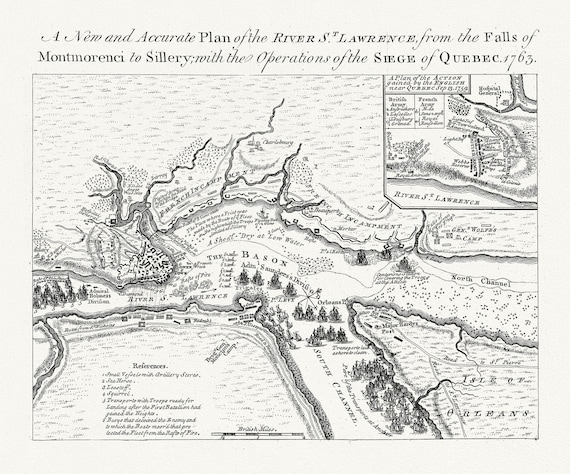 Plan of the river St. Laurence, the falls of Montmorency to Sillery., with the siege of Quebec, 1763, map on cotton canvas, 20x27" approx
$41.48
Plan of the river St. Laurence, the falls of Montmorency to Sillery., with the siege of Quebec, 1763, map on cotton canvas, 20x27" approx
$41.48
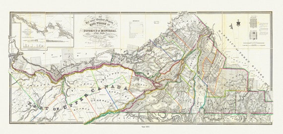 Wyld, Map of the District Of Montreal, Lower Canada, 1831 , map on heavy cotton canvas, 20x27" approx.
$41.48
Wyld, Map of the District Of Montreal, Lower Canada, 1831 , map on heavy cotton canvas, 20x27" approx.
$41.48
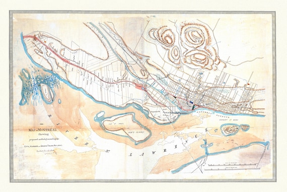 Sketch Map of Montreal and the proposed connection of the Grand Trunk Railway, 1860 , map on heavy cotton canvas, 20x27" approx.
$41.48
Sketch Map of Montreal and the proposed connection of the Grand Trunk Railway, 1860 , map on heavy cotton canvas, 20x27" approx.
$41.48
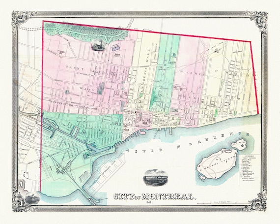 Magnus, City of Montreal, 1863, map on heavy cotton canvas, 20x27" approx.
$41.48
Magnus, City of Montreal, 1863, map on heavy cotton canvas, 20x27" approx.
$41.48
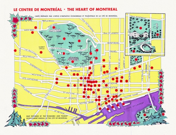 Le Centre de Montréal, The Heart of Montreal, 1960, map on heavy cotton canvas, 20x27" approx.
$41.48
Le Centre de Montréal, The Heart of Montreal, 1960, map on heavy cotton canvas, 20x27" approx.
$41.48
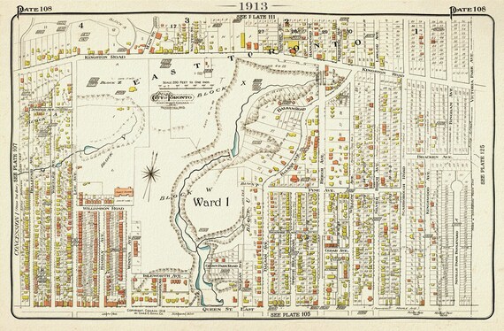 Plate 108, Toronto East, The Beach, Pine Ave.,1913, map on heavy cotton canvas, 20 x 30" or 50 x 75cm. approx.
$41.48
Plate 108, Toronto East, The Beach, Pine Ave.,1913, map on heavy cotton canvas, 20 x 30" or 50 x 75cm. approx.
$41.48
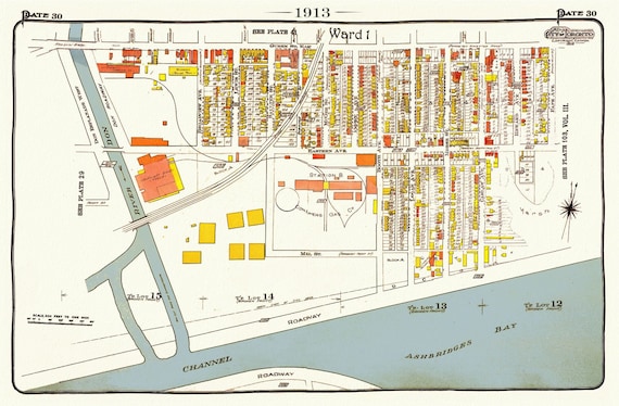 Plate 106, Toronto East, Waterfront, Leslieville, 1913, map on heavy cotton canvas, 20 x 30" or 50 x 75cm. approx.
$33.94
Plate 106, Toronto East, Waterfront, Leslieville, 1913, map on heavy cotton canvas, 20 x 30" or 50 x 75cm. approx.
$33.94