
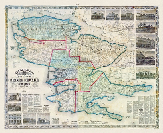
 Prince Edward County, 1863, Tremaine auth., 1863, map on heavy cotton canvas, 50 x 70cm, 20 x 25" approx.
$41.07
Prince Edward County, 1863, Tremaine auth., 1863, map on heavy cotton canvas, 50 x 70cm, 20 x 25" approx.
$41.07
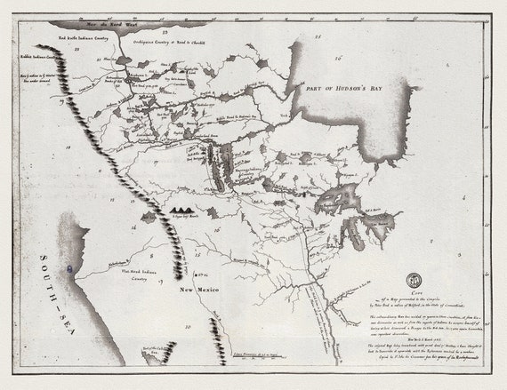 A map shewing the communication of the lakes and the rivers between Lake Superior and Slave Lake in North America, 1785 on canvas, 22x27"
$41.07
A map shewing the communication of the lakes and the rivers between Lake Superior and Slave Lake in North America, 1785 on canvas, 22x27"
$41.07
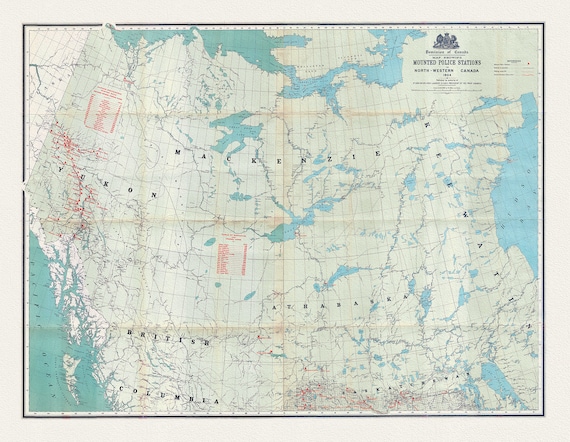 Map showing Mounted Police stations in North-Western Canada, 1904 , map on heavy cotton canvas, 22x27" approx.
$41.07
Map showing Mounted Police stations in North-Western Canada, 1904 , map on heavy cotton canvas, 22x27" approx.
$41.07
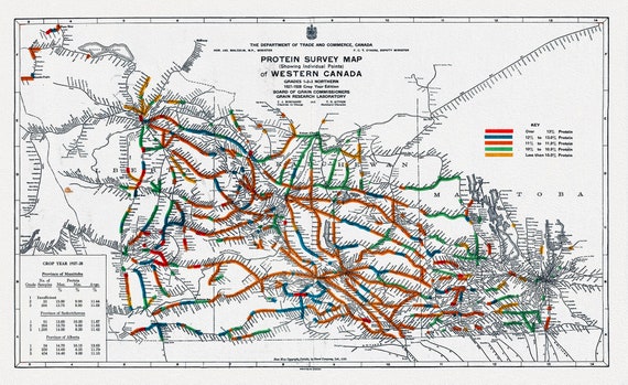 Map of Western Canada showing the protein content of red spring wheat, 1928, map on heavy cotton canvas, 22x27" approx.
$41.07
Map of Western Canada showing the protein content of red spring wheat, 1928, map on heavy cotton canvas, 22x27" approx.
$41.07
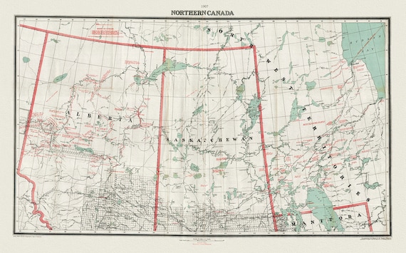 Northern Canada, 1907, map on heavy cotton canvas, 22x27" approx.
$41.07
Northern Canada, 1907, map on heavy cotton canvas, 22x27" approx.
$41.07
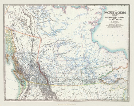 Johnston, Western Canada, 1893, map on heavy cotton canvas, 22x27" approx.
$41.07
Johnston, Western Canada, 1893, map on heavy cotton canvas, 22x27" approx.
$41.07
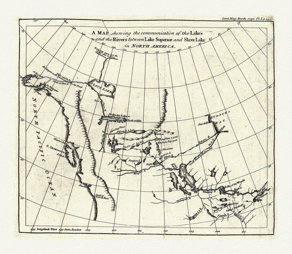 A map shewing the communication of the lakes and rivers between Lake Superior and Slave Lake in N. America, 1790, on canvas, 22x27" approx.
$41.07
A map shewing the communication of the lakes and rivers between Lake Superior and Slave Lake in N. America, 1790, on canvas, 22x27" approx.
$41.07
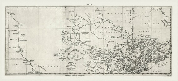 Jefferys, A map of Canada and the north part of Louisiana with the adjacent countrys, 1768 Ver. 2, on heavy cotton canvas, 22x27" approx.
$41.07
Jefferys, A map of Canada and the north part of Louisiana with the adjacent countrys, 1768 Ver. 2, on heavy cotton canvas, 22x27" approx.
$41.07
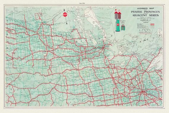 Highways Map of Prairie Provinces and Adjacent States, 1930, map on heavy cotton canvas, 22x27" approx.
$41.07
Highways Map of Prairie Provinces and Adjacent States, 1930, map on heavy cotton canvas, 22x27" approx.
$41.07
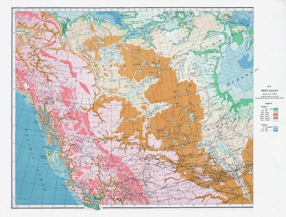 Canada Department of the Interior, West sheet, Physical map of the Dominion of Canada, 1915 , map on heavy cotton canvas, 22x27" approx.
$41.07
Canada Department of the Interior, West sheet, Physical map of the Dominion of Canada, 1915 , map on heavy cotton canvas, 22x27" approx.
$41.07
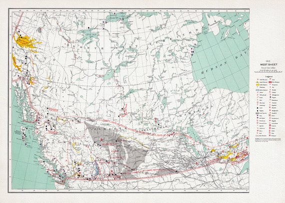 Canada Department of the Interior, West sheet. Mineral map of the Dominion of Canada, 1915, map on heavy cotton canvas, 22x27" approx.
$41.07
Canada Department of the Interior, West sheet. Mineral map of the Dominion of Canada, 1915, map on heavy cotton canvas, 22x27" approx.
$41.07
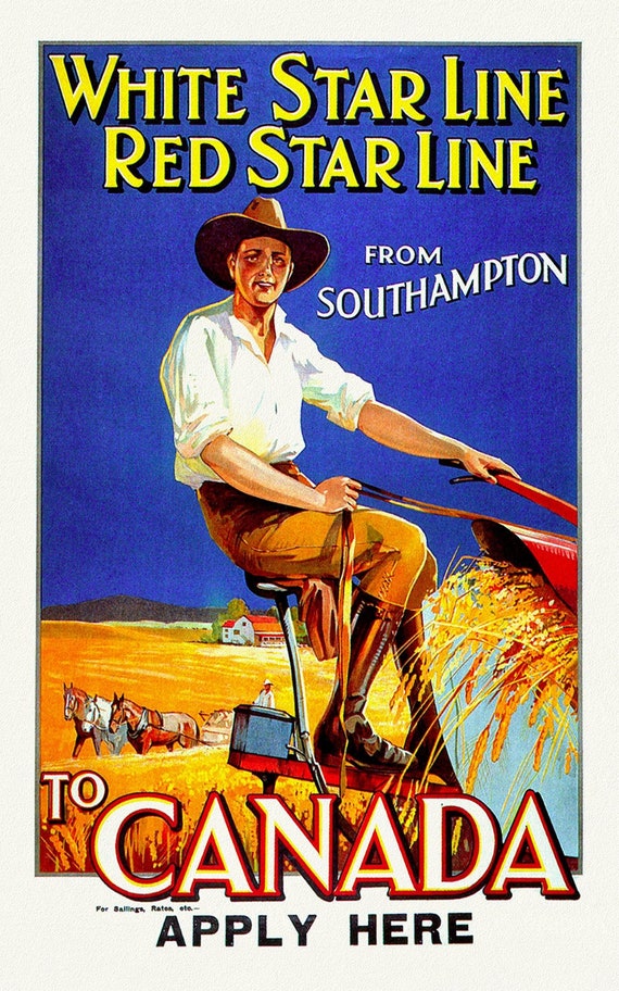 White Star Line to Canada from Southampton, vintage ocean travel poster on heavy cotton canvas, 50 x 70 cm, 20 x 25" approx.
$41.07
White Star Line to Canada from Southampton, vintage ocean travel poster on heavy cotton canvas, 50 x 70 cm, 20 x 25" approx.
$41.07
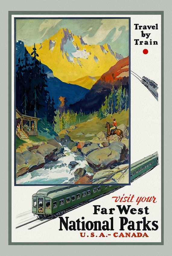 Travel By Train, USA-Canada , vintage train travel poster on heavy cotton canvas, 50 x 70 cm, 20 x 25" approx.
$41.07
Travel By Train, USA-Canada , vintage train travel poster on heavy cotton canvas, 50 x 70 cm, 20 x 25" approx.
$41.07
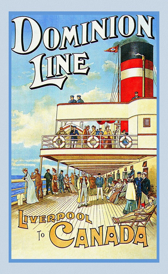 Liverpool to Canada, Dominion Line , vintage travel poster on heavy cotton canvas, 50 x 70 cm, 20 x 25" approx.
$41.07
Liverpool to Canada, Dominion Line , vintage travel poster on heavy cotton canvas, 50 x 70 cm, 20 x 25" approx.
$41.07
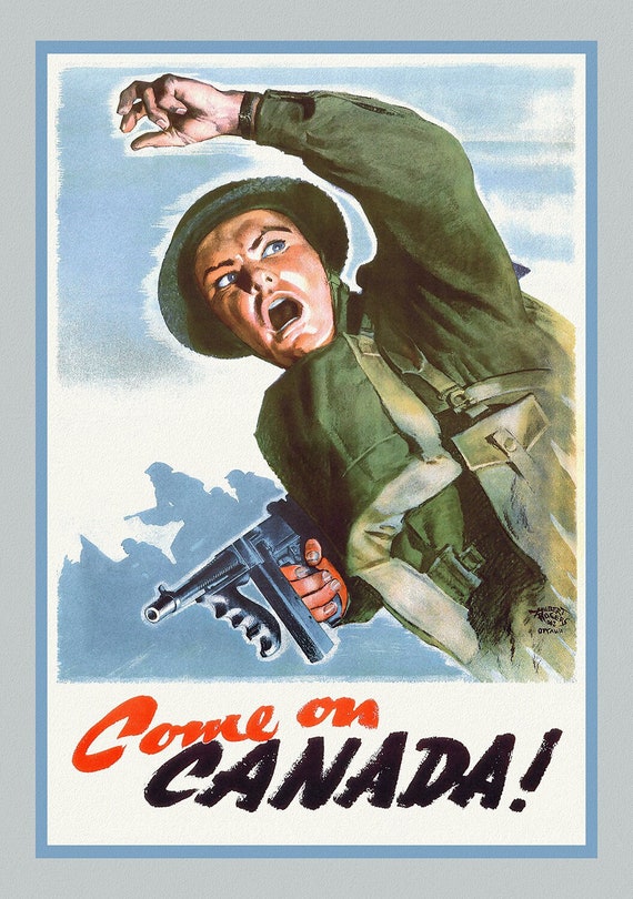 Come on Canada!, 1942 , Canadian war poster on heavy cotton canvas, 50 x 70 cm, 20 x 25" approx.
$41.07
Come on Canada!, 1942 , Canadian war poster on heavy cotton canvas, 50 x 70 cm, 20 x 25" approx.
$41.07
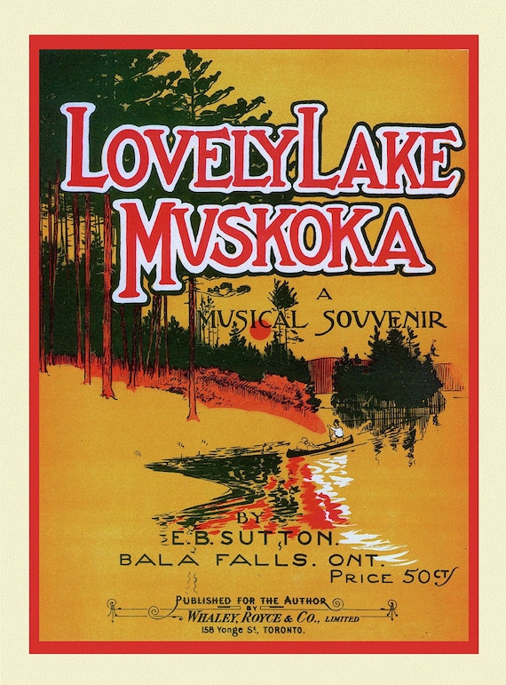 Lovely Lake Muskoka, A Musical Souvenir, travel poster on heavy cotton canvas, 50 x 70 cm, 20 x 25" approx.
$41.07
Lovely Lake Muskoka, A Musical Souvenir, travel poster on heavy cotton canvas, 50 x 70 cm, 20 x 25" approx.
$41.07
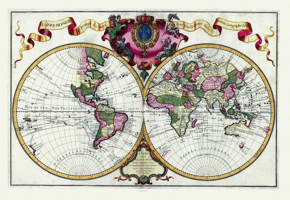 Guillaume Delisle, Mappemonde a l'usage du Roy, 1720 Ver. A, Map on heavy cotton canvas, 22x27in. approx.
$41.07
Guillaume Delisle, Mappemonde a l'usage du Roy, 1720 Ver. A, Map on heavy cotton canvas, 22x27in. approx.
$41.07
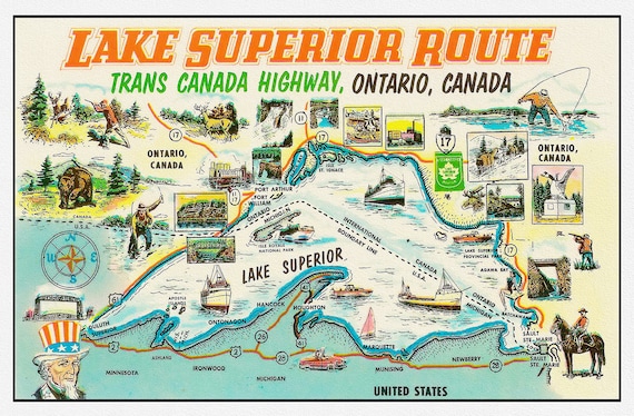 Lake Superior Route, Trans Canada Highway, Ontario, , map on heavy cotton canvas, 22x27" approx.
$41.07
Lake Superior Route, Trans Canada Highway, Ontario, , map on heavy cotton canvas, 22x27" approx.
$41.07
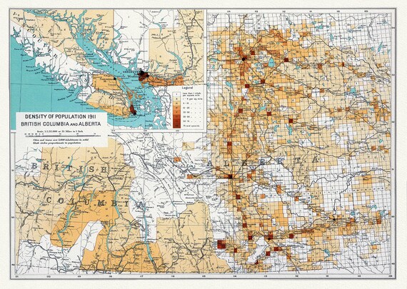 Canada Department of the Interior, Density of population 1911, British Columbia and Alberta, 1915, on heavy cotton canvas, 22x27" approx.
$41.07
Canada Department of the Interior, Density of population 1911, British Columbia and Alberta, 1915, on heavy cotton canvas, 22x27" approx.
$41.07
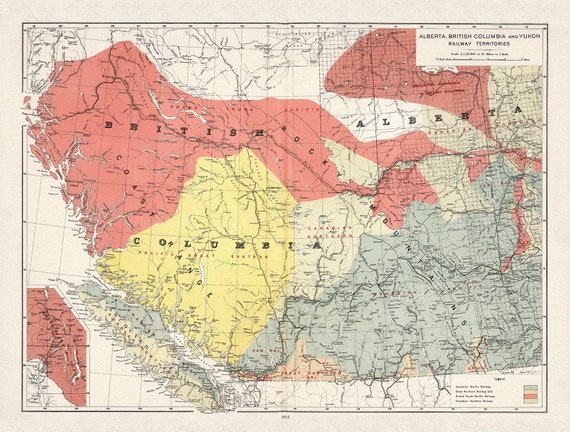 Canada Department of the Interior, Alberta, British Columbia and Yukon Railway Territories, 1915, on heavy cotton canvas, 22x27" approx.
$41.07
Canada Department of the Interior, Alberta, British Columbia and Yukon Railway Territories, 1915, on heavy cotton canvas, 22x27" approx.
$41.07