
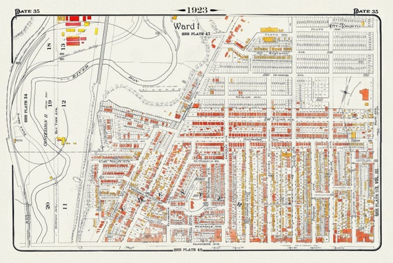
 Plate 35, Toronto East York, Chester, 1923, Map on heavy cotton canvas, 18x27in. approx.
$41.48
Plate 35, Toronto East York, Chester, 1923, Map on heavy cotton canvas, 18x27in. approx.
$41.48
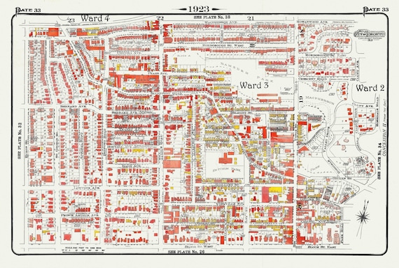 Plate 33, Toronto Uptown, Yorkville, & The Annex, 1923, Map on heavy cotton canvas, 18x27in. approx.
$41.48
Plate 33, Toronto Uptown, Yorkville, & The Annex, 1923, Map on heavy cotton canvas, 18x27in. approx.
$41.48
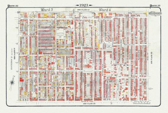 Plate 32, Toronto West, Bloorcourt, Seaton Village, Annex , 1923, Map on heavy cotton canvas, 18x27in. approx.
$41.48
Plate 32, Toronto West, Bloorcourt, Seaton Village, Annex , 1923, Map on heavy cotton canvas, 18x27in. approx.
$41.48
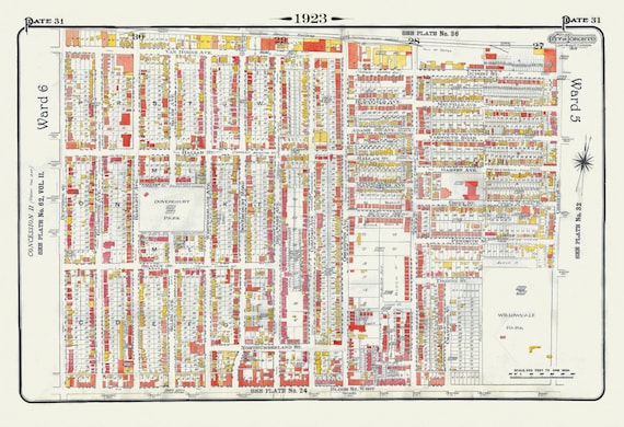 Plate 31, Toronto West, Bloorcourt, Dovercourt, 1923, Map on heavy cotton canvas, 18x27in. approx.
$41.48
Plate 31, Toronto West, Bloorcourt, Dovercourt, 1923, Map on heavy cotton canvas, 18x27in. approx.
$41.48
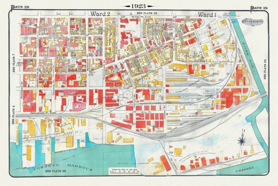 Plate 29, Toronto Downtown East, Corktown, 1923, Map on heavy cotton canvas, 18x27in. approx.
$41.48
Plate 29, Toronto Downtown East, Corktown, 1923, Map on heavy cotton canvas, 18x27in. approx.
$41.48
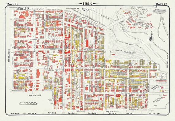 Plate 27, Toronto Downtown East, St. James, Cabbagetown, 1923, Map on heavy cotton canvas, 18x27in. approx.
$41.48
Plate 27, Toronto Downtown East, St. James, Cabbagetown, 1923, Map on heavy cotton canvas, 18x27in. approx.
$41.48
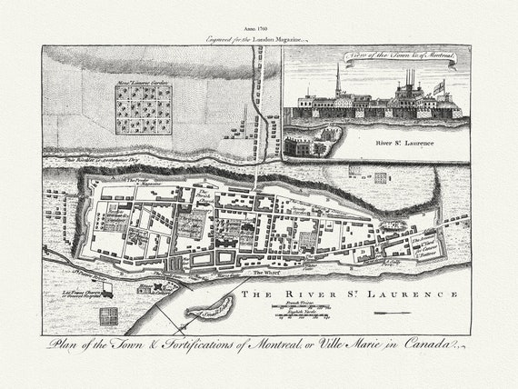 Plan of the town & fortifications of Montreal, or Ville Marie in Canada, 1760, map on heavy cotton canvas, 22x27" approx.
$41.48
Plan of the town & fortifications of Montreal, or Ville Marie in Canada, 1760, map on heavy cotton canvas, 22x27" approx.
$41.48
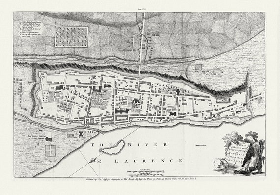 Jefferys, Montreal or Ville Marie, 1758
$41.48
Jefferys, Montreal or Ville Marie, 1758
$41.48
 Map of the Grand Trunk Pacific Railway, also showing lines of the Grand Trunk Railway System, 1906 Western Section, 22x27" cotton canvas
$41.48
Map of the Grand Trunk Pacific Railway, also showing lines of the Grand Trunk Railway System, 1906 Western Section, 22x27" cotton canvas
$41.48
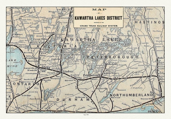 Kawartha Lake District, Grand Trunk Railway, 1903 Ver. II, map on durable cotton canvas, 50 x 70 cm, 20 x 25" approx.
$41.48
Kawartha Lake District, Grand Trunk Railway, 1903 Ver. II, map on durable cotton canvas, 50 x 70 cm, 20 x 25" approx.
$41.48
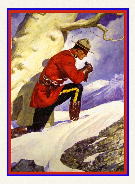
 RCMP, Maintain The Right, Ver. X
$41.48
RCMP, Maintain The Right, Ver. X
$41.48
 RCMP, Maintain The Right, Ver. III, poster on heavy cotton canvas, 50 x 70 cm, 20 x 25" approx.
$41.48
RCMP, Maintain The Right, Ver. III, poster on heavy cotton canvas, 50 x 70 cm, 20 x 25" approx.
$41.48
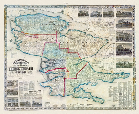 Prince Edward County, 1863, Tremaine auth., 1863, map on heavy cotton canvas, 50 x 70cm, 20 x 25" approx.
$41.48
Prince Edward County, 1863, Tremaine auth., 1863, map on heavy cotton canvas, 50 x 70cm, 20 x 25" approx.
$41.48
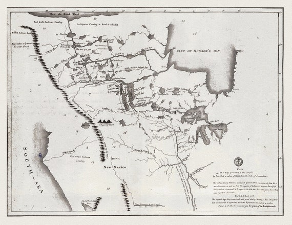 A map shewing the communication of the lakes and the rivers between Lake Superior and Slave Lake in North America, 1785 on canvas, 22x27"
$41.48
A map shewing the communication of the lakes and the rivers between Lake Superior and Slave Lake in North America, 1785 on canvas, 22x27"
$41.48
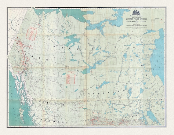 Map showing Mounted Police stations in North-Western Canada, 1904 , map on heavy cotton canvas, 22x27" approx.
$41.48
Map showing Mounted Police stations in North-Western Canada, 1904 , map on heavy cotton canvas, 22x27" approx.
$41.48
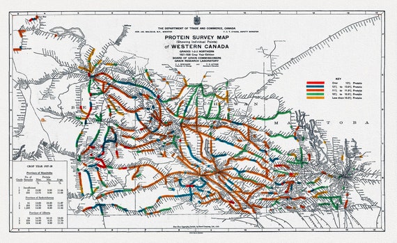 Map of Western Canada showing the protein content of red spring wheat, 1928, map on heavy cotton canvas, 22x27" approx.
$41.48
Map of Western Canada showing the protein content of red spring wheat, 1928, map on heavy cotton canvas, 22x27" approx.
$41.48
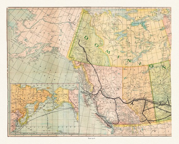
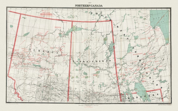 Northern Canada, 1907, map on heavy cotton canvas, 22x27" approx.
$41.48
Northern Canada, 1907, map on heavy cotton canvas, 22x27" approx.
$41.48
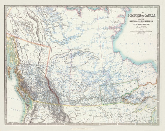 Johnston, Western Canada, 1893, map on heavy cotton canvas, 22x27" approx.
$41.48
Johnston, Western Canada, 1893, map on heavy cotton canvas, 22x27" approx.
$41.48
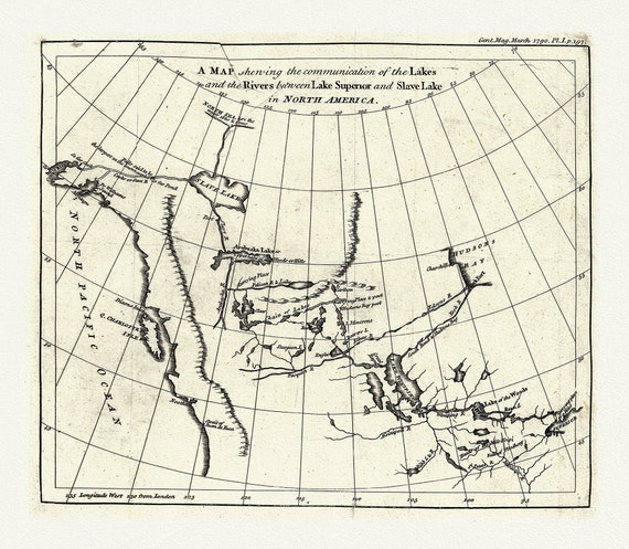 A map shewing the communication of the lakes and rivers between Lake Superior and Slave Lake in N. America, 1790, on canvas, 22x27" approx.
$41.48
A map shewing the communication of the lakes and rivers between Lake Superior and Slave Lake in N. America, 1790, on canvas, 22x27" approx.
$41.48
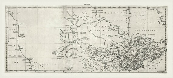 Jefferys, A map of Canada and the north part of Louisiana with the adjacent countrys, 1768 Ver. 2, on heavy cotton canvas, 22x27" approx.
$41.48
Jefferys, A map of Canada and the north part of Louisiana with the adjacent countrys, 1768 Ver. 2, on heavy cotton canvas, 22x27" approx.
$41.48