
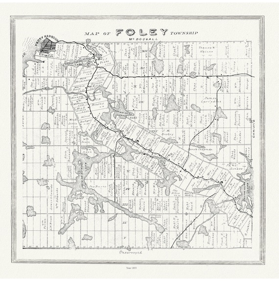
 Muskoka-Haliburton, Foley Township, 1893, map on heavy cotton canvas, 20 x 25" approx.
$41.48
Muskoka-Haliburton, Foley Township, 1893, map on heavy cotton canvas, 20 x 25" approx.
$41.48
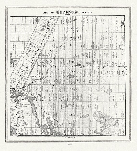 Muskoka-Haliburton, Chapman Township, 1893 , map on heavy cotton canvas, 20 x 25" approx.
$41.48
Muskoka-Haliburton, Chapman Township, 1893 , map on heavy cotton canvas, 20 x 25" approx.
$41.48
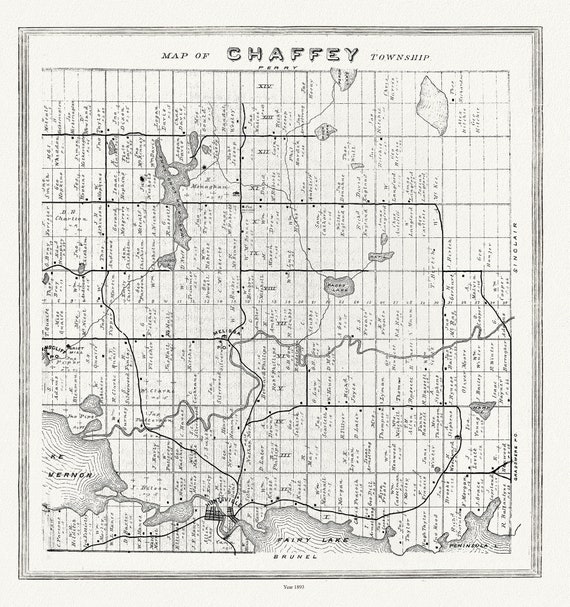 Muskoka-Haliburton, Chaffey Township, 1893, map on heavy cotton canvas, 20 x 25" approx.
$41.48
Muskoka-Haliburton, Chaffey Township, 1893, map on heavy cotton canvas, 20 x 25" approx.
$41.48
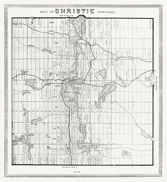 Muskoka-Haliburton, Christie Township, 1893 , map on heavy cotton canvas, 20 x 25" approx.
$41.48
Muskoka-Haliburton, Christie Township, 1893 , map on heavy cotton canvas, 20 x 25" approx.
$41.48
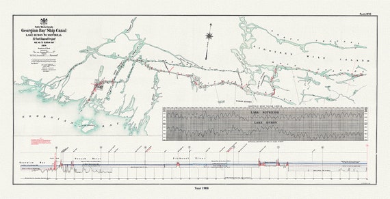 The Georgian Bay Ship Canal from Lake Huron to Montreal, 1908
$41.48
The Georgian Bay Ship Canal from Lake Huron to Montreal, 1908
$41.48
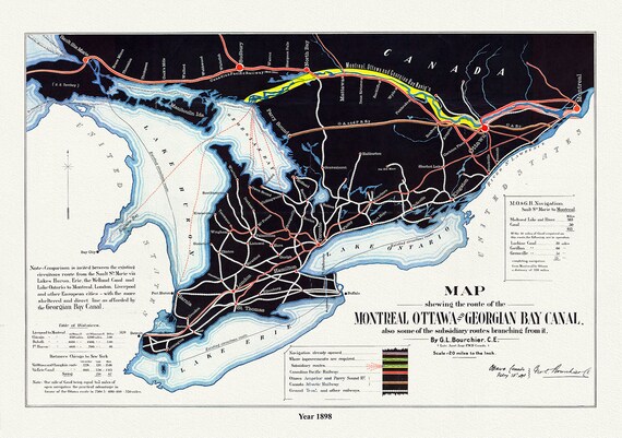 Map shewing the route of the Montreal, Ottawa and Georgian Bay Canal, also subsidiary routes, 1898, on canvas, 50 x 70 cm, 20 x 25" approx.
$41.48
Map shewing the route of the Montreal, Ottawa and Georgian Bay Canal, also subsidiary routes, 1898, on canvas, 50 x 70 cm, 20 x 25" approx.
$41.48
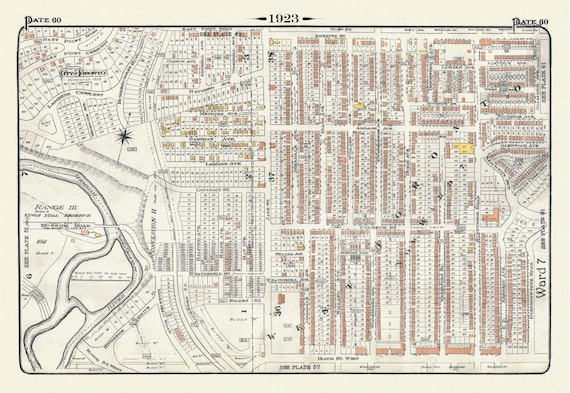 Plate 60, Toronto West, Bloor West Village, 1923, Map on heavy cotton canvas, 18x27in. approx.
$41.48
Plate 60, Toronto West, Bloor West Village, 1923, Map on heavy cotton canvas, 18x27in. approx.
$41.48
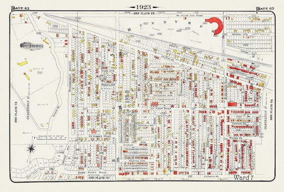 Plate 63, Toronto West, Junction & Stockyards, 1923, Map on heavy cotton canvas, 18x27in. approx.
$41.48
Plate 63, Toronto West, Junction & Stockyards, 1923, Map on heavy cotton canvas, 18x27in. approx.
$41.48
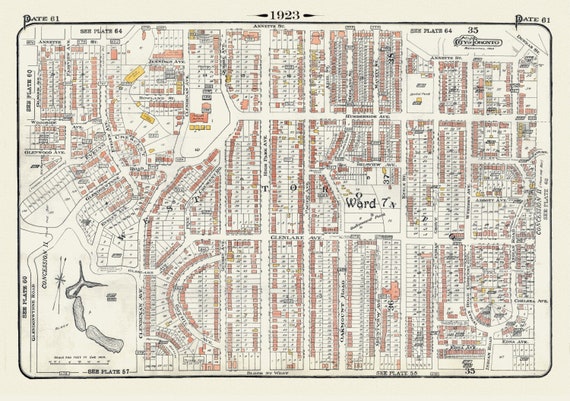 Plate 61, Toronto West, High Park North, 1923, Map on heavy cotton canvas, 18x27in. approx.
$41.48
Plate 61, Toronto West, High Park North, 1923, Map on heavy cotton canvas, 18x27in. approx.
$41.48
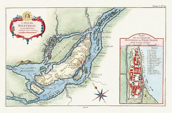 Bellin (Jacques Nicolas, 1703-1772), L'Isle de Montreal, et ses environs, 1764 Ver. C, map on heavy cotton canvas, 20x27" approx.
$41.48
Bellin (Jacques Nicolas, 1703-1772), L'Isle de Montreal, et ses environs, 1764 Ver. C, map on heavy cotton canvas, 20x27" approx.
$41.48
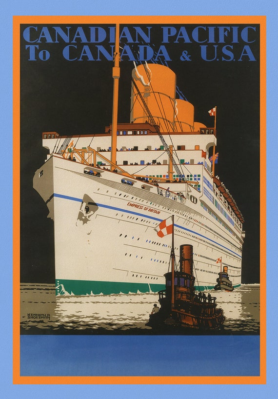 Canadian Pacific to Canada & USA, 1933, travel poster on heavy cotton canvas, 45 x 65 cm, 18 x 24" approx.
$41.48
Canadian Pacific to Canada & USA, 1933, travel poster on heavy cotton canvas, 45 x 65 cm, 18 x 24" approx.
$41.48
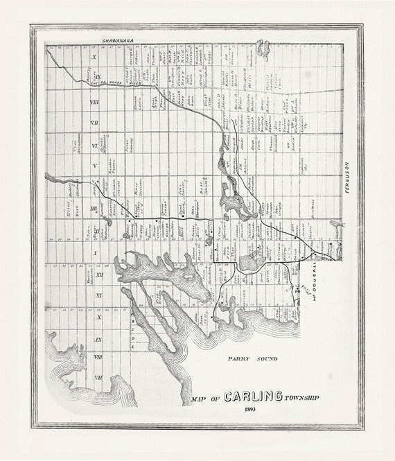 Muskoka-Haliburton, Carling Township, 1893, map on heavy cotton canvas, 20 x 25" approx.
$41.48
Muskoka-Haliburton, Carling Township, 1893, map on heavy cotton canvas, 20 x 25" approx.
$41.48
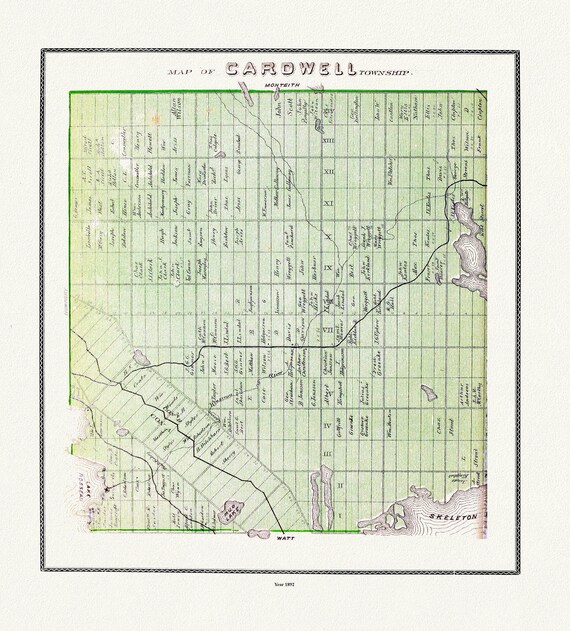 Muskoka-Haliburton, Cardwell Township, 1893, map on heavy cotton canvas, 20 x 25" approx.
$41.48
Muskoka-Haliburton, Cardwell Township, 1893, map on heavy cotton canvas, 20 x 25" approx.
$41.48
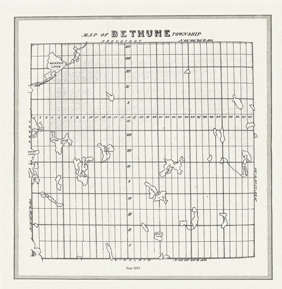 Muskoka-Haliburton, Bethune Township, 1893, map on heavy cotton canvas, 20 x 25" approx.
$41.48
Muskoka-Haliburton, Bethune Township, 1893, map on heavy cotton canvas, 20 x 25" approx.
$41.48
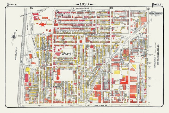 Plate 41, Toronto East, Riverdale & Leslieville, 1923, Map on heavy cotton canvas, 18x27in. approx.
$41.48
Plate 41, Toronto East, Riverdale & Leslieville, 1923, Map on heavy cotton canvas, 18x27in. approx.
$41.48
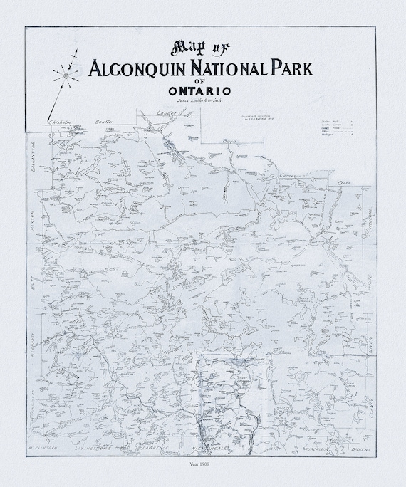 Historic Algonquin Park Map, Dr. Bell auth., 1908 Ver. II , map on heavy cotton canvas, 45 x 65 cm, 18 x 24" approx.
$41.48
Historic Algonquin Park Map, Dr. Bell auth., 1908 Ver. II , map on heavy cotton canvas, 45 x 65 cm, 18 x 24" approx.
$41.48
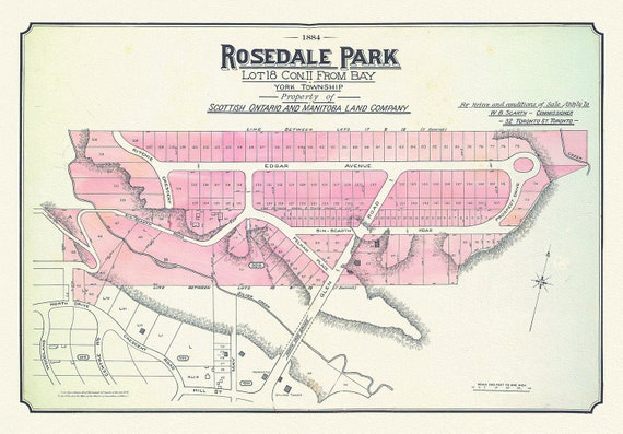 Toronto Uptown, Rosedale, 1884 , map on heavy cotton canvas, 20 x 30" approx.
$41.48
Toronto Uptown, Rosedale, 1884 , map on heavy cotton canvas, 20 x 30" approx.
$41.48
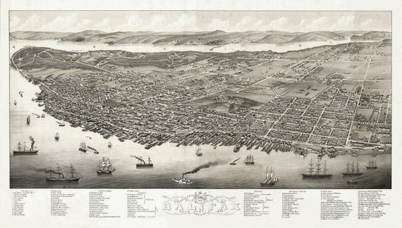 City of Halifax, Panoramic view, Nova Scotia, 1879, on heavy cotton canvas, approx. 18x27"
$41.48
City of Halifax, Panoramic view, Nova Scotia, 1879, on heavy cotton canvas, approx. 18x27"
$41.48
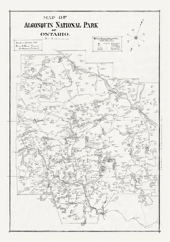 Historic Algonquin Park Map, auth. Arthur Brown, 1925, map on heavy cotton canvas, 19 x 28" approx.
$41.48
Historic Algonquin Park Map, auth. Arthur Brown, 1925, map on heavy cotton canvas, 19 x 28" approx.
$41.48
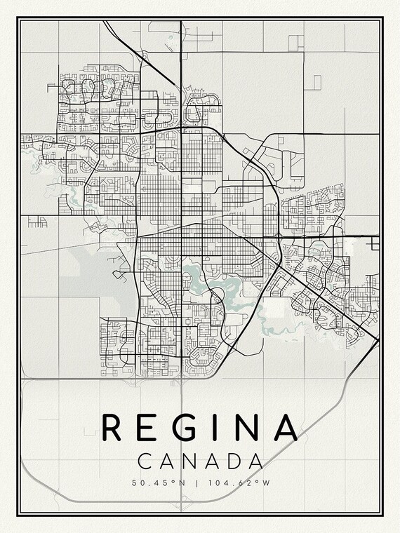 Regina, Saskatchewan, A Modern Map on heavy cotton canvas, 45 x 65 cm, 18 x 24" approx.
$41.48
Regina, Saskatchewan, A Modern Map on heavy cotton canvas, 45 x 65 cm, 18 x 24" approx.
$41.48