
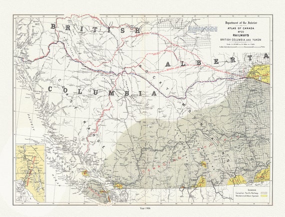
 British Columbia and Yukon, Railways, 1906 , map on durable cotton canvas, 50 x 70 cm, 20 x 25" approx.
$41.48
British Columbia and Yukon, Railways, 1906 , map on durable cotton canvas, 50 x 70 cm, 20 x 25" approx.
$41.48
 Canadian National Railway, Alaska and the Yukon, 1907, map on durable cotton canvas, 50 x 70 cm, 20 x 25" approx.
$41.48
Canadian National Railway, Alaska and the Yukon, 1907, map on durable cotton canvas, 50 x 70 cm, 20 x 25" approx.
$41.48
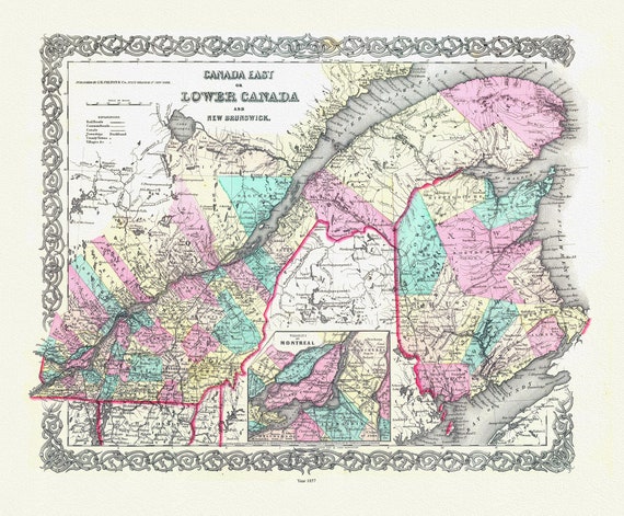
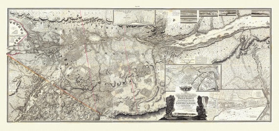
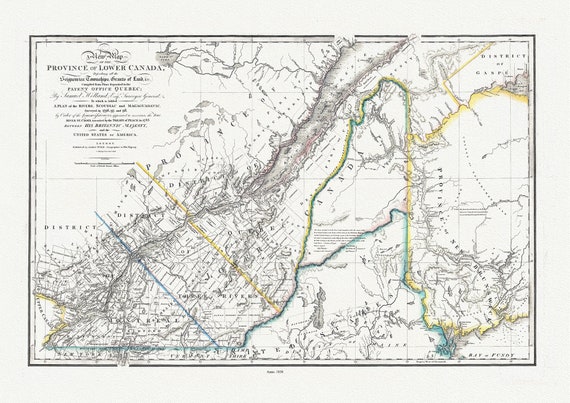 Province Of Lower Canada, 1838 , map on durable cotton canvas, 50 x 70 cm, 20 x 25" approx.
$41.48
Province Of Lower Canada, 1838 , map on durable cotton canvas, 50 x 70 cm, 20 x 25" approx.
$41.48
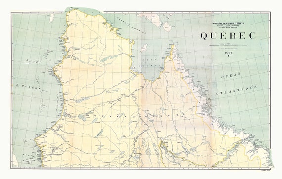 Québec, North Sheet, 1914
$41.48
Québec, North Sheet, 1914
$41.48
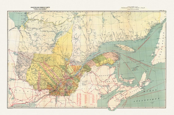 Québec, South Sheet, 1914 , map on durable cotton canvas, 50 x 70 cm, 20 x 25" approx.
$41.48
Québec, South Sheet, 1914 , map on durable cotton canvas, 50 x 70 cm, 20 x 25" approx.
$41.48
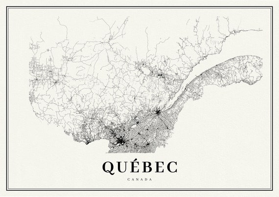 Quebec, A Modern Map
$41.48
Quebec, A Modern Map
$41.48
 Lower Canada. 1857, map on durable cotton canvas, 50 x 70 cm, 20 x 25" approx.
$41.48
Lower Canada. 1857, map on durable cotton canvas, 50 x 70 cm, 20 x 25" approx.
$41.48
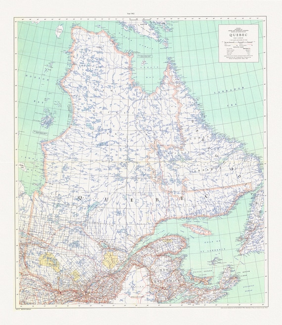 Québec, 1962, map on durable cotton canvas, 50 x 70 cm, 20 x 25" approx.
$41.48
Québec, 1962, map on durable cotton canvas, 50 x 70 cm, 20 x 25" approx.
$41.48
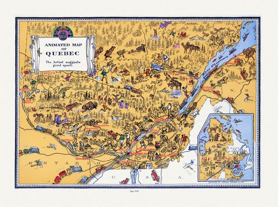 Master et Elias, An Animated Map of Quebec, 1929, map on durable cotton canvas, 50 x 70 cm, 20 x 25" approx.
$41.48
Master et Elias, An Animated Map of Quebec, 1929, map on durable cotton canvas, 50 x 70 cm, 20 x 25" approx.
$41.48
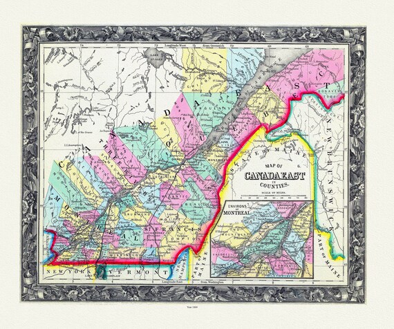 Map Of Canada East, In Counties, 1860 , map on durable cotton canvas, 50 x 70 cm, 20 x 25" approx.
$41.48
Map Of Canada East, In Counties, 1860 , map on durable cotton canvas, 50 x 70 cm, 20 x 25" approx.
$41.48
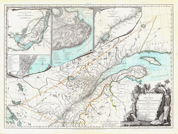 New Map Of The Province of Quebec, 1776, Jefferys auth., map on durable cotton canvas, 50 x 70 cm, 20 x 25" approx.
$41.48
New Map Of The Province of Quebec, 1776, Jefferys auth., map on durable cotton canvas, 50 x 70 cm, 20 x 25" approx.
$41.48
 Map of Quebec, 1884, Hardesty & Co. auth. , map on durable cotton canvas, 50 x 70 cm, 20 x 25" approx.
$41.48
Map of Quebec, 1884, Hardesty & Co. auth. , map on durable cotton canvas, 50 x 70 cm, 20 x 25" approx.
$41.48
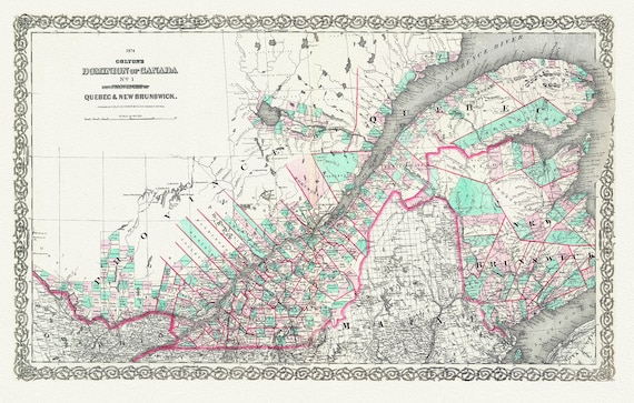 Quebec & New Brunswick, 1874, Colton auth., map on durable cotton canvas, 50 x 70 cm, 20 x 25" approx.
$41.48
Quebec & New Brunswick, 1874, Colton auth., map on durable cotton canvas, 50 x 70 cm, 20 x 25" approx.
$41.48
 Bouchette et Faden, Map of Lower Canada, 1815 , map on durable cotton canvas, 50 x 70 cm, 20 x 25" approx.
$41.48
Bouchette et Faden, Map of Lower Canada, 1815 , map on durable cotton canvas, 50 x 70 cm, 20 x 25" approx.
$41.48
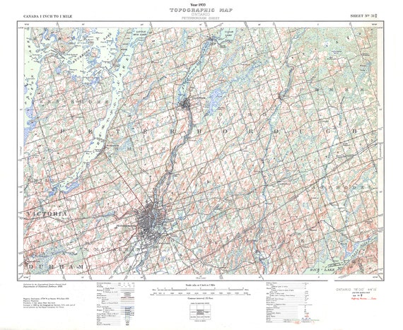 Peterborough, Ont. Topographic Map sheet 031D08, 1933 , map on durable cotton canvas, 50 x 70 cm, 20 x 25" approx.
$41.48
Peterborough, Ont. Topographic Map sheet 031D08, 1933 , map on durable cotton canvas, 50 x 70 cm, 20 x 25" approx.
$41.48
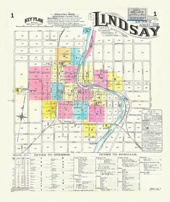 Key Plan, Lindsay, Ontario, 1898 , map on durable cotton canvas, 50 x 70 cm, 20 x 25" approx.
$41.48
Key Plan, Lindsay, Ontario, 1898 , map on durable cotton canvas, 50 x 70 cm, 20 x 25" approx.
$41.48
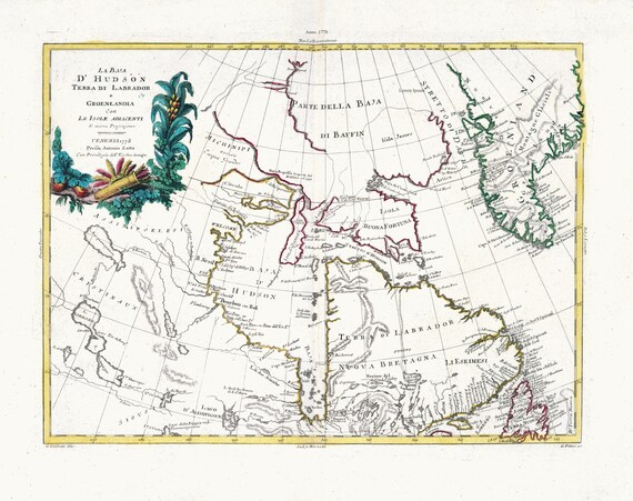 Zatta, Zuiliani, Novelli et Pitteri, La Baja D'Hudson Terra di Labrador e Groenlandia, 1778, map on heavy cotton canvas, 22x27" approx.
$41.48
Zatta, Zuiliani, Novelli et Pitteri, La Baja D'Hudson Terra di Labrador e Groenlandia, 1778, map on heavy cotton canvas, 22x27" approx.
$41.48
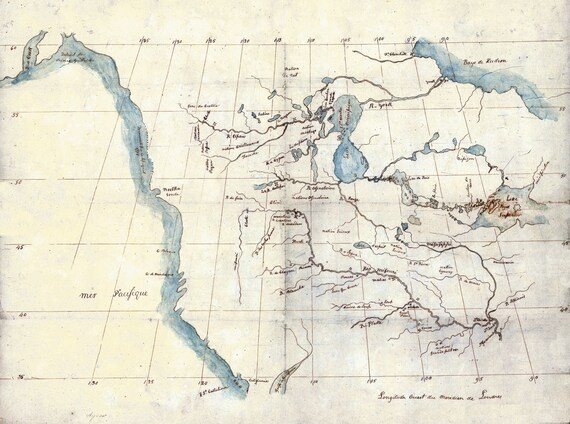 North America from the Mississippi River to the Pacific, between the 35th and 60th parallels, 1790 , on heavy cotton canvas, 22x27" approx.
$41.48
North America from the Mississippi River to the Pacific, between the 35th and 60th parallels, 1790 , on heavy cotton canvas, 22x27" approx.
$41.48
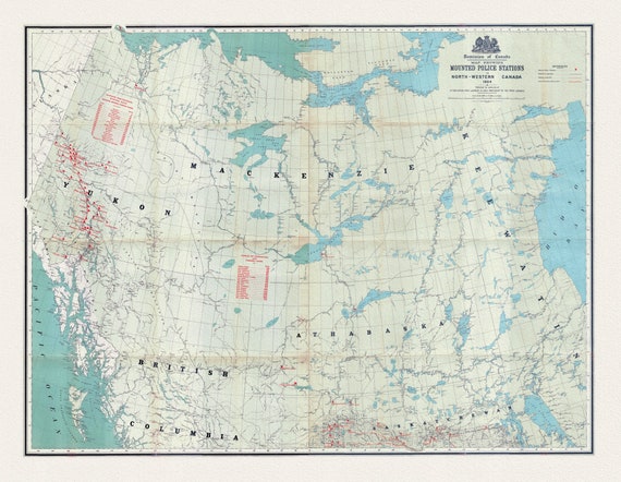 Map showing Mounted Police stations in North-Western Canada, 1904, map on heavy cotton canvas, 22x27" approx.
$41.48
Map showing Mounted Police stations in North-Western Canada, 1904, map on heavy cotton canvas, 22x27" approx.
$41.48
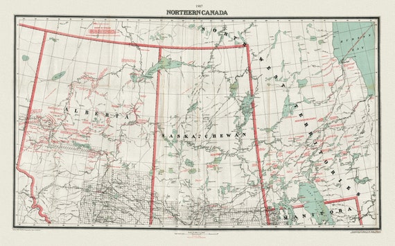 Northern Canada, 1907, map on heavy cotton canvas, 22x27" approx.
$41.48
Northern Canada, 1907, map on heavy cotton canvas, 22x27" approx.
$41.48