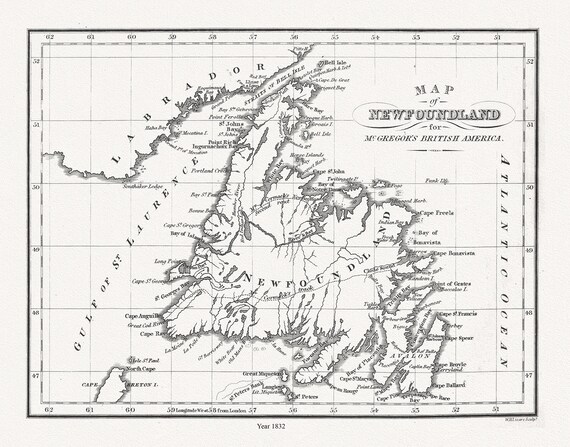
 Map of Newfoundland in British America, McGregor auth., 1832, map on heavy cotton canvas, 45 x 65 cm, 18 x 24" approx.
$45.41
Map of Newfoundland in British America, McGregor auth., 1832, map on heavy cotton canvas, 45 x 65 cm, 18 x 24" approx.
$45.41
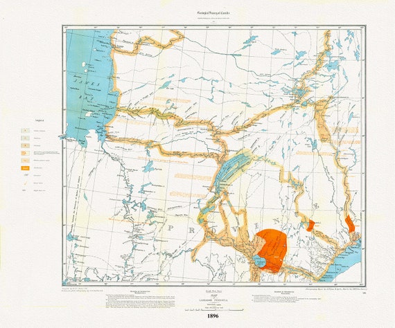 Labrador Peninsula, SW Sheet, 1896 , map on heavy cotton canvas, 45 x 65 cm, 18 x 24" approx.
$45.41
Labrador Peninsula, SW Sheet, 1896 , map on heavy cotton canvas, 45 x 65 cm, 18 x 24" approx.
$45.41
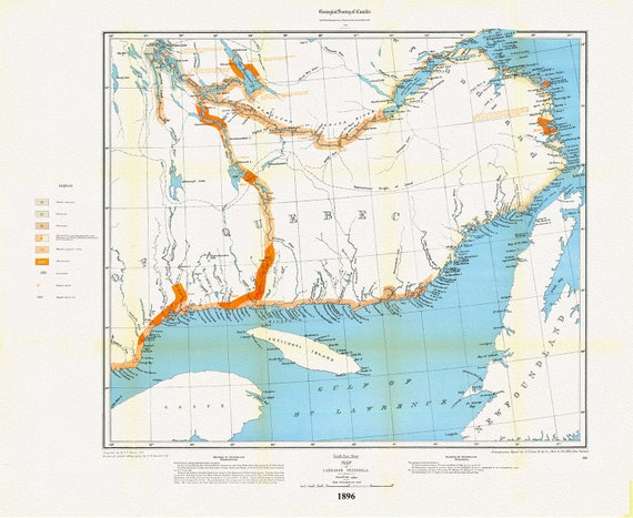 Labrador Peninsula, SE Sheet, 1896, map on heavy cotton canvas, 45 x 65 cm, 18 x 24" approx.
$45.41
Labrador Peninsula, SE Sheet, 1896, map on heavy cotton canvas, 45 x 65 cm, 18 x 24" approx.
$45.41
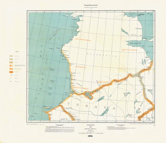 Labrador Peninsula, NW Sheet, 1896 , map on heavy cotton canvas, 45 x 65 cm, 18 x 24" approx.
$45.41
Labrador Peninsula, NW Sheet, 1896 , map on heavy cotton canvas, 45 x 65 cm, 18 x 24" approx.
$45.41
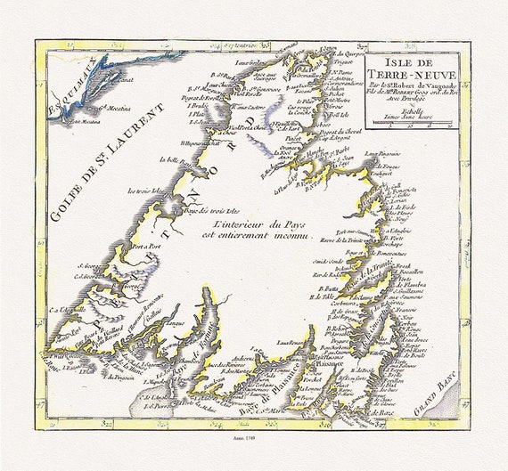 Isle de Terre-neuve, Vaugondy auth., 1749 , map on heavy cotton canvas, 45 x 65 cm, 18 x 24" approx.
$45.41
Isle de Terre-neuve, Vaugondy auth., 1749 , map on heavy cotton canvas, 45 x 65 cm, 18 x 24" approx.
$45.41
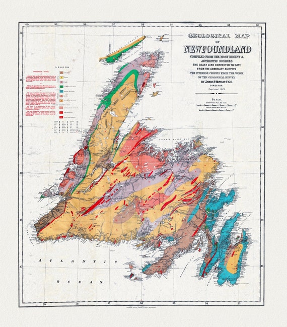
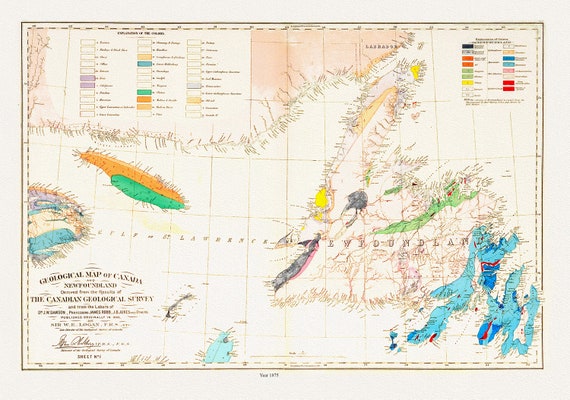 Geological map of Canada and Newfoundland, 1875 , map on heavy cotton canvas, 45 x 65 cm, 18 x 24" approx.
$45.41
Geological map of Canada and Newfoundland, 1875 , map on heavy cotton canvas, 45 x 65 cm, 18 x 24" approx.
$45.41
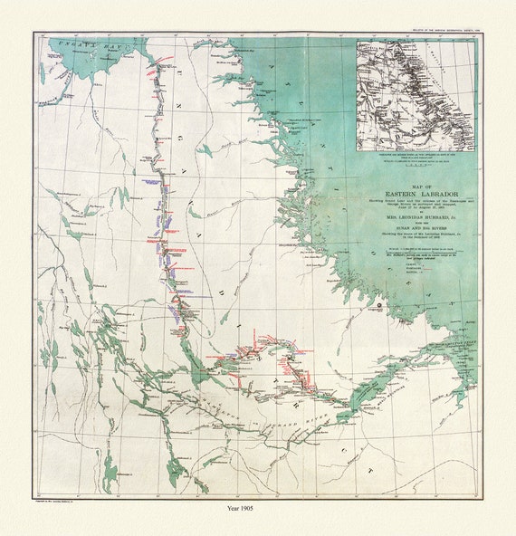 Labrador, Hubbard auth., 1908
$45.41
Labrador, Hubbard auth., 1908
$45.41
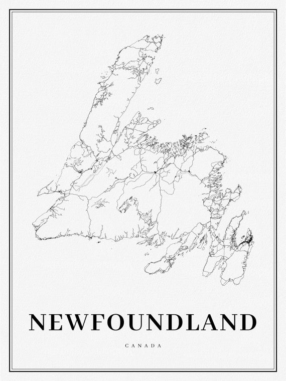 Newfoundland, A Modern Map on heavy cotton canvas, 45 x 65 cm, 18 x 24" approx.
$45.41
Newfoundland, A Modern Map on heavy cotton canvas, 45 x 65 cm, 18 x 24" approx.
$45.41
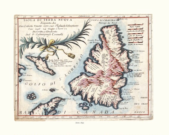
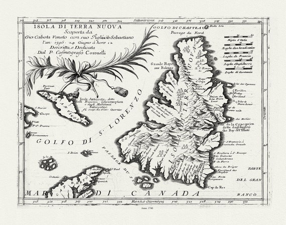 Coronelli, Map of Newfoundland,1692 Ver. III , map on heavy cotton canvas, 45 x 65 cm, 18 x 24" approx.
$45.41
Coronelli, Map of Newfoundland,1692 Ver. III , map on heavy cotton canvas, 45 x 65 cm, 18 x 24" approx.
$45.41
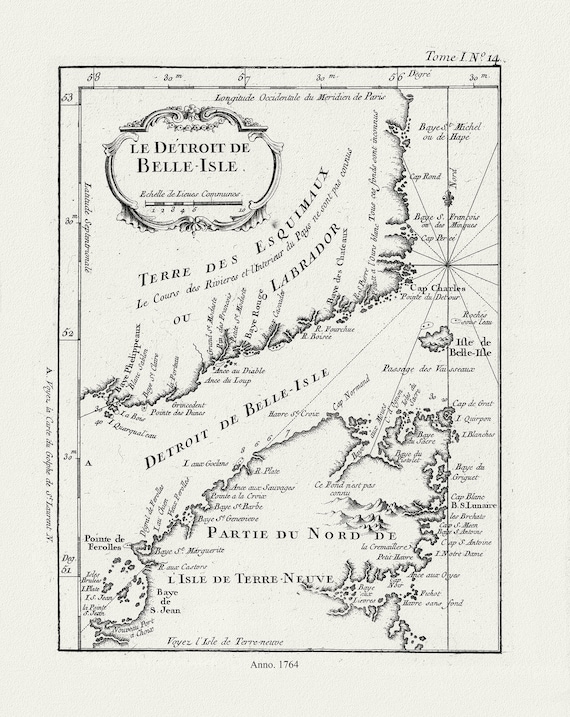 E Bellin, Le Detroit de Belle-Isle, 1764 , map on heavy cotton canvas, 45 x 65 cm, 18 x 24" approx.
$45.41
E Bellin, Le Detroit de Belle-Isle, 1764 , map on heavy cotton canvas, 45 x 65 cm, 18 x 24" approx.
$45.41
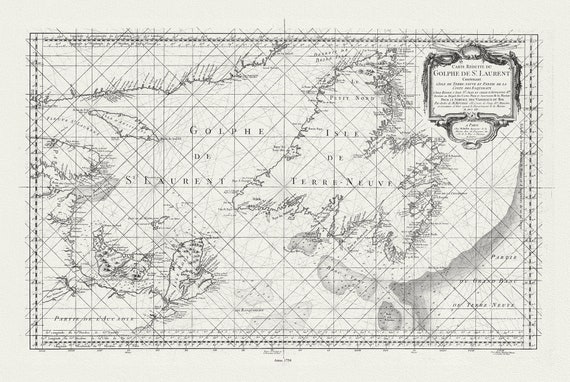 Bellin, Carte reduite du Golphe de St. Laurent, 1754
$45.41
Bellin, Carte reduite du Golphe de St. Laurent, 1754
$45.41
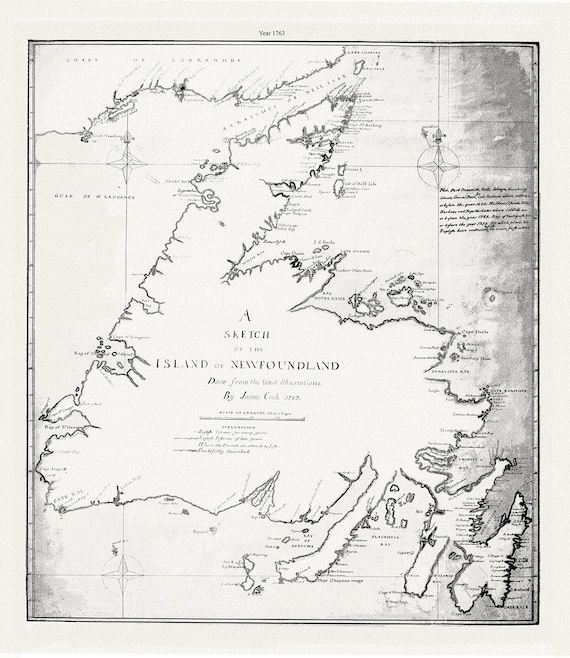 A sketch of the island of Newfoundland.Cook. 1763 , map on heavy cotton canvas, 45 x 65 cm, 18 x 24" approx.
$45.41
A sketch of the island of Newfoundland.Cook. 1763 , map on heavy cotton canvas, 45 x 65 cm, 18 x 24" approx.
$45.41
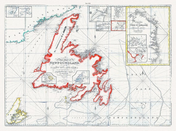 A new chart of Newfoundland, and coast of Labrador extending to Sandwich Bay, Blachford ,1838 , cotton canvas, 45 x 65 cm, 18 x 24" approx.
$45.41
A new chart of Newfoundland, and coast of Labrador extending to Sandwich Bay, Blachford ,1838 , cotton canvas, 45 x 65 cm, 18 x 24" approx.
$45.41
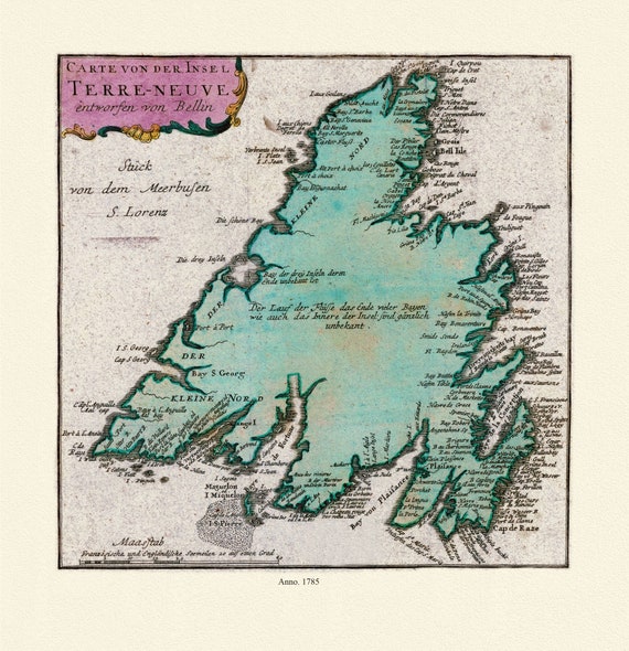 Map of Newfoundland, Canada, 1785, Authors Bellin et Raspe, on Heavy durable cotton canvas, approx. 20 x 24"
$45.41
Map of Newfoundland, Canada, 1785, Authors Bellin et Raspe, on Heavy durable cotton canvas, approx. 20 x 24"
$45.41
 A Geological Map of Newfoundland, dated 1921, on heavy, clear coated, natural cotton canvas, approx. 20x24"
$45.41
A Geological Map of Newfoundland, dated 1921, on heavy, clear coated, natural cotton canvas, approx. 20x24"
$45.41
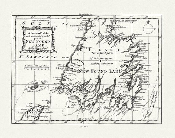 Kitchin, A new map of the only useful and frequented part of New Found Land, 1762 , map on heavy cotton canvas, 22x27" approx.
$41.63
Kitchin, A new map of the only useful and frequented part of New Found Land, 1762 , map on heavy cotton canvas, 22x27" approx.
$41.63
 Map of Newfoundland, Canada, Author Coronelli, 1692, on Heavy clear coated natural cotton canvas, 20x24" approx.
$41.63
Map of Newfoundland, Canada, Author Coronelli, 1692, on Heavy clear coated natural cotton canvas, 20x24" approx.
$41.63
 Map of Newfoundland, Canada, Author Bellin, Jacques Nicolas, 1703-1772, on heavy cotton canvas, approx. 20x24"
$41.63
Map of Newfoundland, Canada, Author Bellin, Jacques Nicolas, 1703-1772, on heavy cotton canvas, approx. 20x24"
$41.63
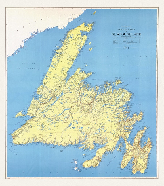 A Ten Mile Map of Newfoundland, 1941 , map on heavy cotton canvas, 50 x 70 cm, 20 x 25" approx.
$45.41
A Ten Mile Map of Newfoundland, 1941 , map on heavy cotton canvas, 50 x 70 cm, 20 x 25" approx.
$45.41
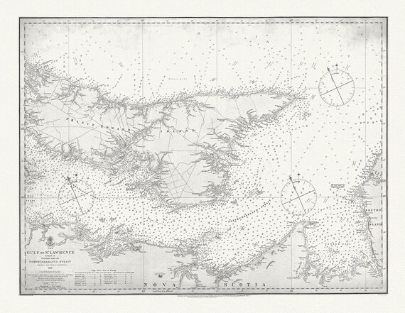 Nautical Chart, Gulf of St. Lawrence. Sheet IX, Eastern Part of Northumberland Strait, 1872, map on heavy cotton canvas, 20 x 25" approx.
$45.41
Nautical Chart, Gulf of St. Lawrence. Sheet IX, Eastern Part of Northumberland Strait, 1872, map on heavy cotton canvas, 20 x 25" approx.
$45.41