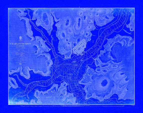
 Nautical Chart, Prince Edward Island, Charlottetown Harbour, 1861 Cyanotype , map on durable cotton canvas, 50 x 70 cm, 20 x 25" approx.
$40.18
Nautical Chart, Prince Edward Island, Charlottetown Harbour, 1861 Cyanotype , map on durable cotton canvas, 50 x 70 cm, 20 x 25" approx.
$40.18
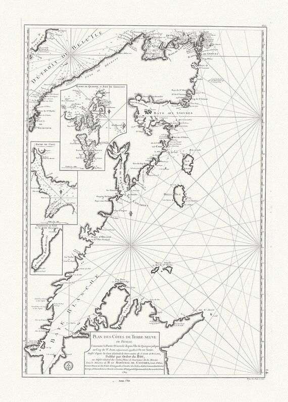 Plan des cotes de Terre-Neuve VII, 1784, Cook et Lane auths. map on durable cotton canvas, 50 x 70 cm, 20 x 25" approx.
$40.18
Plan des cotes de Terre-Neuve VII, 1784, Cook et Lane auths. map on durable cotton canvas, 50 x 70 cm, 20 x 25" approx.
$40.18
 Newfoundland, 1814, Purdie auth., map on durable cotton canvas, 50 x 70 cm, 20 x 25" approx.
$40.18
Newfoundland, 1814, Purdie auth., map on durable cotton canvas, 50 x 70 cm, 20 x 25" approx.
$40.18
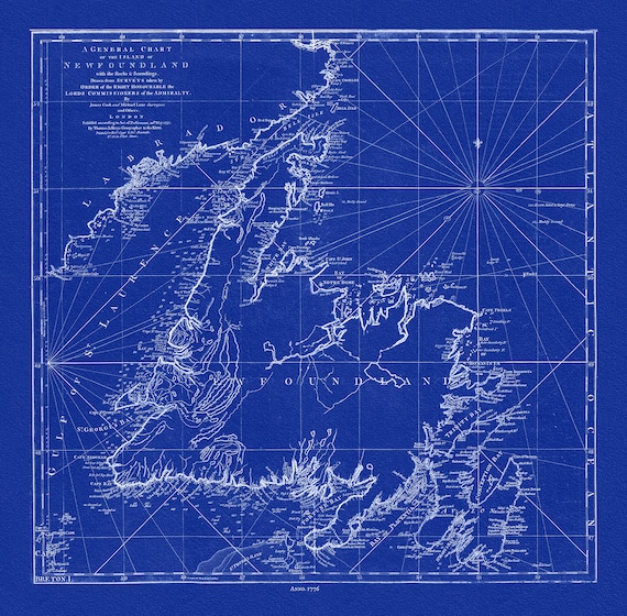 A General Chart Of The Island Of Newfoundland, 1776,Jefferys, auth., Cyanotype, map on durable cotton canvas, 50 x 70 cm, 20 x 25" approx.
$40.18
A General Chart Of The Island Of Newfoundland, 1776,Jefferys, auth., Cyanotype, map on durable cotton canvas, 50 x 70 cm, 20 x 25" approx.
$40.18
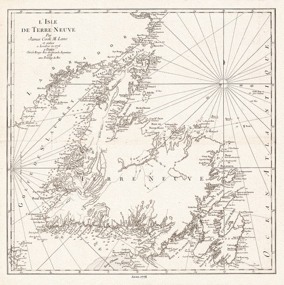 L'Isle de Terre-Neuve, 1778, Capt. Cook auth., map on durable cotton canvas, 50 x 70 cm, 20 x 25" approx.
$40.18
L'Isle de Terre-Neuve, 1778, Capt. Cook auth., map on durable cotton canvas, 50 x 70 cm, 20 x 25" approx.
$40.18
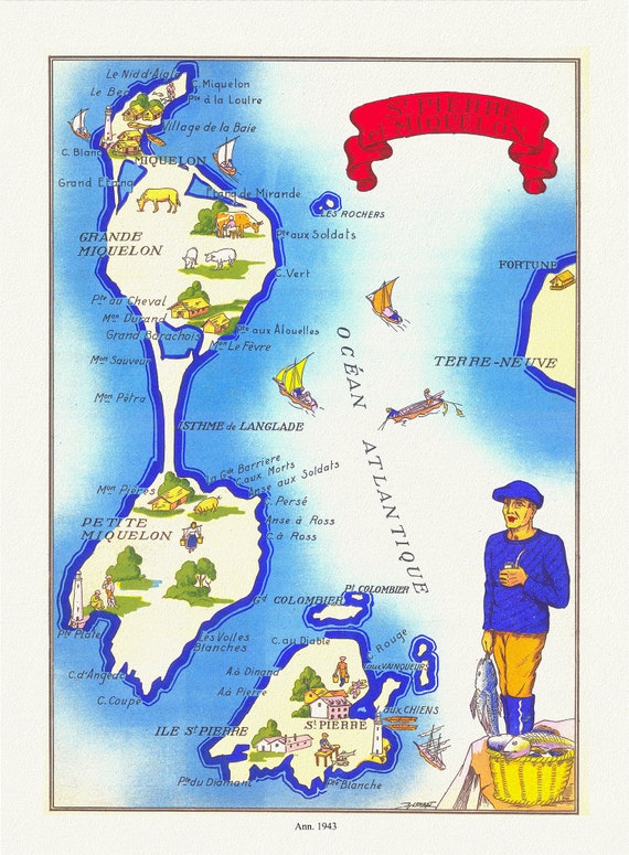 St Pierre et Miquelon, 1943, map on durable cotton canvas, 50 x 70 cm, 20 x 25" approx.
$40.18
St Pierre et Miquelon, 1943, map on durable cotton canvas, 50 x 70 cm, 20 x 25" approx.
$40.18
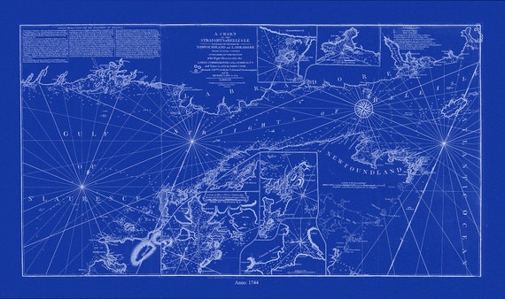 A chart of the Straights of Bell Isle with part of the coast of Newfoundland and Labradore, 1744, Cyanotype Ver. II, canvas, 50 x 70 cm
$40.18
A chart of the Straights of Bell Isle with part of the coast of Newfoundland and Labradore, 1744, Cyanotype Ver. II, canvas, 50 x 70 cm
$40.18
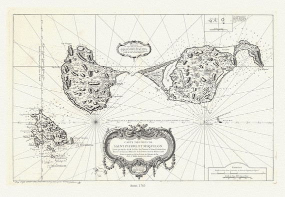 Carte des les Saint Pierre et Miquelon, 1763, Bellin auth. , map on durable cotton canvas, 50 x 70 cm, 20 x 25" approx.
$40.18
Carte des les Saint Pierre et Miquelon, 1763, Bellin auth. , map on durable cotton canvas, 50 x 70 cm, 20 x 25" approx.
$40.18
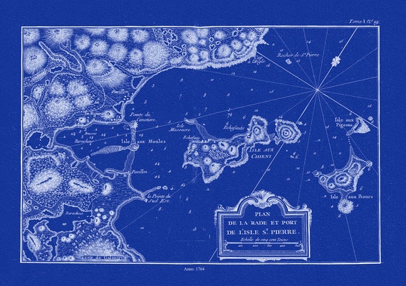 l'Isle St. Pierre,Plan de la rade et port, 1764, Bellin auth., Cyanotype
$40.18
l'Isle St. Pierre,Plan de la rade et port, 1764, Bellin auth., Cyanotype
$40.18
 l'Isle St. Pierre,Plan de la rade et port, 1764, Bellin auth. , map on durable cotton canvas, 50 x 70 cm, 20 x 25" approx.
$40.18
l'Isle St. Pierre,Plan de la rade et port, 1764, Bellin auth. , map on durable cotton canvas, 50 x 70 cm, 20 x 25" approx.
$40.18
 Carte des les Saint Pierre et Miquelon, 1763, Bellin auth., Cyanotype, map on durable cotton canvas, 50 x 70 cm, 20 x 25" approx.
$40.18
Carte des les Saint Pierre et Miquelon, 1763, Bellin auth., Cyanotype, map on durable cotton canvas, 50 x 70 cm, 20 x 25" approx.
$40.18
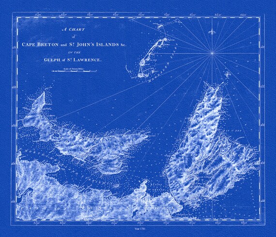 Cape Breton and St. John's Islands &c. in the gulph of St. Lawrence, Des Barres auth.,1781, Cyanotype , canvas, 50 x 70 cm, 20 x 25" approx.
$40.18
Cape Breton and St. John's Islands &c. in the gulph of St. Lawrence, Des Barres auth.,1781, Cyanotype , canvas, 50 x 70 cm, 20 x 25" approx.
$40.18
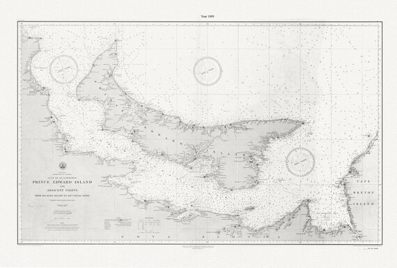 PEI: Prince Edward Island and adjacent coasts, from Sea Wolf Island to Escuminac Point, 1889, Nautical chart on canvas 20x25" approx.
$40.18
PEI: Prince Edward Island and adjacent coasts, from Sea Wolf Island to Escuminac Point, 1889, Nautical chart on canvas 20x25" approx.
$40.18
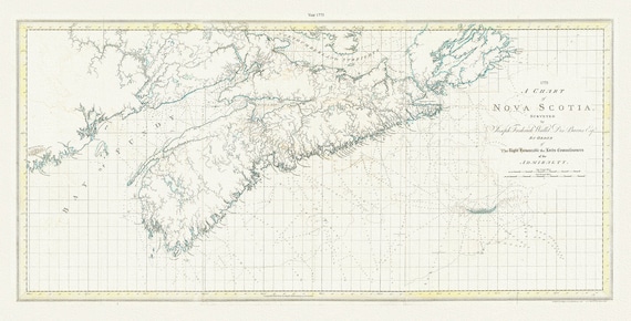 A chart of Nova Scotia, 1775, Des Barres auth., map on durable cotton canvas, 50 x 90 cm, 20 x 30" approx.
$40.18
A chart of Nova Scotia, 1775, Des Barres auth., map on durable cotton canvas, 50 x 90 cm, 20 x 30" approx.
$40.18
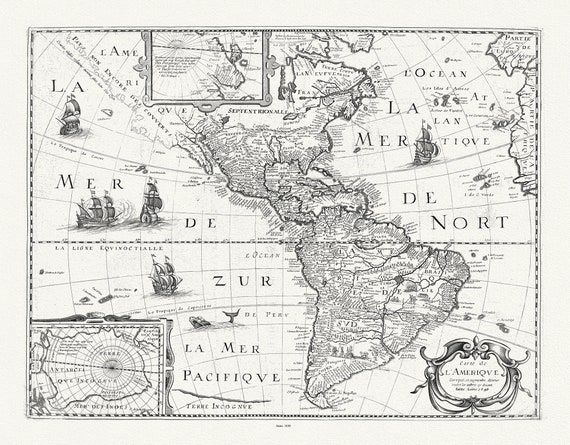 Mariette, Carte de l'Amerique, 1646, map on durable cotton canvas, 50 x 70 cm, 20 x 25" approx.
$40.18
Mariette, Carte de l'Amerique, 1646, map on durable cotton canvas, 50 x 70 cm, 20 x 25" approx.
$40.18
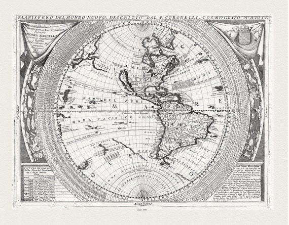 Coronelli, Planisfero del Mondo Nuovo, 1693, map on durable cotton canvas, 50 x 70 cm, 20 x 25" approx.
$40.18
Coronelli, Planisfero del Mondo Nuovo, 1693, map on durable cotton canvas, 50 x 70 cm, 20 x 25" approx.
$40.18
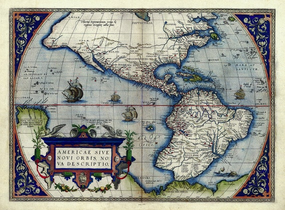 Abraham Ortelius, Theatrum Orbis Terrarum-Americae sive novi orbis, nova descriptio, Anno. 1570 Ver. III, 50 x 70 cm, 20 x 25" approx.
$40.18
Abraham Ortelius, Theatrum Orbis Terrarum-Americae sive novi orbis, nova descriptio, Anno. 1570 Ver. III, 50 x 70 cm, 20 x 25" approx.
$40.18
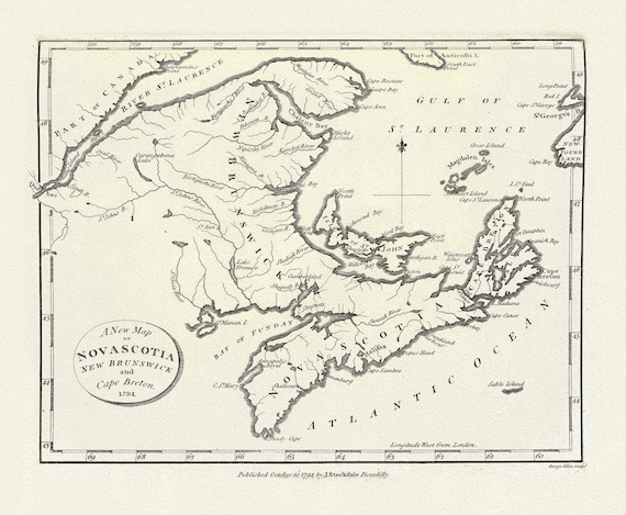 Morse, Jedidiah, A New Map of Nova Scotia, New Brunswick and Cape Breton, 1794, map on durable cotton canvas, 50 x 70 cm, 20 x 25" approx.
$40.18
Morse, Jedidiah, A New Map of Nova Scotia, New Brunswick and Cape Breton, 1794, map on durable cotton canvas, 50 x 70 cm, 20 x 25" approx.
$40.18
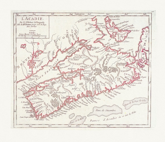 L'Acadie ,1769 Vaugondy auth., map on durable cotton canvas, 50 x 70 cm, 20 x 25" approx.
$40.18
L'Acadie ,1769 Vaugondy auth., map on durable cotton canvas, 50 x 70 cm, 20 x 25" approx.
$40.18
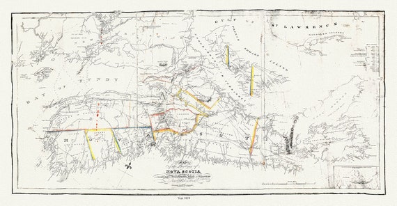 Map of the province of Nova Scotia including Cape Breton Prince Edwards Island and part of New Brunswick, Toler, 1819, 20 x 25" approx.
$40.18
Map of the province of Nova Scotia including Cape Breton Prince Edwards Island and part of New Brunswick, Toler, 1819, 20 x 25" approx.
$40.18