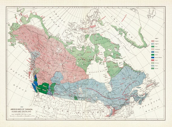
 Aborigines of Canada, Alaska and Greenland, issued 1915, Map on heavy cotton canvas, 22x27" approx.
$33.98
Aborigines of Canada, Alaska and Greenland, issued 1915, Map on heavy cotton canvas, 22x27" approx.
$33.98
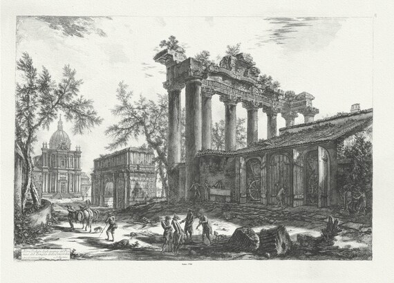 Giovanni Battista Piranesi, Alternate view of the Temple of Concord, 1760 , map on heavy cotton canvas, 22x27" approx.
$33.98
Giovanni Battista Piranesi, Alternate view of the Temple of Concord, 1760 , map on heavy cotton canvas, 22x27" approx.
$33.98
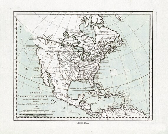 Carte de L'Amerique Septentrionale, 1744 Ver. II, map on heavy cotton canvas, 22x27" approx.
$33.98
Carte de L'Amerique Septentrionale, 1744 Ver. II, map on heavy cotton canvas, 22x27" approx.
$33.98
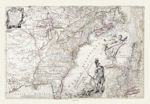 Carte de l'Amérique Septle. pour servir à l'intelligence de la guerre entre les Anglois et les insurgents, 1777,canvas,22x27" approx.
$33.98
Carte de l'Amérique Septle. pour servir à l'intelligence de la guerre entre les Anglois et les insurgents, 1777,canvas,22x27" approx.
$33.98
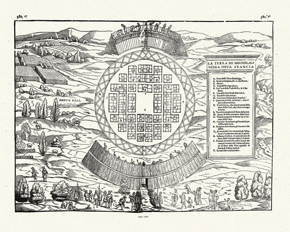 Rasmusio, Hochelaga,1606
$33.98
Rasmusio, Hochelaga,1606
$33.98
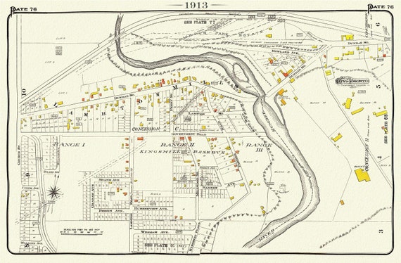 Plate 76, Toronto West, Etobicoke, Kingsway, Lambton, 1913, map on heavy cotton canvas, 20 x 30" or 50 x 75cm. approx.
$33.98
Plate 76, Toronto West, Etobicoke, Kingsway, Lambton, 1913, map on heavy cotton canvas, 20 x 30" or 50 x 75cm. approx.
$33.98
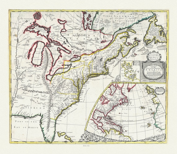 A New Map of the English Empire in America, 1721, on heavy cotton canvas, 22x27" approx.
$33.98
A New Map of the English Empire in America, 1721, on heavy cotton canvas, 22x27" approx.
$33.98
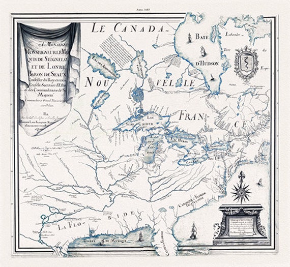
 Nouvelle France, 1714, map on heavy cotton canvas, 22x27" approx.
$33.98
Nouvelle France, 1714, map on heavy cotton canvas, 22x27" approx.
$33.98
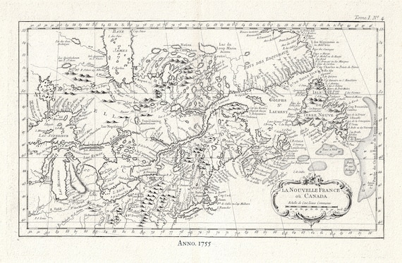 Canada, Nouvelle France, 1755, Jacques Nicolas Bellin, map on heavy cotton canvas, 50x70cm (20 x 25") approx.
$33.98
Canada, Nouvelle France, 1755, Jacques Nicolas Bellin, map on heavy cotton canvas, 50x70cm (20 x 25") approx.
$33.98
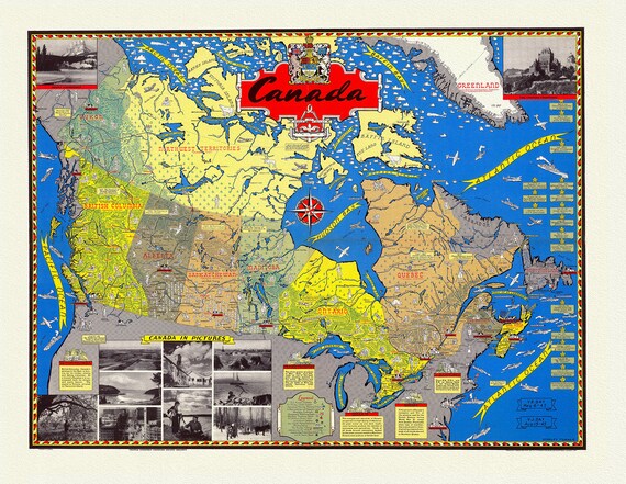 Canada in Pictures, 1945, Map on heavy cotton canvas, 22x27" approx.
$33.98
Canada in Pictures, 1945, Map on heavy cotton canvas, 22x27" approx.
$33.98
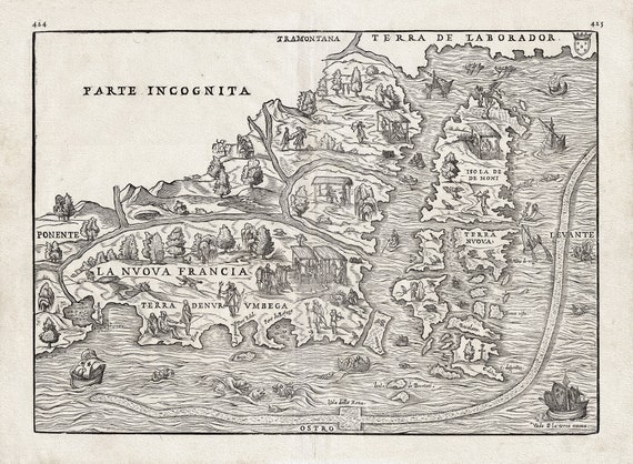 Rasmusio, La Terra Nuova, 1556, on heavy cotton canvas, approx.22x27"
$33.98
Rasmusio, La Terra Nuova, 1556, on heavy cotton canvas, approx.22x27"
$33.98
 Amérique septentrionale sur les iournaux, mémoires, et observations les plus justes en l'année 1685
$33.98
Amérique septentrionale sur les iournaux, mémoires, et observations les plus justes en l'année 1685
$33.98
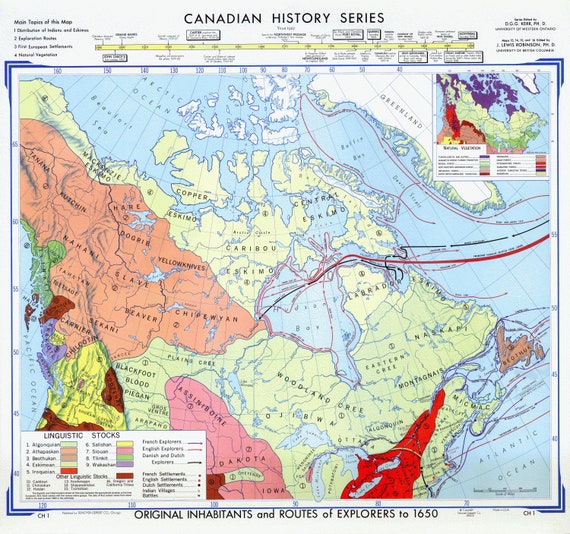 Map of Canadian History & Exploration, 1965, on heavy cotton canvas, 22x27" approx.
$33.98
Map of Canadian History & Exploration, 1965, on heavy cotton canvas, 22x27" approx.
$33.98
 Canada Air Mail Routes,1939, on heavy cotton canvas, 22x27" approx.
$33.98
Canada Air Mail Routes,1939, on heavy cotton canvas, 22x27" approx.
$33.98
 A Mineral Map of Canada, 1911, on heavy cotton canvas, 16x27" approx.
$33.98
A Mineral Map of Canada, 1911, on heavy cotton canvas, 16x27" approx.
$33.98
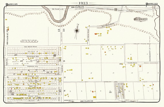 Plate 115, Toronto East , Danforth, Todmorden, 1913, map on heavy cotton canvas, 50 x 70cm, 20 x 25" approx.
$33.98
Plate 115, Toronto East , Danforth, Todmorden, 1913, map on heavy cotton canvas, 50 x 70cm, 20 x 25" approx.
$33.98
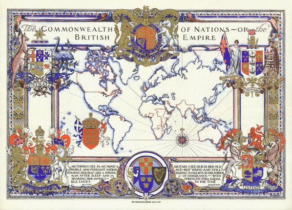 The Commonwealth of Nations ( or the British Empire ), 1937, on heavy cotton canvas, 22x27" approx.
$33.98
The Commonwealth of Nations ( or the British Empire ), 1937, on heavy cotton canvas, 22x27" approx.
$33.98
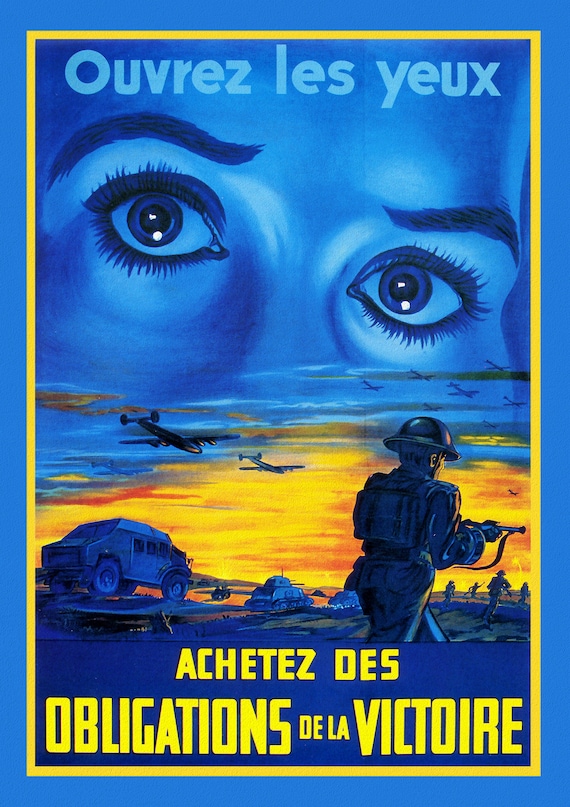 Canada WW I Poster, Open Your Eyes !, 1915,on heavy cotton canvas, 22x27" approx.
$33.98
Canada WW I Poster, Open Your Eyes !, 1915,on heavy cotton canvas, 22x27" approx.
$33.98
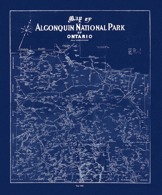 Historic Algonquin Park Map, Dr. Bell auth., 1908 Ver. Cyanotype , map on heavy cotton canvas, 45 x 65 cm, 18 x 24" approx.
$33.98
Historic Algonquin Park Map, Dr. Bell auth., 1908 Ver. Cyanotype , map on heavy cotton canvas, 45 x 65 cm, 18 x 24" approx.
$33.98
 Canada WW I Poster, Britishers, you're needed! Come across now! ,1917, on heavy canvas, 22x27" approx.
$33.98
Canada WW I Poster, Britishers, you're needed! Come across now! ,1917, on heavy canvas, 22x27" approx.
$33.98