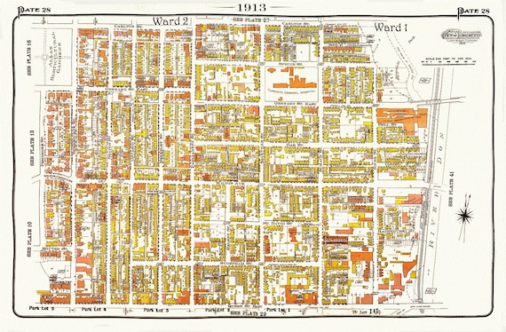
 Plate 28, Toronto Central East, Cabbagetown, 1913, map on heavy cotton canvas, 20 x 30" approx.
$33.94
Plate 28, Toronto Central East, Cabbagetown, 1913, map on heavy cotton canvas, 20 x 30" approx.
$33.94
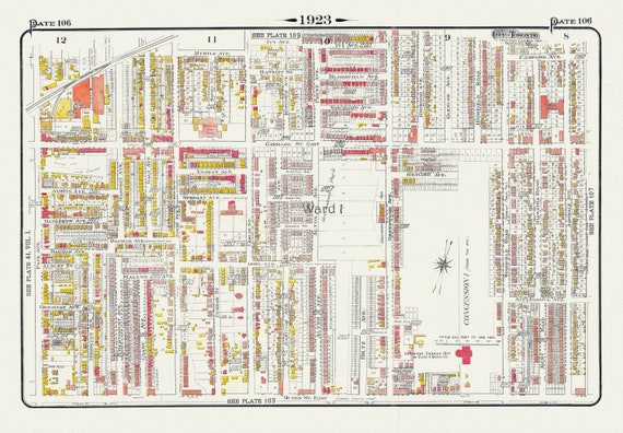 Plate 106, Toronto East, Leslieville and North, 1923, Map on heavy cotton canvas, 18x27in. approx.
$33.94
Plate 106, Toronto East, Leslieville and North, 1923, Map on heavy cotton canvas, 18x27in. approx.
$33.94
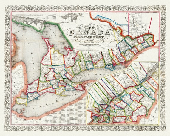 Ensign, Bridgman & Fanning, A Map of Canada East And West, 1855, map on heavy cotton canvas, 22x27" approx.
$33.94
Ensign, Bridgman & Fanning, A Map of Canada East And West, 1855, map on heavy cotton canvas, 22x27" approx.
$33.94
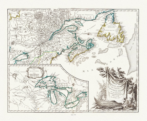 Nouvelle France ou le Canada, 1755, map on heavy cotton canvas, 22x27", 22x27" approx.
$33.94
Nouvelle France ou le Canada, 1755, map on heavy cotton canvas, 22x27", 22x27" approx.
$33.94
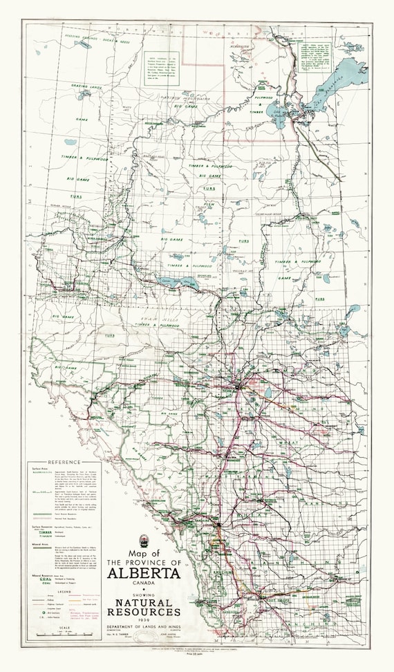 Map of the Province of Alberta, Canada, showing natural resources, 1945 ,on heavy cotton canvas, 22x27" approx.
$33.94
Map of the Province of Alberta, Canada, showing natural resources, 1945 ,on heavy cotton canvas, 22x27" approx.
$33.94
 Plate 114, Toronto East, Danforth Ave., Dawes Ave., 1913, map on heavy cotton canvas, 20 x 30" or 50 x 75cm. approx.
$33.94
Plate 114, Toronto East, Danforth Ave., Dawes Ave., 1913, map on heavy cotton canvas, 20 x 30" or 50 x 75cm. approx.
$33.94
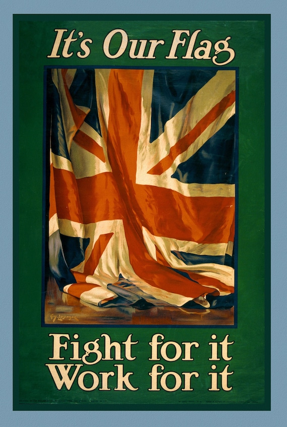 It's our flag. Fight for it. Work for it, Canada WW I Poster, 1915
$33.94
It's our flag. Fight for it. Work for it, Canada WW I Poster, 1915
$33.94
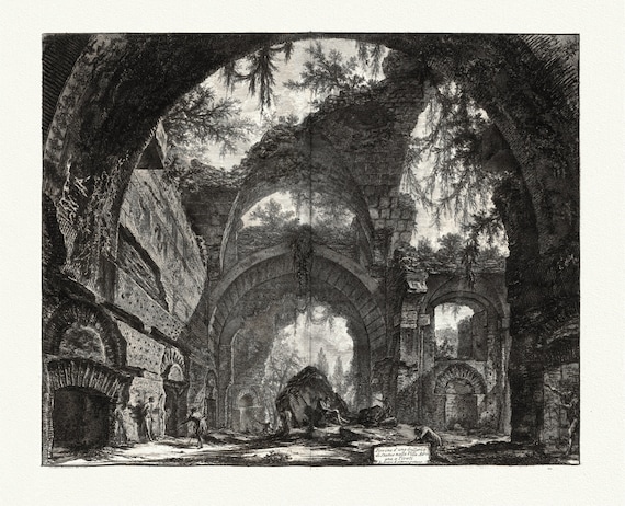 Giovanni Battista Piranesi, Vedute di Roma, Ruins of a Sculpture Gallery at Hadrian's Villa at Tivoli, 1760, cotton canvas, 22x27" approx.
$33.94
Giovanni Battista Piranesi, Vedute di Roma, Ruins of a Sculpture Gallery at Hadrian's Villa at Tivoli, 1760, cotton canvas, 22x27" approx.
$33.94
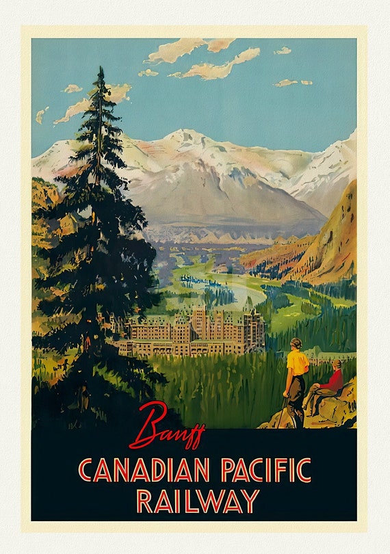 Banff, Canadian Pacific Railway , vintage travel poster reprinted on heavy cotton canvas, 50 x 70 cm, 20 x 25" approx.
$33.94
Banff, Canadian Pacific Railway , vintage travel poster reprinted on heavy cotton canvas, 50 x 70 cm, 20 x 25" approx.
$33.94
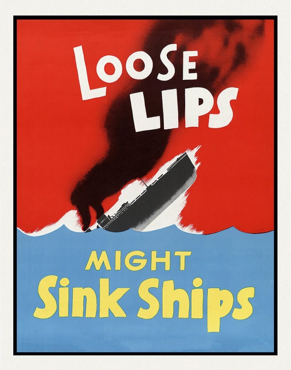 Loose Lips Might Sink Ships
$33.94
Loose Lips Might Sink Ships
$33.94
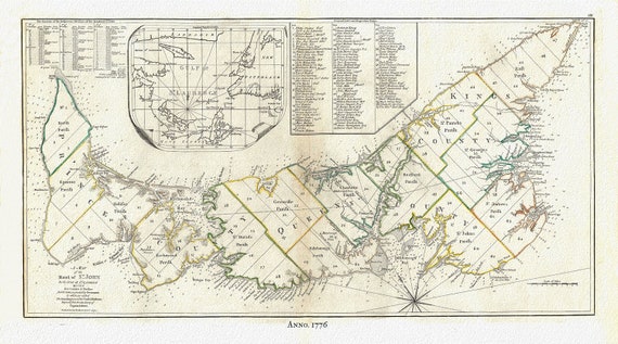 PEI:Gulf of St. Lawrence, Prince Edward Island, Jefferys auth.,1776 , map reprinted on durable cotton canvas, 50 x 70 cm or 20x25" approx.
$33.94
PEI:Gulf of St. Lawrence, Prince Edward Island, Jefferys auth.,1776 , map reprinted on durable cotton canvas, 50 x 70 cm or 20x25" approx.
$33.94
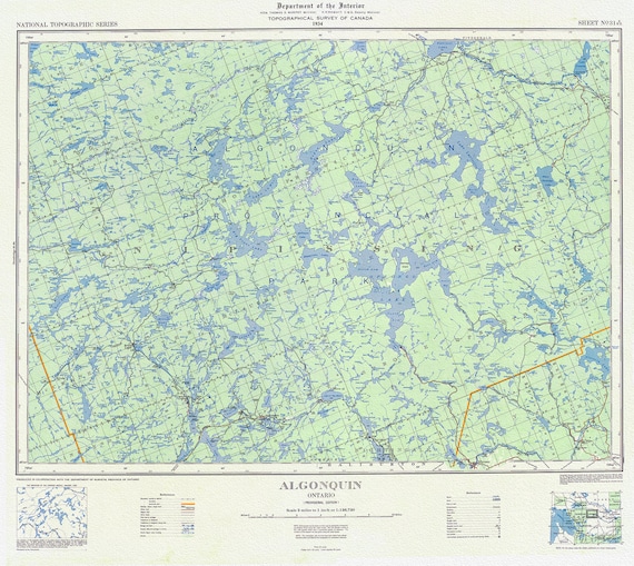 Topographical Map of Algonquin, 1934 , map on heavy cotton canvas, 22x27" approx.
$33.94
Topographical Map of Algonquin, 1934 , map on heavy cotton canvas, 22x27" approx.
$33.94
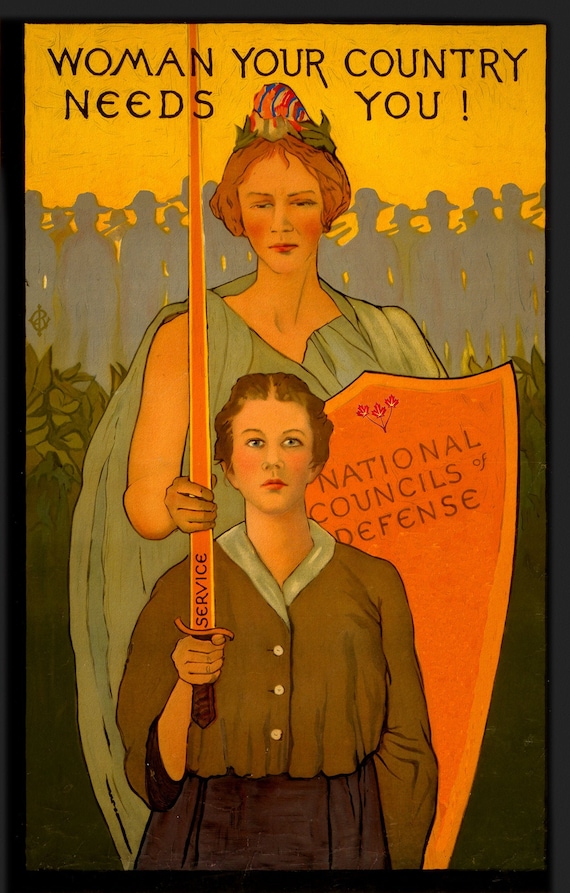 Woman your country needs you!, Canada WW I Poster,1 917 Ver. 5, on heavy cotton canvas, 27x22" approx.
$33.94
Woman your country needs you!, Canada WW I Poster,1 917 Ver. 5, on heavy cotton canvas, 27x22" approx.
$33.94
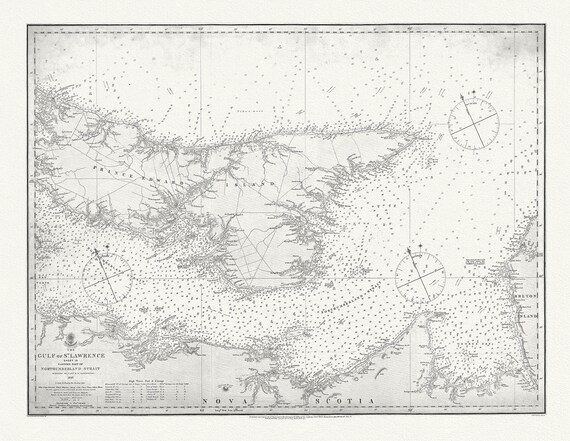 Nautical Chart, Gulf of St. Lawrence. Sheet IX, Eastern Part of Northumberland Strait, 1872, map on heavy cotton canvas, 20 x 25" approx.
$33.94
Nautical Chart, Gulf of St. Lawrence. Sheet IX, Eastern Part of Northumberland Strait, 1872, map on heavy cotton canvas, 20 x 25" approx.
$33.94
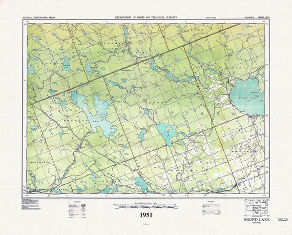 Historic Algonquin Park Map, Round Lake, National Topographic Series, 1951 , map on heavy cotton canvas, 45 x 65 cm, 18 x 24" approx.
$33.94
Historic Algonquin Park Map, Round Lake, National Topographic Series, 1951 , map on heavy cotton canvas, 45 x 65 cm, 18 x 24" approx.
$33.94
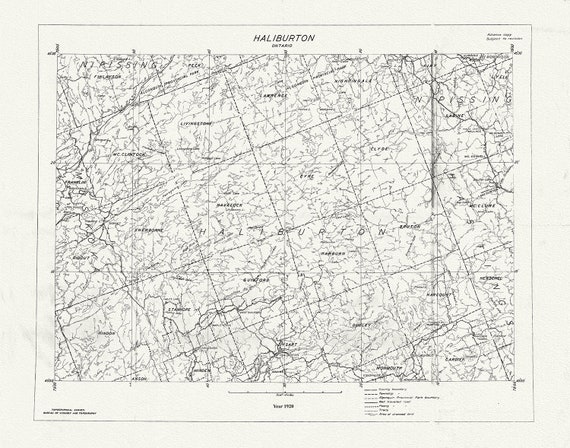 Historic Algonquin Park Map, National Topographic Series, Haliburton County, 1920
$33.94
Historic Algonquin Park Map, National Topographic Series, Haliburton County, 1920
$33.94
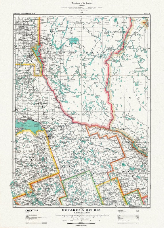 Historic Algonquin Park Map, Nipissing District, 1922, map on heavy cotton canvas, 20 x 30" or 50 x 75cm. approx.
$33.94
Historic Algonquin Park Map, Nipissing District, 1922, map on heavy cotton canvas, 20 x 30" or 50 x 75cm. approx.
$33.94
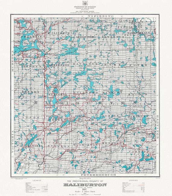 Historic Algonquin Park Map, Haliburton County, 1937 Ver. A, map on heavy cotton canvas, 45 x 65 cm, 18 x 24" approx.
$33.94
Historic Algonquin Park Map, Haliburton County, 1937 Ver. A, map on heavy cotton canvas, 45 x 65 cm, 18 x 24" approx.
$33.94
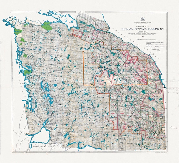 Algonquin Park Area, Part of the Huron and Ottawa Territories, 1913 , map on heavy cotton canvas, 45 x 65 cm, 18 x 24" approx.
$33.94
Algonquin Park Area, Part of the Huron and Ottawa Territories, 1913 , map on heavy cotton canvas, 45 x 65 cm, 18 x 24" approx.
$33.94
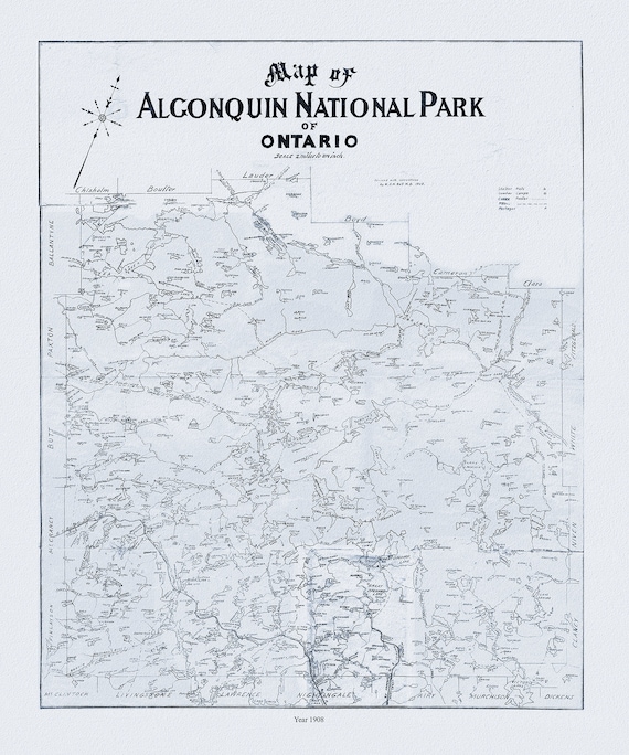 Historic Algonquin Park Map, Dr. Bell auth., 1908 Ver. II , map on heavy cotton canvas, 45 x 65 cm, 18 x 24" approx.
$33.94
Historic Algonquin Park Map, Dr. Bell auth., 1908 Ver. II , map on heavy cotton canvas, 45 x 65 cm, 18 x 24" approx.
$33.94