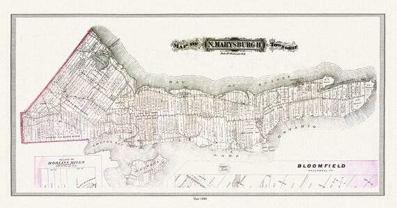
 North Marysburgh Township, Prince Edward County, 1888, map on heavy cotton canvas, 45 x 65 cm, 18 x 24" approx.0
$33.94
North Marysburgh Township, Prince Edward County, 1888, map on heavy cotton canvas, 45 x 65 cm, 18 x 24" approx.0
$33.94
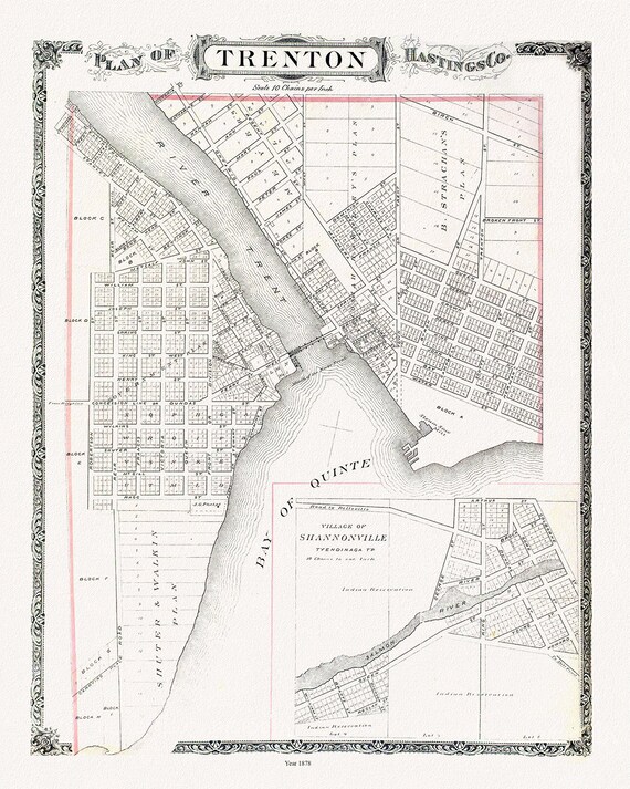 Map of Trenton, 1878, map on heavy cotton canvas, 45 x 65 cm, 18 x 24" approx.
$33.94
Map of Trenton, 1878, map on heavy cotton canvas, 45 x 65 cm, 18 x 24" approx.
$33.94
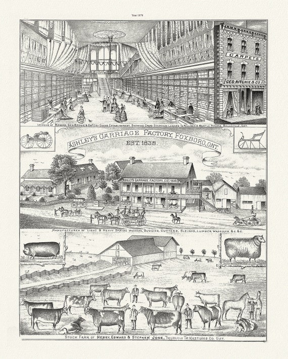 Hastings County, Businesses, 1878, map on heavy cotton canvas, 45 x 65 cm, 18 x 24" approx.
$33.94
Hastings County, Businesses, 1878, map on heavy cotton canvas, 45 x 65 cm, 18 x 24" approx.
$33.94
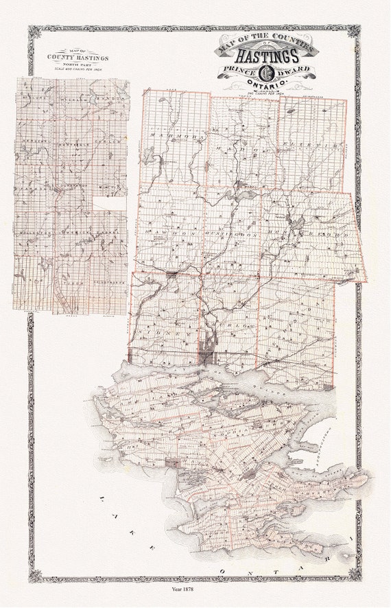 Hastings and Prince Edward Counties, Ontario, 1879, map on heavy cotton canvas, 45 x 65 cm, 18 x 24" approx.
$33.94
Hastings and Prince Edward Counties, Ontario, 1879, map on heavy cotton canvas, 45 x 65 cm, 18 x 24" approx.
$33.94
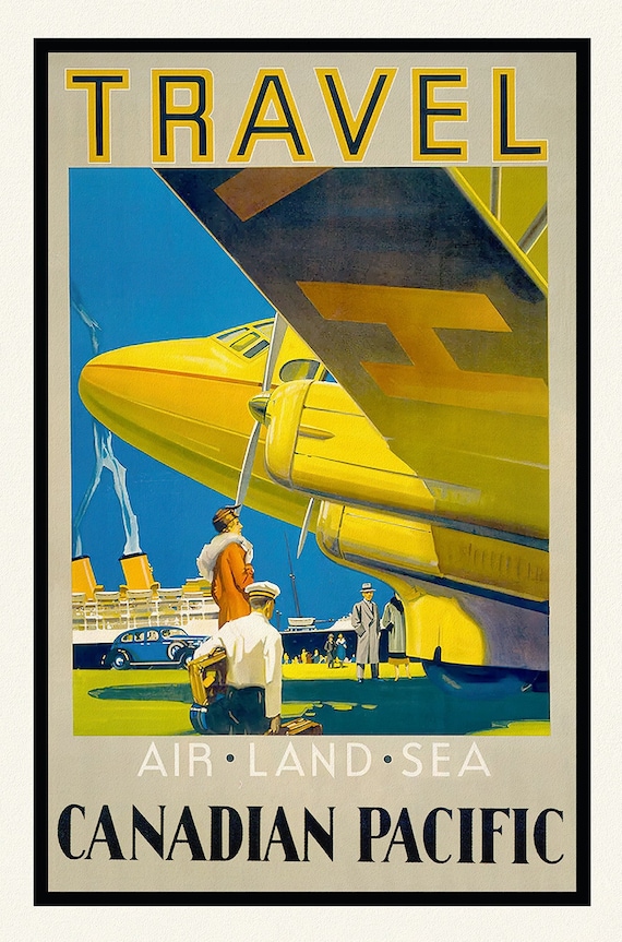 Travel Canadian Pacific, Air, Land, and Sea, travel poster reprinted on durable cotton canvas, 50 x 70 cm, 20 x 25" approx.
$33.94
Travel Canadian Pacific, Air, Land, and Sea, travel poster reprinted on durable cotton canvas, 50 x 70 cm, 20 x 25" approx.
$33.94
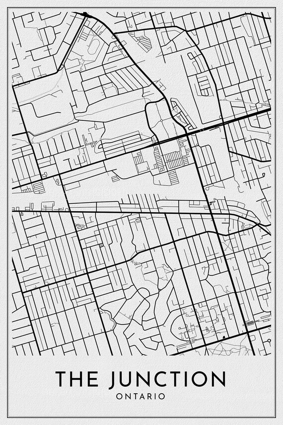 Toronto: The Junction, Toronto, A Modern Map, on durable canvas 50 x 70 cm, 20 x 25" approx.
$33.94
Toronto: The Junction, Toronto, A Modern Map, on durable canvas 50 x 70 cm, 20 x 25" approx.
$33.94
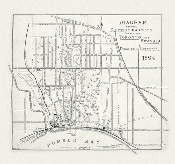 Toronto: Diagram showing electric railways connecting Toronto and Swansea projected and constructed, 1894, map on canvas, 20 x 25" approx
$33.94
Toronto: Diagram showing electric railways connecting Toronto and Swansea projected and constructed, 1894, map on canvas, 20 x 25" approx
$33.94
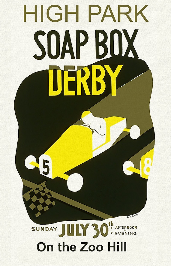 Toronto: High Park Soap Box Derby on the Zoo Hill, vintage poster on canvas, 20 x 25" approx.
$33.94
Toronto: High Park Soap Box Derby on the Zoo Hill, vintage poster on canvas, 20 x 25" approx.
$33.94
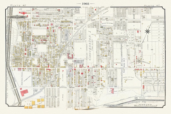 Plate 47, Toronto East, Riverdale & Leslieville, 1903, map on heavy cotton canvas, 20 x 30" or 50 x 75cm. approx.
$33.94
Plate 47, Toronto East, Riverdale & Leslieville, 1903, map on heavy cotton canvas, 20 x 30" or 50 x 75cm. approx.
$33.94
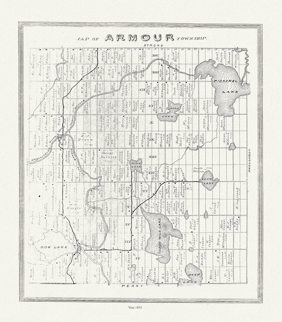 Muskoka-Haliburton, Armour Township, 1893, map on heavy cotton canvas, 20 x 25" approx.
$33.94
Muskoka-Haliburton, Armour Township, 1893, map on heavy cotton canvas, 20 x 25" approx.
$33.94
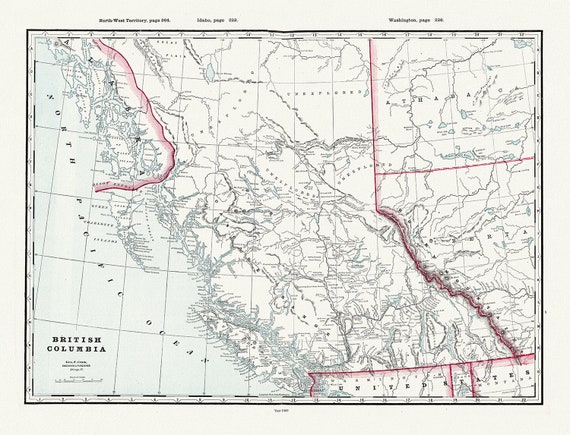
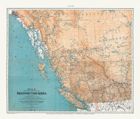 Province of British Columbia, 1893 , map on heavy cotton canvas, 45 x 65 cm, 18 x 24" approx.
$33.94
Province of British Columbia, 1893 , map on heavy cotton canvas, 45 x 65 cm, 18 x 24" approx.
$33.94
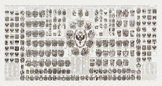 Heraldic Crests of the Roman Empire, Carte Heraldique Representant Les Armes De L' Empereur, 1720, on heavy cotton canvas, 18x43" approx.
$60.34
Heraldic Crests of the Roman Empire, Carte Heraldique Representant Les Armes De L' Empereur, 1720, on heavy cotton canvas, 18x43" approx.
$60.34
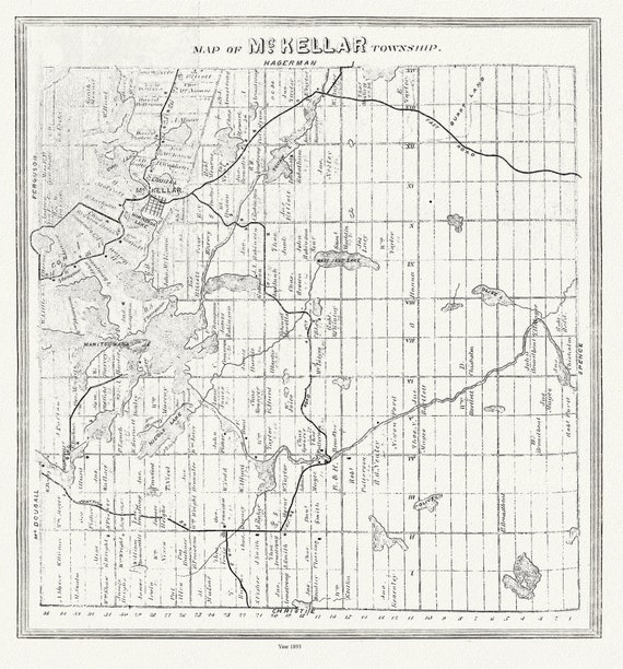 Muskoka-Haliburton, McKellar Township, 1893, map on heavy cotton canvas, 20 x 25" approx.
$33.94
Muskoka-Haliburton, McKellar Township, 1893, map on heavy cotton canvas, 20 x 25" approx.
$33.94
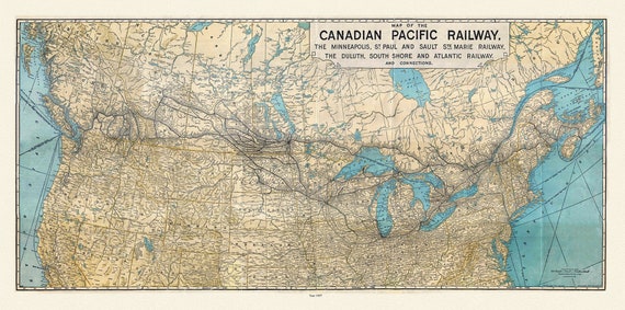 Map of the Canadian Pacific Railway, the Minneapolis, St. Paul and Sault Ste. Marie, Railway, Duluth, South Shore et c., 1907, 22x27" canvas
$33.94
Map of the Canadian Pacific Railway, the Minneapolis, St. Paul and Sault Ste. Marie, Railway, Duluth, South Shore et c., 1907, 22x27" canvas
$33.94
 British Columbia, Southern Part, A Modern Map, map on heavy cotton canvas, 45 x 65 cm, 18 x 24" approx.
$33.94
British Columbia, Southern Part, A Modern Map, map on heavy cotton canvas, 45 x 65 cm, 18 x 24" approx.
$33.94
 British Columbia, Cram auth., 1889, map on heavy cotton canvas, 45 x 65 cm, 18 x 24" approx.
$33.94
British Columbia, Cram auth., 1889, map on heavy cotton canvas, 45 x 65 cm, 18 x 24" approx.
$33.94
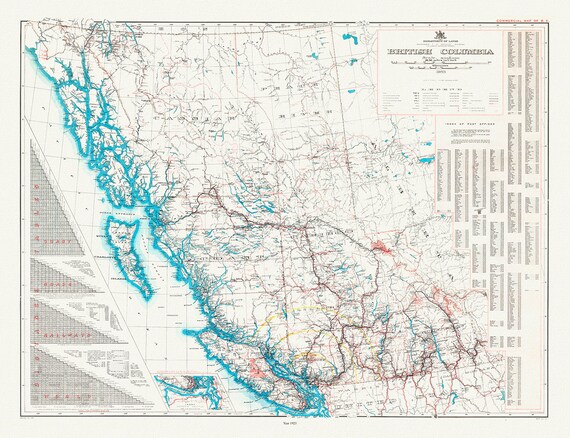 British Columbia, A Commercial Map, 1923, map on heavy cotton canvas, 45 x 65 cm, 18 x 24" approx.
$33.94
British Columbia, A Commercial Map, 1923, map on heavy cotton canvas, 45 x 65 cm, 18 x 24" approx.
$33.94
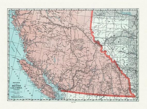 British Columbia, Cummins auth., 1925 , map on heavy cotton canvas, 45 x 65 cm, 18 x 24" approx.
$33.94
British Columbia, Cummins auth., 1925 , map on heavy cotton canvas, 45 x 65 cm, 18 x 24" approx.
$33.94
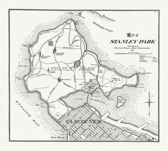 Vancouver, Map of Stanley Park, 1916, map on heavy cotton canvas, 45 x 65 cm, 18 x 24" approx.
$33.94
Vancouver, Map of Stanley Park, 1916, map on heavy cotton canvas, 45 x 65 cm, 18 x 24" approx.
$33.94
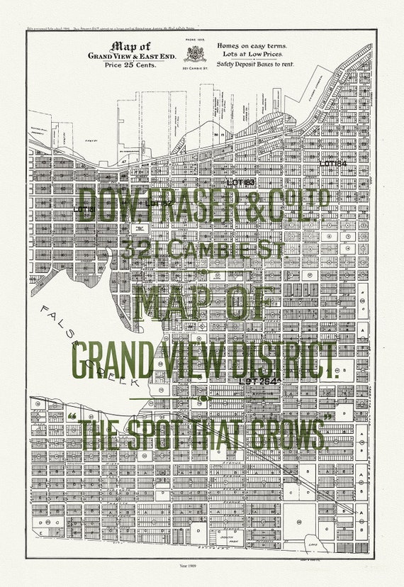 Vancouver, Map of Grandview and East End, 1909, map on heavy cotton canvas, 45 x 65 cm, 18 x 24" approx.
$33.94
Vancouver, Map of Grandview and East End, 1909, map on heavy cotton canvas, 45 x 65 cm, 18 x 24" approx.
$33.94