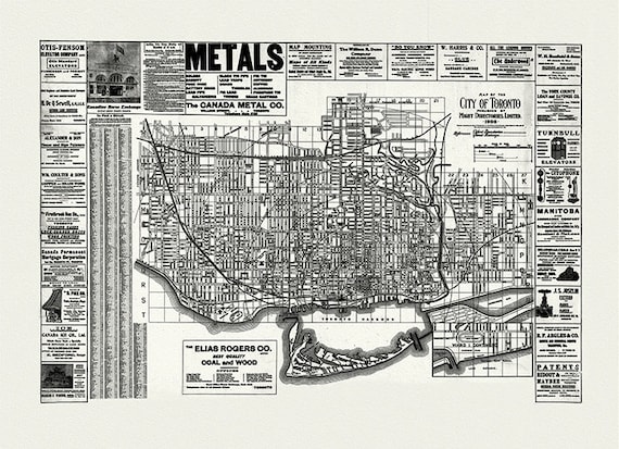
 City of Toronto, 1906 Ver. W, map on heavy cotton canvas, 22x27" approx.
$41.44
City of Toronto, 1906 Ver. W, map on heavy cotton canvas, 22x27" approx.
$41.44
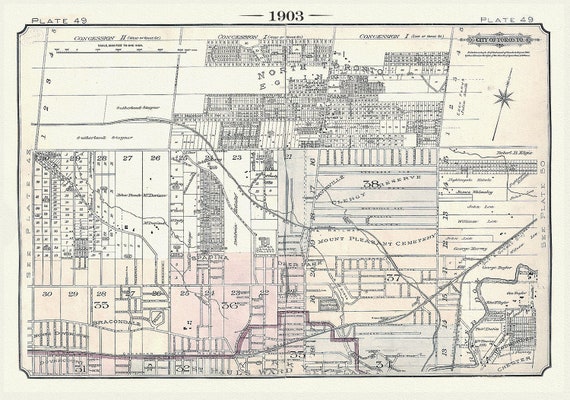 Plate 49, Toronto North, Davisville, Eglinton & Yonge St., 1903, map on heavy cotton canvas, 20 x 30" or 50 x 75cm. approx.
$41.44
Plate 49, Toronto North, Davisville, Eglinton & Yonge St., 1903, map on heavy cotton canvas, 20 x 30" or 50 x 75cm. approx.
$41.44
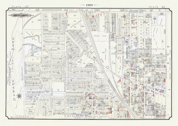 Plate 42A ,Toronto West, High Park to Brockton, 1903 Ver. II, map on heavy cotton canvas, 20 x 30" or 50 x 75cm. approx.
$41.44
Plate 42A ,Toronto West, High Park to Brockton, 1903 Ver. II, map on heavy cotton canvas, 20 x 30" or 50 x 75cm. approx.
$41.44
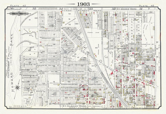 Plate 42, Toronto West, High Park to Brockton, Roncesvalles Village, 1903 Version I
$41.44
Plate 42, Toronto West, High Park to Brockton, Roncesvalles Village, 1903 Version I
$41.44
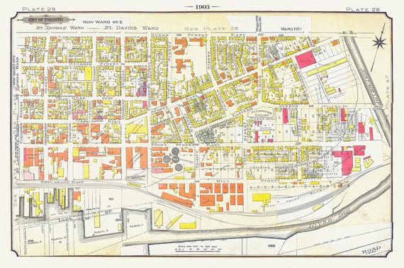 Plate 29, Toronto Downtown East, Corktown & Distillery, 1903, map on heavy cotton canvas, 20 x 30" or 50 x 75cm. approx
$41.44
Plate 29, Toronto Downtown East, Corktown & Distillery, 1903, map on heavy cotton canvas, 20 x 30" or 50 x 75cm. approx
$41.44
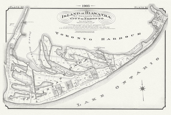 Plate 30, Toronto, Island of Hiawatha, 1903 , map on heavy cotton canvas, 20 x 30", 50 x 76cm, approx.
$41.44
Plate 30, Toronto, Island of Hiawatha, 1903 , map on heavy cotton canvas, 20 x 30", 50 x 76cm, approx.
$41.44
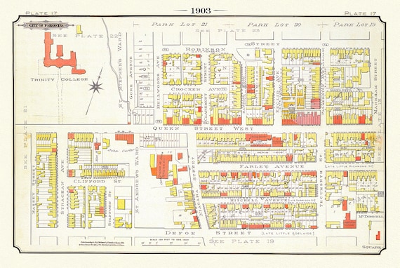 Plate 17, Toronto West, Parkdale & Trinity College, 1903, map on heavy cotton canvas, 20 x 30", 50 x 76cm, approx.
$41.44
Plate 17, Toronto West, Parkdale & Trinity College, 1903, map on heavy cotton canvas, 20 x 30", 50 x 76cm, approx.
$41.44
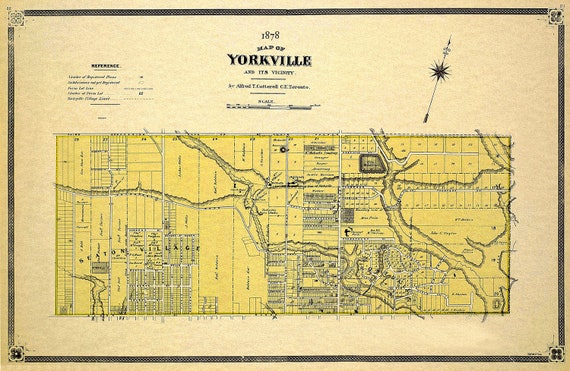 Cotterell, Yorkville, County of York, 1878 Ver.II, map on heavy cotton canvas, 22x27" approx.
$41.44
Cotterell, Yorkville, County of York, 1878 Ver.II, map on heavy cotton canvas, 22x27" approx.
$41.44
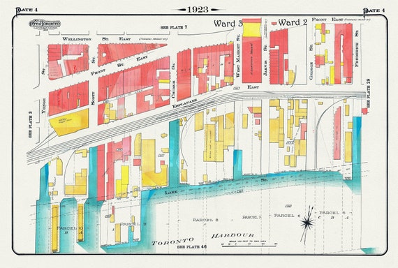 Plate 4, Toronto Downtown Waterfront, Esplanade, 1923, Map on heavy cotton canvas, 19x27in. approx.
$41.44
Plate 4, Toronto Downtown Waterfront, Esplanade, 1923, Map on heavy cotton canvas, 19x27in. approx.
$41.44
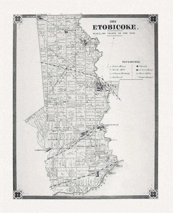 Etobicoke, York County Atlas, 1884, map on heavy cotton canvas, 22x27" approx.
$41.44
Etobicoke, York County Atlas, 1884, map on heavy cotton canvas, 22x27" approx.
$41.44
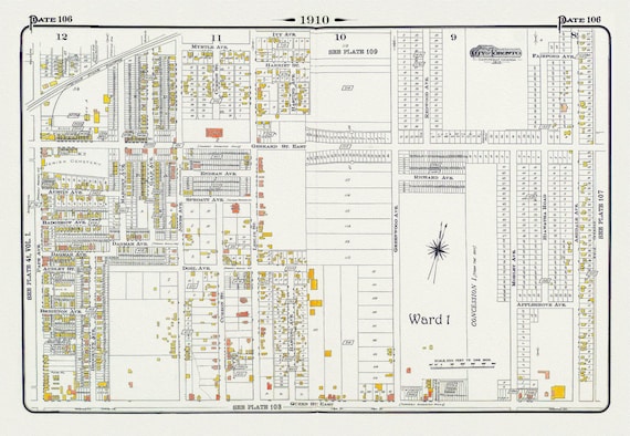 Plate 106, Toronto East, Leslieville and North, 1910 , map on heavy cotton canvas, 20 x 30" approx.
$41.44
Plate 106, Toronto East, Leslieville and North, 1910 , map on heavy cotton canvas, 20 x 30" approx.
$41.44
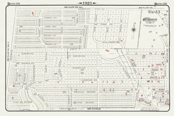 Plate 129, Toronto North, South of Lawrence Ave., 1923, Map on heavy cotton canvas, 18x27in. approx.
$41.44
Plate 129, Toronto North, South of Lawrence Ave., 1923, Map on heavy cotton canvas, 18x27in. approx.
$41.44
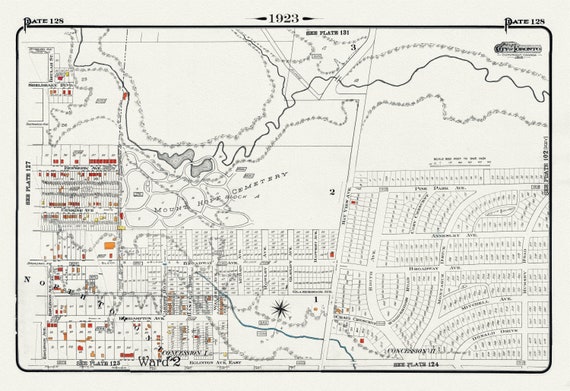 Plate 128, Toronto Uptown East, Leaside, Mount Hope Cemetery, 1923, Map on heavy cotton canvas, 18x27in. approx.
$41.44
Plate 128, Toronto Uptown East, Leaside, Mount Hope Cemetery, 1923, Map on heavy cotton canvas, 18x27in. approx.
$41.44
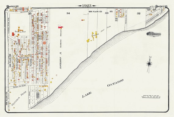 Plate 125, Toronto East, Waterfront, Beach & Hunt Club, 1923, Map on heavy cotton canvas, 18x27in. approx.
$41.44
Plate 125, Toronto East, Waterfront, Beach & Hunt Club, 1923, Map on heavy cotton canvas, 18x27in. approx.
$41.44
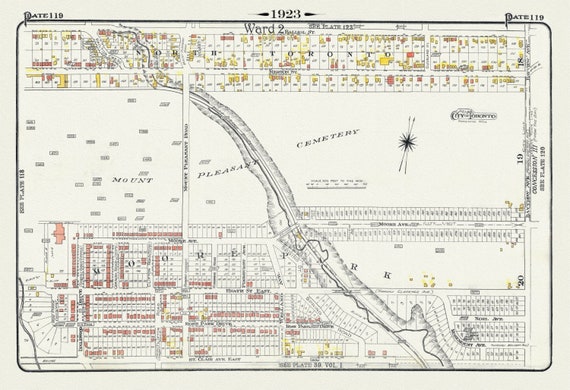 Plate 119, Toronto Uptown, Moore Park & Mount Pleasant, 1923, Map on heavy cotton canvas, 18x27in. approx.
$41.44
Plate 119, Toronto Uptown, Moore Park & Mount Pleasant, 1923, Map on heavy cotton canvas, 18x27in. approx.
$41.44
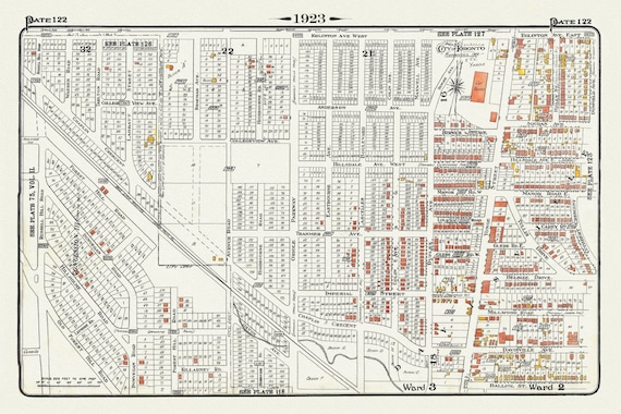 Plate 122, Toronto North, South of Eglinton Avenue, 1923, Map on heavy cotton canvas, 18x27in. approx.
$41.44
Plate 122, Toronto North, South of Eglinton Avenue, 1923, Map on heavy cotton canvas, 18x27in. approx.
$41.44
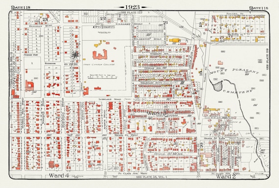 Plate 118, Toronto Uptown, Upper Canada College, Mount Pleasant, 1923, Map on heavy cotton canvas, 18x27in. approx.
$41.44
Plate 118, Toronto Uptown, Upper Canada College, Mount Pleasant, 1923, Map on heavy cotton canvas, 18x27in. approx.
$41.44
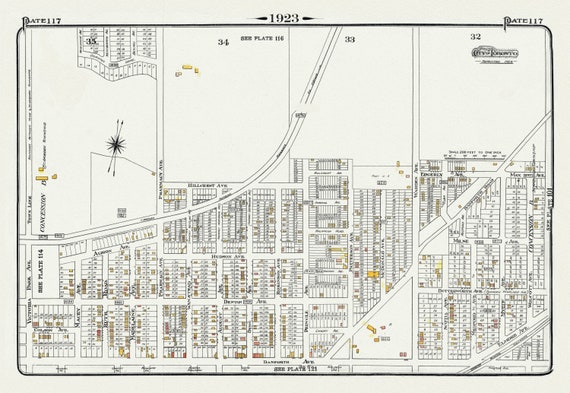 Plate 117, Toronto East, Scarborough, Pharmacy Avenue North of Danforth Avenue, 1923, Map on heavy cotton canvas, 18x27in. approx.
$41.44
Plate 117, Toronto East, Scarborough, Pharmacy Avenue North of Danforth Avenue, 1923, Map on heavy cotton canvas, 18x27in. approx.
$41.44
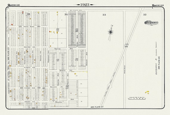 Plate 116, Toronto East, Scarborough, Pharmacy Ave., South of St. Clair, 1923, Map on heavy cotton canvas, 18x27in. approx.
$41.44
Plate 116, Toronto East, Scarborough, Pharmacy Ave., South of St. Clair, 1923, Map on heavy cotton canvas, 18x27in. approx.
$41.44
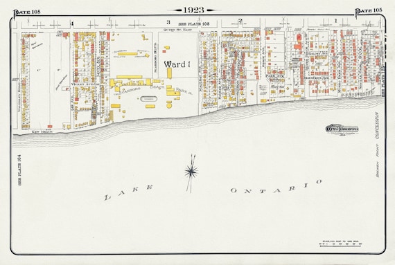 Plate 105, Toronto East, Waterfront, Kew Gardens & Scarborough Beach Park, 1923, Map on heavy cotton canvas, 18x27in. approx.
$41.44
Plate 105, Toronto East, Waterfront, Kew Gardens & Scarborough Beach Park, 1923, Map on heavy cotton canvas, 18x27in. approx.
$41.44