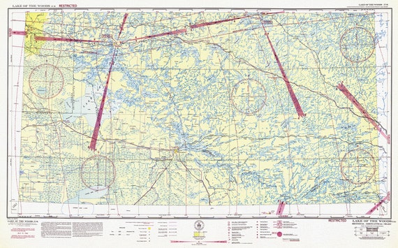
 Aeronautical Chart, Ontario, Lake of the Woods Section, 1942, map on heavy cotton canvas, 20 x 27" approx.
$40.18
Aeronautical Chart, Ontario, Lake of the Woods Section, 1942, map on heavy cotton canvas, 20 x 27" approx.
$40.18
 Aeronautical Chart, Ontario, Lake Superior Section, 1942 , map on heavy cotton canvas, 20 x 27" approx.
$40.18
Aeronautical Chart, Ontario, Lake Superior Section, 1942 , map on heavy cotton canvas, 20 x 27" approx.
$40.18
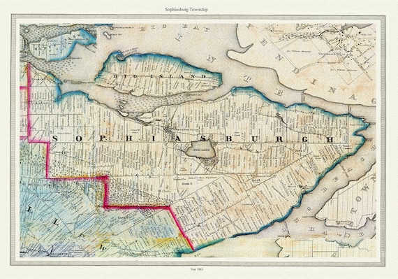 Township of Sophiasburg in Prince Edward County, Tremaine auth., 1863, map on heavy cotton canvas, 45 x 65 cm, 18 x 24" approx.
$40.18
Township of Sophiasburg in Prince Edward County, Tremaine auth., 1863, map on heavy cotton canvas, 45 x 65 cm, 18 x 24" approx.
$40.18
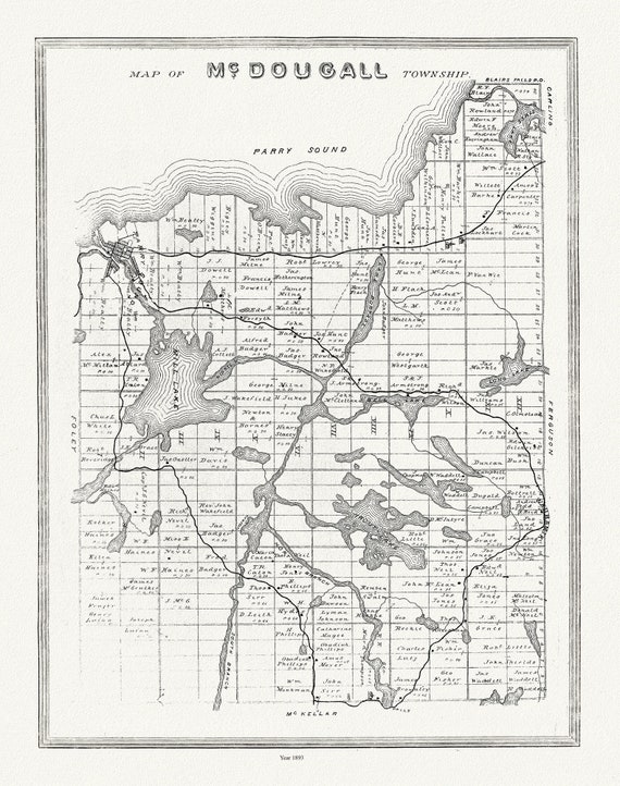 Muskoka-Haliburton, McDougall Township, 1893, map on heavy cotton canvas, 20 x 25" approx.
$40.18
Muskoka-Haliburton, McDougall Township, 1893, map on heavy cotton canvas, 20 x 25" approx.
$40.18
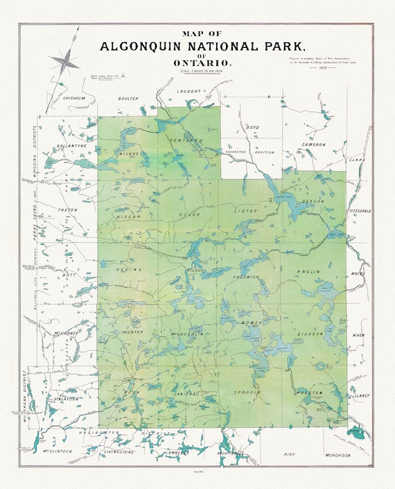
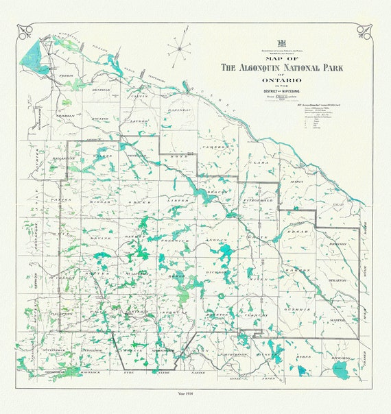 Historic Algonquin Park Map, 1914, map on heavy cotton canvas, 20x27" approx
$40.18
Historic Algonquin Park Map, 1914, map on heavy cotton canvas, 20x27" approx
$40.18
 Bird's eye view of Chatham, Ontario, 1870, map on heavy cotton canvas, 22x27" approx.
$40.18
Bird's eye view of Chatham, Ontario, 1870, map on heavy cotton canvas, 22x27" approx.
$40.18
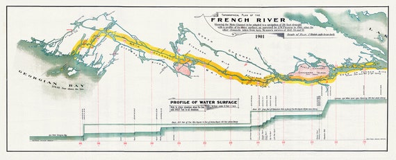 French River Canal, main channel to be adapted to a navigation of 20 foot draught, 1901, map on heavy cotton canvas, 18x27" approx.
$40.18
French River Canal, main channel to be adapted to a navigation of 20 foot draught, 1901, map on heavy cotton canvas, 18x27" approx.
$40.18
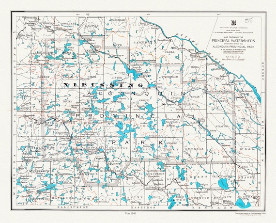 Algonquin Provincial Park, Principal Watersheds, 1946 , map on heavy cotton canvas, 45 x 65 cm, 18 x 24" approx.
$40.18
Algonquin Provincial Park, Principal Watersheds, 1946 , map on heavy cotton canvas, 45 x 65 cm, 18 x 24" approx.
$40.18
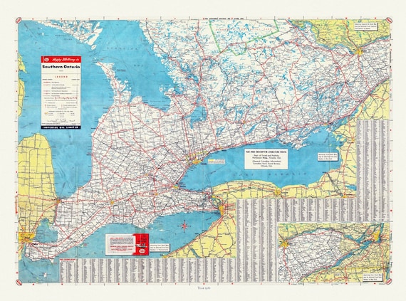 Road Map of Southern Ontario, 1955 , map on heavy cotton canvas, 22x27" approx.
$40.18
Road Map of Southern Ontario, 1955 , map on heavy cotton canvas, 22x27" approx.
$40.18
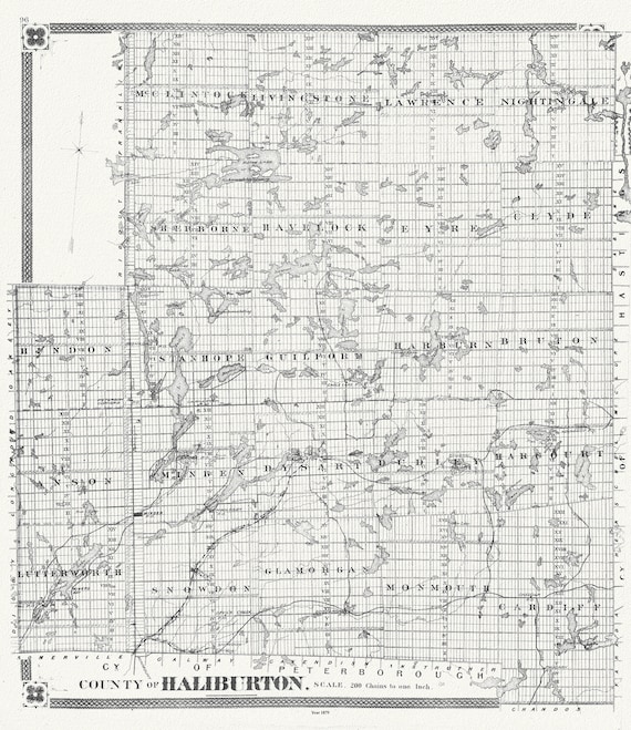 Historic Algonquin Park Map, Haliburton County, 1879, map on heavy cotton canvas, 20 x 25" approx.
$43.84
Historic Algonquin Park Map, Haliburton County, 1879, map on heavy cotton canvas, 20 x 25" approx.
$43.84
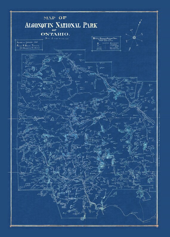 Historic Algonquin Park Map, auth. Arthur Brown, 1925 Cyanotype , map on heavy cotton canvas, 20x27" approx.
$40.18
Historic Algonquin Park Map, auth. Arthur Brown, 1925 Cyanotype , map on heavy cotton canvas, 20x27" approx.
$40.18
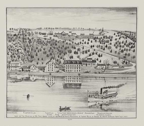 Glenora & Lake on the Mountain, Picton, Prince Edward County, 1878, map on heavy cotton canvas, 45 x 65 cm, 18 x 24" approx.
$40.18
Glenora & Lake on the Mountain, Picton, Prince Edward County, 1878, map on heavy cotton canvas, 45 x 65 cm, 18 x 24" approx.
$40.18
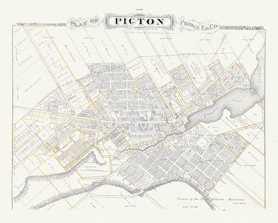 Plan of Picton, Prince Edward County, Ontario, 1880, map on heavy cotton canvas, 45 x 65 cm, 18 x 24" approx.
$40.18
Plan of Picton, Prince Edward County, Ontario, 1880, map on heavy cotton canvas, 45 x 65 cm, 18 x 24" approx.
$40.18
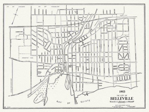 The City of Belleville, Hastings County, Ontario, 1953
$40.18
The City of Belleville, Hastings County, Ontario, 1953
$40.18
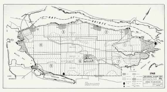 Prince Edward County, Ameliasburgh planning area, 1968, map on heavy cotton canvas, 45 x 65 cm, 18 x 24" approx.
$40.18
Prince Edward County, Ameliasburgh planning area, 1968, map on heavy cotton canvas, 45 x 65 cm, 18 x 24" approx.
$40.18
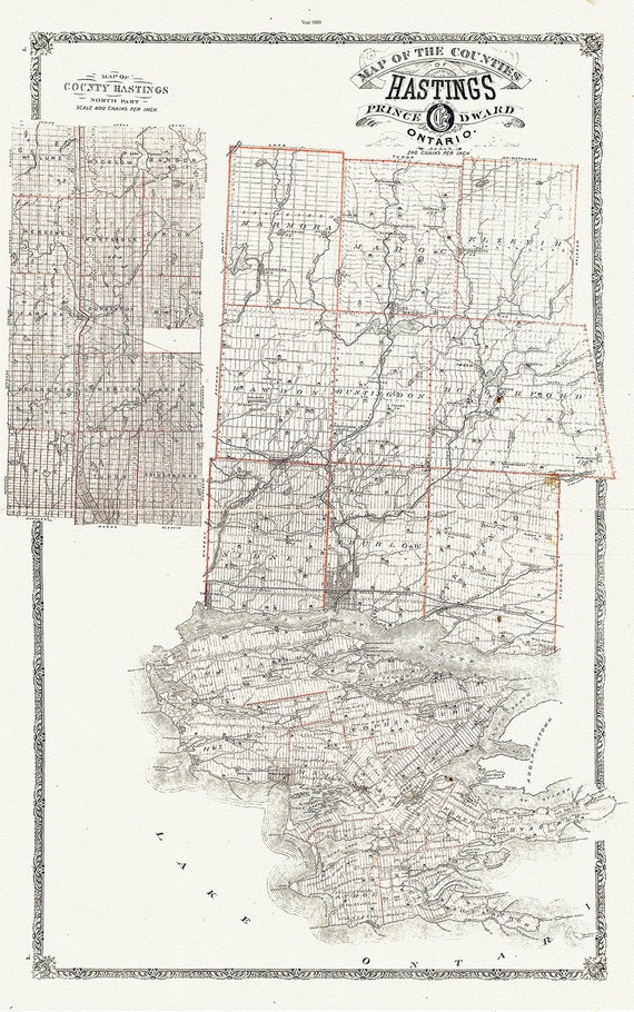 Map of Hastings County, Ontario, 1880 , map on heavy cotton canvas, 45 x 65 cm, 18 x 24" approx.
$40.18
Map of Hastings County, Ontario, 1880 , map on heavy cotton canvas, 45 x 65 cm, 18 x 24" approx.
$40.18
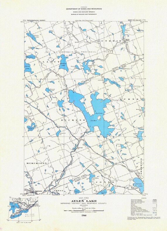 Historic Algonquin Park Map, Aylen Lake, National Topographic Series, 1944, map on heavy cotton canvas, 20 x 25" approx.
$40.18
Historic Algonquin Park Map, Aylen Lake, National Topographic Series, 1944, map on heavy cotton canvas, 20 x 25" approx.
$40.18
 Historic Algonquin Park Map, Algonquin Park Commission, 1893, map on heavy cotton canvas, 20x27" approx.
$40.18
Historic Algonquin Park Map, Algonquin Park Commission, 1893, map on heavy cotton canvas, 20x27" approx.
$40.18
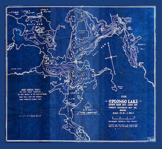 Historic Algonquin Park Map, Depth Map, Opeongo Lake, 1958 Cyanotype , map on heavy cotton canvas, 20x27" approx
$40.18
Historic Algonquin Park Map, Depth Map, Opeongo Lake, 1958 Cyanotype , map on heavy cotton canvas, 20x27" approx
$40.18
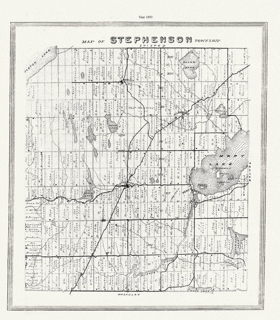 Muskoka-Haliburton, Stephenson Township, 1893 , map on heavy cotton canvas, 20 x 25" approx.
$40.18
Muskoka-Haliburton, Stephenson Township, 1893 , map on heavy cotton canvas, 20 x 25" approx.
$40.18