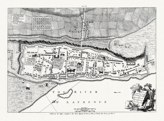
 Jefferys, Town and Fortifications of Montreal or Ville Marie in Canada, 1758, map on heavy cotton canvas, 20x27" approx.
$40.14
Jefferys, Town and Fortifications of Montreal or Ville Marie in Canada, 1758, map on heavy cotton canvas, 20x27" approx.
$40.14
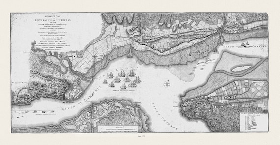 Jefferys, A correct plan of the environs of Quebec, and of the battle fought on the 13th September, 1759, Map on canvas 20x25"
$40.14
Jefferys, A correct plan of the environs of Quebec, and of the battle fought on the 13th September, 1759, Map on canvas 20x25"
$40.14
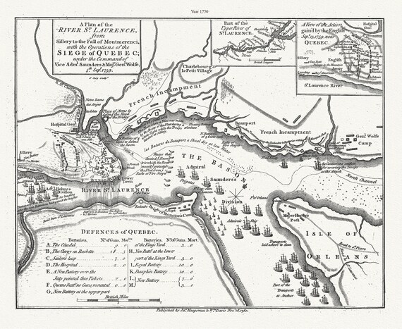 A Plan of the River St. Laurence, from Sillery to Montmerenci Falls with the operations of the Siege of Quebec, 1759-1780,canvas, 22x27"
$40.14
A Plan of the River St. Laurence, from Sillery to Montmerenci Falls with the operations of the Siege of Quebec, 1759-1780,canvas, 22x27"
$40.14
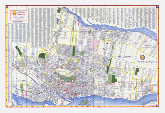 Shell Street Map of Montreal, 1950 , map on heavy cotton canvas, 22x27" approx.
$32.84
Shell Street Map of Montreal, 1950 , map on heavy cotton canvas, 22x27" approx.
$32.84
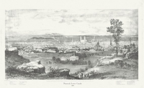 Montreal, Lower Canada, 1855, Whitfield auth., vintage print reprinted on durable cotton canvas, 50 x 70 cm, 20 x 25" approx.
$40.14
Montreal, Lower Canada, 1855, Whitfield auth., vintage print reprinted on durable cotton canvas, 50 x 70 cm, 20 x 25" approx.
$40.14
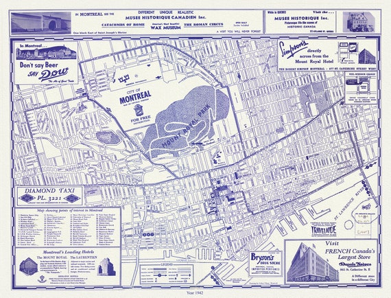 Montreal, a base Map, 1942 reprinted on durable cotton canvas, 50 x 70 cm, 20 x 25" approx.
$40.14
Montreal, a base Map, 1942 reprinted on durable cotton canvas, 50 x 70 cm, 20 x 25" approx.
$40.14
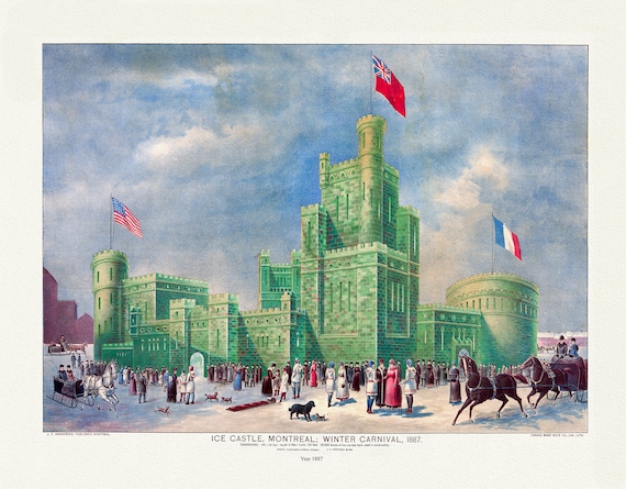 Montreal Winter Carnival, 1887 , vintage print reprinted on durable cotton canvas, 50 x 70 cm or 20x25" approx
$40.14
Montreal Winter Carnival, 1887 , vintage print reprinted on durable cotton canvas, 50 x 70 cm or 20x25" approx
$40.14
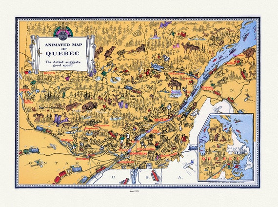 Quebec: Master et Elias, An Animated Map of Quebec, 1929 , map on heavy cotton canvas, 22x27" approx.
$40.14
Quebec: Master et Elias, An Animated Map of Quebec, 1929 , map on heavy cotton canvas, 22x27" approx.
$40.14
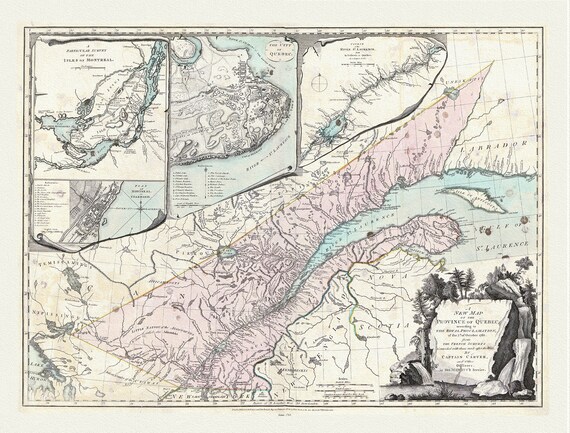 Quebec: Sayer et Carver, A new map of the Province of Quebec, according to the 1763 Royal Proclamation, 1776, cotton canvas, 22x27" approx.
$40.14
Quebec: Sayer et Carver, A new map of the Province of Quebec, according to the 1763 Royal Proclamation, 1776, cotton canvas, 22x27" approx.
$40.14
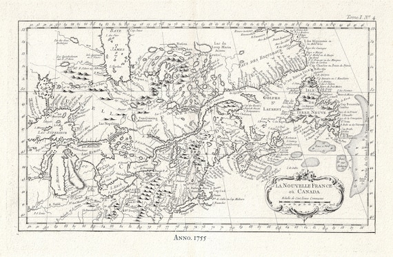 Canada, Nouvelle France, 1755, Jacques Nicolas Bellin, map on heavy cotton canvas, 50x70cm (20 x 25") approx.
$40.14
Canada, Nouvelle France, 1755, Jacques Nicolas Bellin, map on heavy cotton canvas, 50x70cm (20 x 25") approx.
$40.14
 Le Rouge, Vue de Quebec, Capitale du Canada, 1755, on heavy cotton canvas, 20 x 25" approx.
$40.14
Le Rouge, Vue de Quebec, Capitale du Canada, 1755, on heavy cotton canvas, 20 x 25" approx.
$40.14
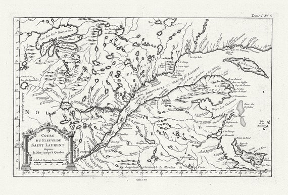 Quebec: Bellin, Cours du Fleuve de Saint Laurent, Depuis la Mer Jusque a Quebec, 1764, map on heavy cotton canvas, 22x27" approx.
$40.14
Quebec: Bellin, Cours du Fleuve de Saint Laurent, Depuis la Mer Jusque a Quebec, 1764, map on heavy cotton canvas, 22x27" approx.
$40.14
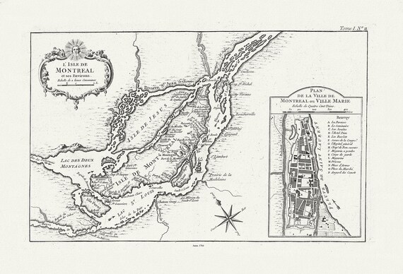 Bellin, L'Isle de Montreal, et ses environs, 1764 , map on heavy cotton canvas, 22x27" approx.
$40.14
Bellin, L'Isle de Montreal, et ses environs, 1764 , map on heavy cotton canvas, 22x27" approx.
$40.14