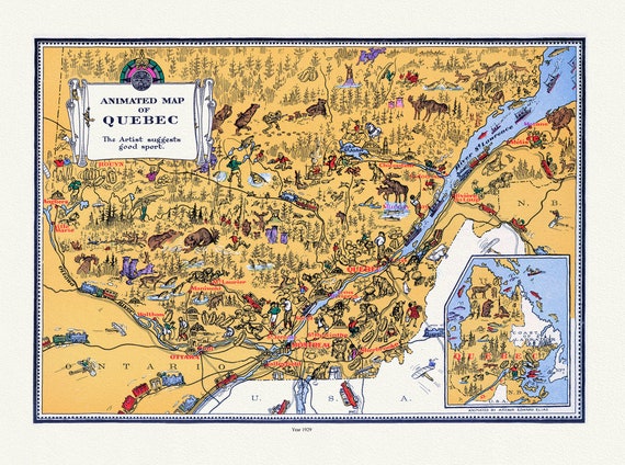
 Quebec: Master et Elias, An Animated Map of Quebec, 1929 , map on heavy cotton canvas, 22x27" approx.
$41.37
Quebec: Master et Elias, An Animated Map of Quebec, 1929 , map on heavy cotton canvas, 22x27" approx.
$41.37
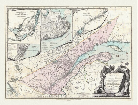 Quebec: Sayer et Carver, A new map of the Province of Quebec, according to the 1763 Royal Proclamation, 1776, cotton canvas, 22x27" approx.
$41.37
Quebec: Sayer et Carver, A new map of the Province of Quebec, according to the 1763 Royal Proclamation, 1776, cotton canvas, 22x27" approx.
$41.37
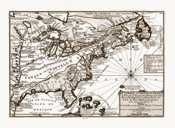 Fer, Le Canada, ou Nouvelle France, 1705, Sepia toned map on heavy cotton canvas, 22x27" approx.
$41.37
Fer, Le Canada, ou Nouvelle France, 1705, Sepia toned map on heavy cotton canvas, 22x27" approx.
$41.37
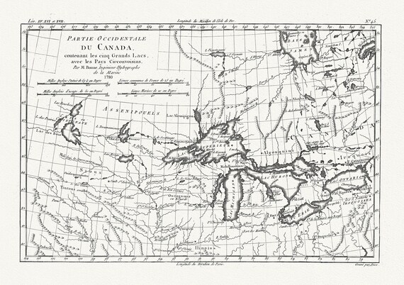 Raynall et Bonne, Partie Occidentale Du Canada, 1780, map on heavy cotton canvas, 50 x 70cm, 20 x 27" approx.
$41.37
Raynall et Bonne, Partie Occidentale Du Canada, 1780, map on heavy cotton canvas, 50 x 70cm, 20 x 27" approx.
$41.37
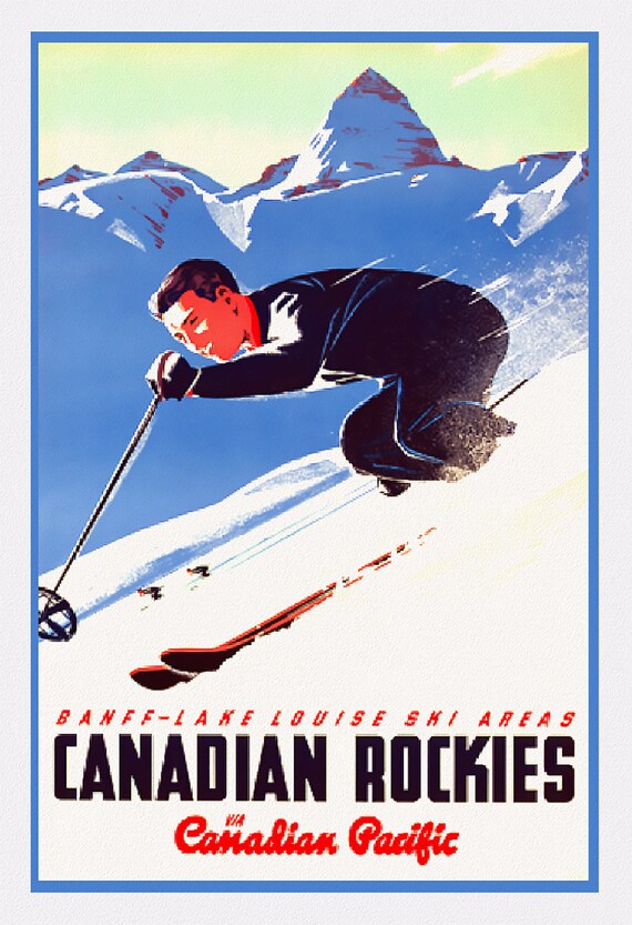 Canadian Pacific, Banff-Lake Louise Ski Areas , vintage poster on heavy cotton canvas, 45 x 65 cm, 18 x 24" approx.
$41.37
Canadian Pacific, Banff-Lake Louise Ski Areas , vintage poster on heavy cotton canvas, 45 x 65 cm, 18 x 24" approx.
$41.37
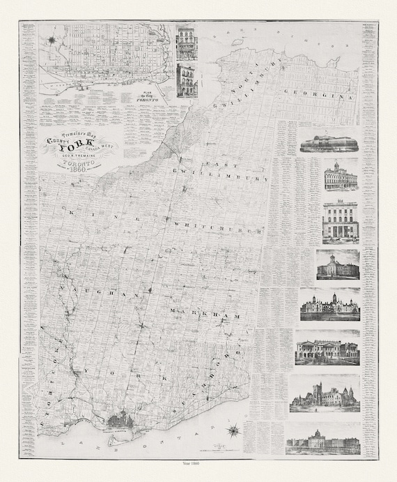 York County: Tremaine's Map of the County of York, Canada West, 1860, map on heavy cotton canvas, 22x27" approx.
$41.37
York County: Tremaine's Map of the County of York, Canada West, 1860, map on heavy cotton canvas, 22x27" approx.
$41.37
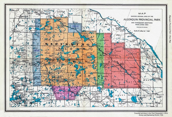
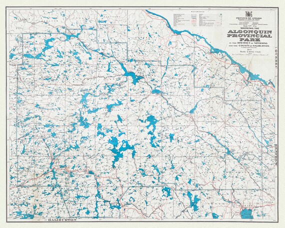 Map No. 47A showing the Algonquin Provincial Park in the District of Nipissing and the County of Haliburton, 1947, cotton canvas, 22x27"
$41.37
Map No. 47A showing the Algonquin Provincial Park in the District of Nipissing and the County of Haliburton, 1947, cotton canvas, 22x27"
$41.37
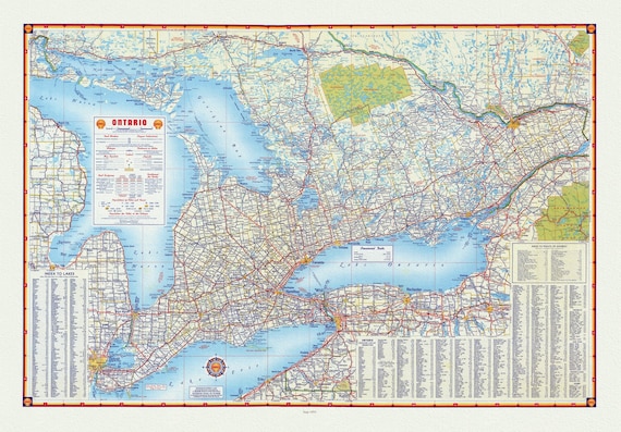 Shell Oil Company of Canada, Road Map of Ontario, 1955, map on heavy cotton canvas, 22x27" approx.
$41.37
Shell Oil Company of Canada, Road Map of Ontario, 1955, map on heavy cotton canvas, 22x27" approx.
$41.37
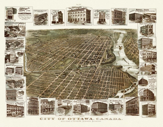 Birdseye View of the City of Ottawa, 1895, on heavy cotton canvas, approx. 22x27"
$41.37
Birdseye View of the City of Ottawa, 1895, on heavy cotton canvas, approx. 22x27"
$41.37
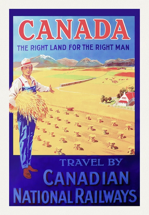 Canada, The Right Land, CNR Ver. III , vintage travel poster reprinted on heavy cotton canvas, 50 x 70 cm, 20 x 25" approx.
$33.85
Canada, The Right Land, CNR Ver. III , vintage travel poster reprinted on heavy cotton canvas, 50 x 70 cm, 20 x 25" approx.
$33.85
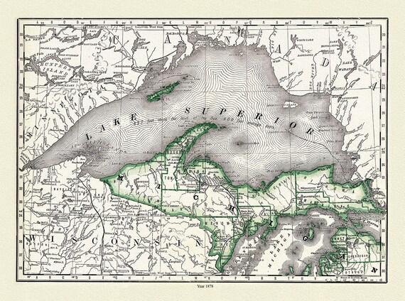 Rand, McNally & Co., Lake Superior and Northern Michigan, 1878,
$41.37
Rand, McNally & Co., Lake Superior and Northern Michigan, 1878,
$41.37
 1946 Map of Algonquin Park, Showing Subsequent Additions since 1893, map on heavy cotton canvas, 22x27" approx.
$41.37
1946 Map of Algonquin Park, Showing Subsequent Additions since 1893, map on heavy cotton canvas, 22x27" approx.
$41.37
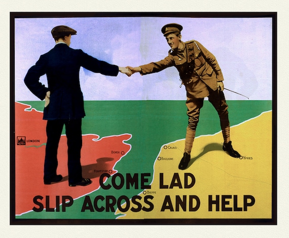 Come Lad Slip Across and Help!, vintage war poster on durable cotton canvas, 50 x 70 cm, 20 x 25" approx.
$41.37
Come Lad Slip Across and Help!, vintage war poster on durable cotton canvas, 50 x 70 cm, 20 x 25" approx.
$41.37
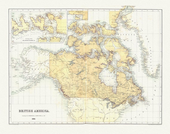 British America, 1856, map on heavy cotton canvas, 50 x 70 cm, 20 x 25" approx.
$41.37
British America, 1856, map on heavy cotton canvas, 50 x 70 cm, 20 x 25" approx.
$41.37
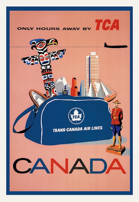 Canada, By Trans-Canada Airways, travel poster on heavy cotton canvas, 20x25" approx.
$41.37
Canada, By Trans-Canada Airways, travel poster on heavy cotton canvas, 20x25" approx.
$41.37
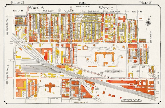 Plate 21, Toronto West, Parkdale, Gladstone Hotel, Asylum, 1924, map on heavy cotton canvas, 20 x 30" or 50 x 75cm. approx.
$41.37
Plate 21, Toronto West, Parkdale, Gladstone Hotel, Asylum, 1924, map on heavy cotton canvas, 20 x 30" or 50 x 75cm. approx.
$41.37
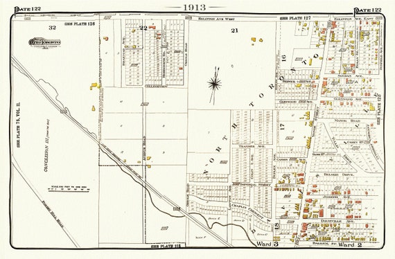 Plate 122, Toronto North, Forest Hill, Uptown, 1913, map on heavy cotton canvas, 20 x 30" or 50 x 75cm. approx.
$41.37
Plate 122, Toronto North, Forest Hill, Uptown, 1913, map on heavy cotton canvas, 20 x 30" or 50 x 75cm. approx.
$41.37
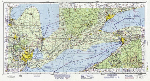 Aeronautical Chart, Ontario, South Western Section, 1970, map on heavy cotton canvas, 20 x 27" approx.
$41.37
Aeronautical Chart, Ontario, South Western Section, 1970, map on heavy cotton canvas, 20 x 27" approx.
$41.37
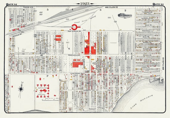 Plate 84, Toronto West, New Toronto, 1923, Map on heavy cotton canvas, 18x27in. approx.
$41.37
Plate 84, Toronto West, New Toronto, 1923, Map on heavy cotton canvas, 18x27in. approx.
$41.37
 Rossi, Romani Imperii Qua Occidens est Descriptio, 1669, map on heavy cotton canvas, 22x27" approx.
$41.37
Rossi, Romani Imperii Qua Occidens est Descriptio, 1669, map on heavy cotton canvas, 22x27" approx.
$41.37