
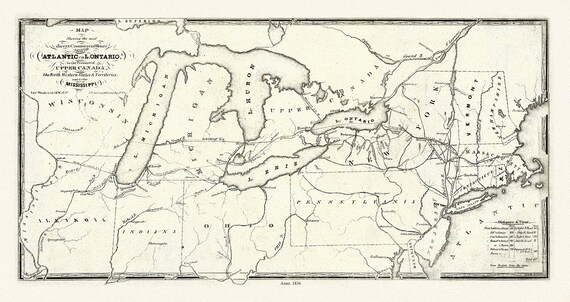
 Price, Map showing the direct commercial route from the Atlantic via L. Ontario, to the province of Upper Canada, Mississippi, 1836, 18x27"
$41.48
Price, Map showing the direct commercial route from the Atlantic via L. Ontario, to the province of Upper Canada, Mississippi, 1836, 18x27"
$41.48
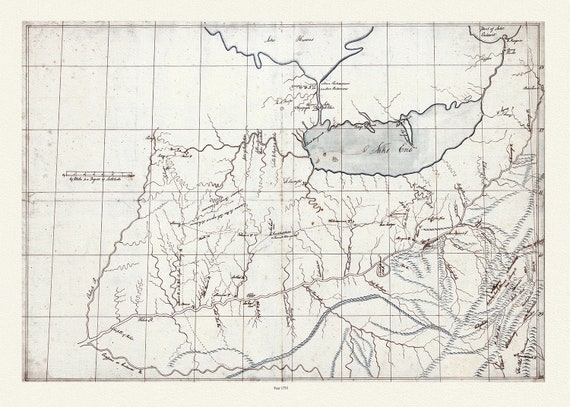 Patten, A trader's map of the Ohio country before 1753, map on heavy cotton canvas, 22x27" approx.
$41.48
Patten, A trader's map of the Ohio country before 1753, map on heavy cotton canvas, 22x27" approx.
$41.48
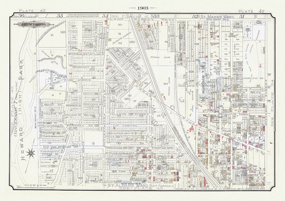 Plate 42A ,Toronto West, High Park to Brockton, 1903 Ver. II, map on heavy cotton canvas, 20 x 30" or 50 x 75cm. approx.
$41.48
Plate 42A ,Toronto West, High Park to Brockton, 1903 Ver. II, map on heavy cotton canvas, 20 x 30" or 50 x 75cm. approx.
$41.48
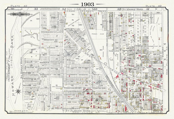 Plate 42, Toronto West, High Park to Brockton, Roncesvalles Village, 1903 Version I
$41.48
Plate 42, Toronto West, High Park to Brockton, Roncesvalles Village, 1903 Version I
$41.48
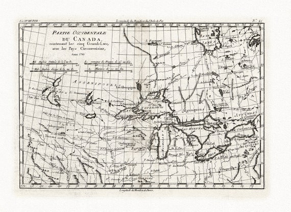 Bonne, Partie Occidentale du Canada, contenant les Cinq Grands Lacs, avec les pays circonvoisins, 1780, map on cotton canvas, 22x27" approx.
$41.48
Bonne, Partie Occidentale du Canada, contenant les Cinq Grands Lacs, avec les pays circonvoisins, 1780, map on cotton canvas, 22x27" approx.
$41.48
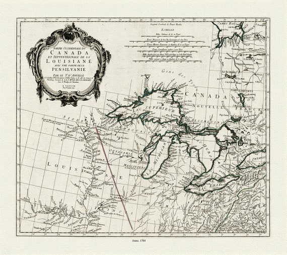 Anville et al., Partie occidentale du Canada et septentrionale de la Louisiane avec une partie de la Pensilvanie, 1784 , on canvas 22x27"
$41.48
Anville et al., Partie occidentale du Canada et septentrionale de la Louisiane avec une partie de la Pensilvanie, 1784 , on canvas 22x27"
$41.48
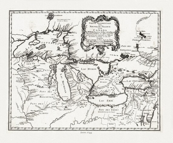
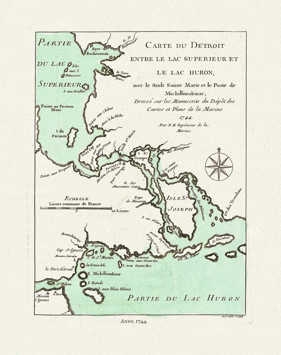 Bellin, Carte du Detroit entre le Lac Superieur et Huron, avec le Sault Ste. Marie, 1744, map on heavy cotton canvas, 22x27" approx.
$41.48
Bellin, Carte du Detroit entre le Lac Superieur et Huron, avec le Sault Ste. Marie, 1744, map on heavy cotton canvas, 22x27" approx.
$41.48
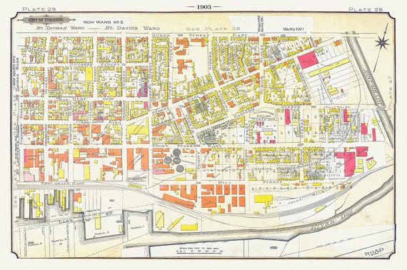 Plate 29, Toronto Downtown East, Corktown & Distillery, 1903, map on heavy cotton canvas, 20 x 30" or 50 x 75cm. approx
$41.48
Plate 29, Toronto Downtown East, Corktown & Distillery, 1903, map on heavy cotton canvas, 20 x 30" or 50 x 75cm. approx
$41.48
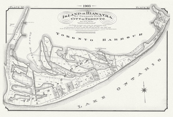 Plate 30, Toronto, Island of Hiawatha, 1903 , map on heavy cotton canvas, 20 x 30", 50 x 76cm, approx.
$41.48
Plate 30, Toronto, Island of Hiawatha, 1903 , map on heavy cotton canvas, 20 x 30", 50 x 76cm, approx.
$41.48
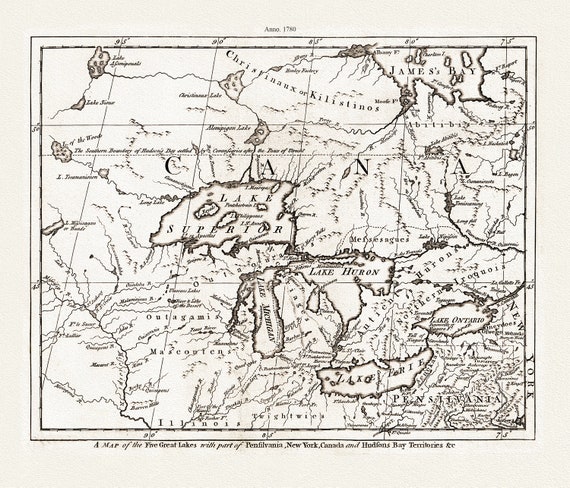 A Map of the Five Great Lakes with part of Pensilvania, New York, Canada, and Hudsons Bay Territories &c., 1780, on cotton canvas, 22x27"
$41.48
A Map of the Five Great Lakes with part of Pensilvania, New York, Canada, and Hudsons Bay Territories &c., 1780, on cotton canvas, 22x27"
$41.48
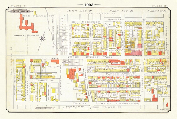 Plate 17, Toronto West, Parkdale & Trinity College, 1903, map on heavy cotton canvas, 20 x 30", 50 x 76cm, approx.
$41.48
Plate 17, Toronto West, Parkdale & Trinity College, 1903, map on heavy cotton canvas, 20 x 30", 50 x 76cm, approx.
$41.48
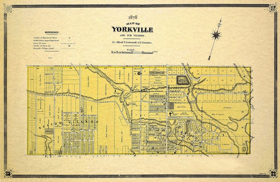 Cotterell, Yorkville, County of York, 1878 Ver.II, map on heavy cotton canvas, 22x27" approx.
$41.48
Cotterell, Yorkville, County of York, 1878 Ver.II, map on heavy cotton canvas, 22x27" approx.
$41.48
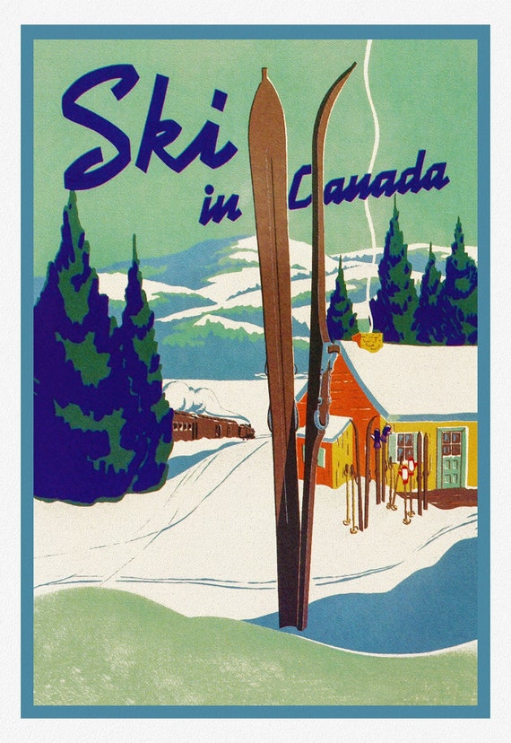 Ski in Canada! , travel poster on heavy cotton canvas, 20x25" approx.
$41.48
Ski in Canada! , travel poster on heavy cotton canvas, 20x25" approx.
$41.48
 Bellin, Partie occidentale de la Nouvelle France ou du Canada, 1744 , map on heavy cotton canvas, 22x27" approx.
$41.48
Bellin, Partie occidentale de la Nouvelle France ou du Canada, 1744 , map on heavy cotton canvas, 22x27" approx.
$41.48
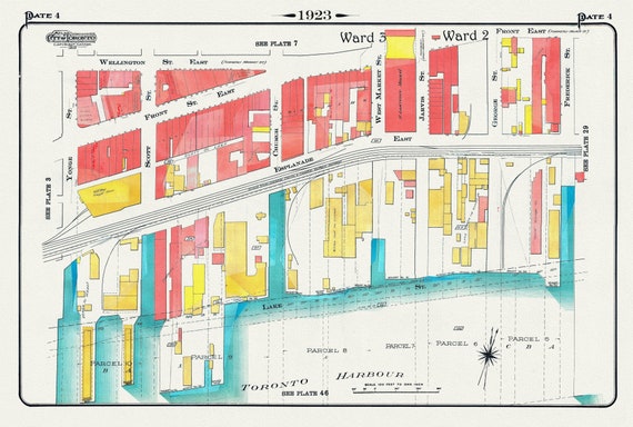 Plate 4, Toronto Downtown Waterfront, Esplanade, 1923, Map on heavy cotton canvas, 19x27in. approx.
$41.48
Plate 4, Toronto Downtown Waterfront, Esplanade, 1923, Map on heavy cotton canvas, 19x27in. approx.
$41.48
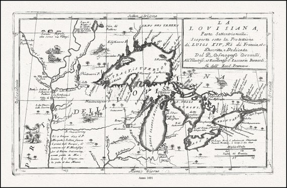 Coronelli, La Louisiana, Parte Settentrionalle, Scoperta sotto Protettione di Luigi XIV, Re di Francia, 1691, cotton canvas, 22x27" approx.
$41.48
Coronelli, La Louisiana, Parte Settentrionalle, Scoperta sotto Protettione di Luigi XIV, Re di Francia, 1691, cotton canvas, 22x27" approx.
$41.48
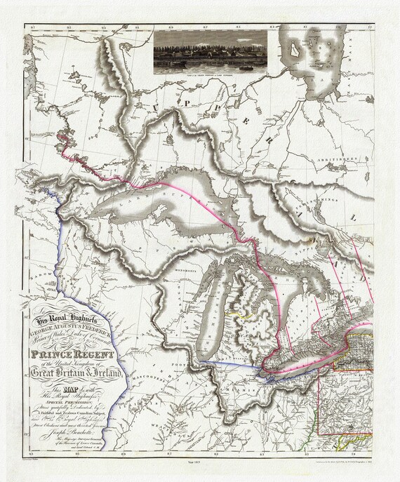 Bouchette et Faden, West sheet, Map of the Provinces of Upper and Lower Canada,etc.,1815, map on heavy cotton canvas, 22x27" approx.
$41.48
Bouchette et Faden, West sheet, Map of the Provinces of Upper and Lower Canada,etc.,1815, map on heavy cotton canvas, 22x27" approx.
$41.48
 Bellin, Carte des Cinq Grande Lacs du Canada, 1764, map on heavy cotton canvas, 22x27" approx.
$41.48
Bellin, Carte des Cinq Grande Lacs du Canada, 1764, map on heavy cotton canvas, 22x27" approx.
$41.48
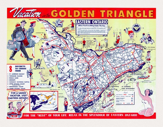 Eastern Ontario, Vacation map and guide, 1959 , map on heavy cotton canvas, 22x27" approx.
$41.48
Eastern Ontario, Vacation map and guide, 1959 , map on heavy cotton canvas, 22x27" approx.
$41.48
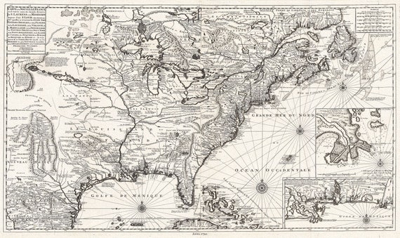 Carte de la Nouvelle France, 1720, Van Keulen, map on heavy cotton canvas, 50 x 70cm, 20 x 25" approx.
$41.48
Carte de la Nouvelle France, 1720, Van Keulen, map on heavy cotton canvas, 50 x 70cm, 20 x 25" approx.
$41.48