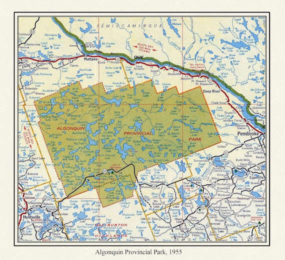
 Algonquin Provincial Park, 1955 , map on heavy cotton canvas, 22x27" approx.
$33.98
Algonquin Provincial Park, 1955 , map on heavy cotton canvas, 22x27" approx.
$33.98
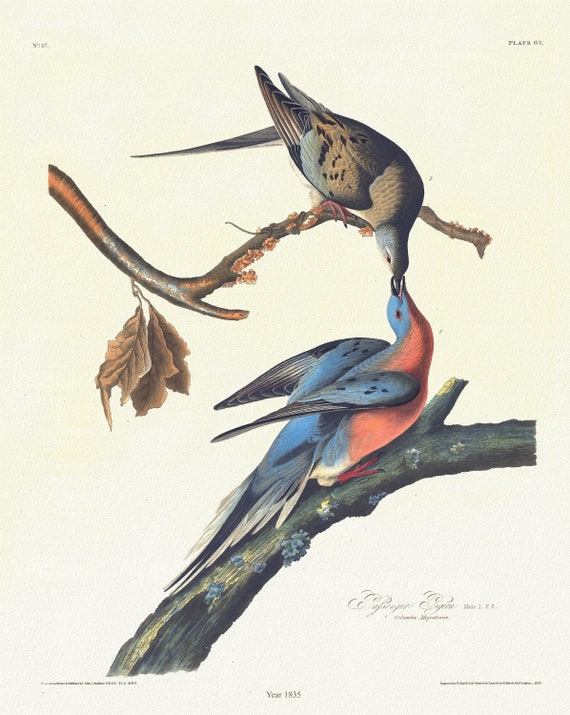 J.J. Audubon, Passenger pigeon. Male, 1. F, 2. Columba migratoria, 1835, vintage nature print on canvas, 50 x 70 cm, 20 x 25" approx.
$33.98
J.J. Audubon, Passenger pigeon. Male, 1. F, 2. Columba migratoria, 1835, vintage nature print on canvas, 50 x 70 cm, 20 x 25" approx.
$33.98
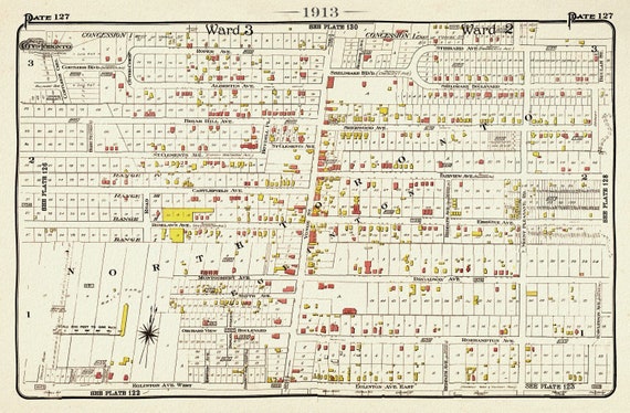 Plate 127, Toronto North, Eglinton & Yonge, 1913, map on heavy cotton canvas, 20 x 30" or 50 x 75cm. approx.
$33.98
Plate 127, Toronto North, Eglinton & Yonge, 1913, map on heavy cotton canvas, 20 x 30" or 50 x 75cm. approx.
$33.98
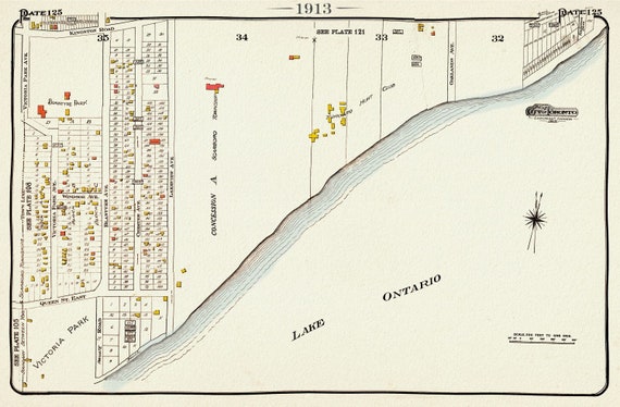 Plate 125, Toronto East, Scarborough, Victoria Park, 1913, map on heavy cotton canvas, 20 x 30" or 50 x 75cm. approx.
$33.98
Plate 125, Toronto East, Scarborough, Victoria Park, 1913, map on heavy cotton canvas, 20 x 30" or 50 x 75cm. approx.
$33.98
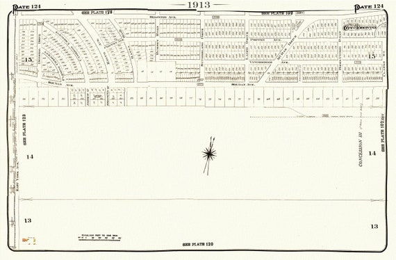 Plate 124, Toronto Uptown East, Leaside, 1913, map on heavy cotton canvas, 20 x 30" or 50 x 75cm. approx.
$33.98
Plate 124, Toronto Uptown East, Leaside, 1913, map on heavy cotton canvas, 20 x 30" or 50 x 75cm. approx.
$33.98
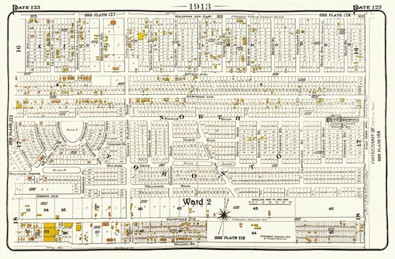 Plate 123, Toronto North and East, 1913, map on heavy cotton canvas, 20 x 30" or 50 x 75cm. approx.
$33.98
Plate 123, Toronto North and East, 1913, map on heavy cotton canvas, 20 x 30" or 50 x 75cm. approx.
$33.98
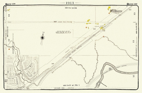 Plate 120, Toronto Uptown East, Leaside Station, 1913, map on heavy cotton canvas, 20 x 30" or 50 x 75cm. approx.
$33.98
Plate 120, Toronto Uptown East, Leaside Station, 1913, map on heavy cotton canvas, 20 x 30" or 50 x 75cm. approx.
$33.98
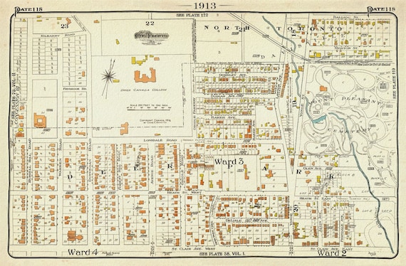 Plate 118, Toronto Uptown West, UCC, St.Clair, 1913, map on heavy cotton canvas, 20 x 30" or 50 x 75cm. approx.
$33.98
Plate 118, Toronto Uptown West, UCC, St.Clair, 1913, map on heavy cotton canvas, 20 x 30" or 50 x 75cm. approx.
$33.98
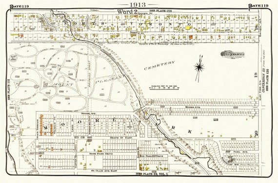 Plate 119, Toronto Uptown, Davisville, Mount. Pleasant Cemetery, 1913, map on heavy cotton canvas, 20 x 30" or 50 x 75cm. approx.
$33.98
Plate 119, Toronto Uptown, Davisville, Mount. Pleasant Cemetery, 1913, map on heavy cotton canvas, 20 x 30" or 50 x 75cm. approx.
$33.98
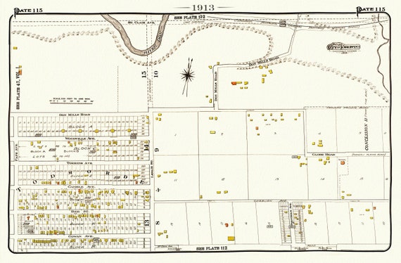 Plate 115, Toronto East, Danforth, Todmorden, 1913, map on heavy cotton canvas, 20 x 30" or 50 x 75cm. approx.
$33.98
Plate 115, Toronto East, Danforth, Todmorden, 1913, map on heavy cotton canvas, 20 x 30" or 50 x 75cm. approx.
$33.98
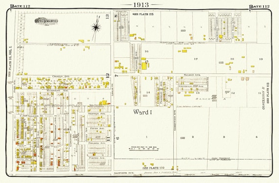 Plate 112, Toronto East, Danforth Pape, Leslie North, 1913, map on heavy cotton canvas, 20 x 30" or 50 x 75cm. approx.
$33.98
Plate 112, Toronto East, Danforth Pape, Leslie North, 1913, map on heavy cotton canvas, 20 x 30" or 50 x 75cm. approx.
$33.98
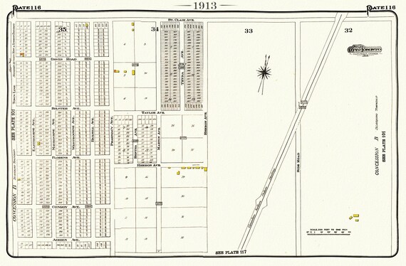 Plate 116, Toronto East, Scarborough, Pharmacy, St. Clair E.,1913, map on heavy cotton canvas, 20 x 30" or 50 x 75cm. approx.
$33.98
Plate 116, Toronto East, Scarborough, Pharmacy, St. Clair E.,1913, map on heavy cotton canvas, 20 x 30" or 50 x 75cm. approx.
$33.98
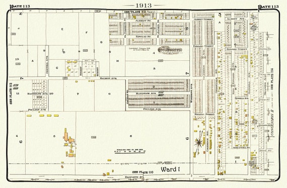 Plate 113, Toronto East, Danforth & Woodbine North, 1913, map on heavy cotton canvas, 20 x 30" or 50 x 75cm. approx.
$33.98
Plate 113, Toronto East, Danforth & Woodbine North, 1913, map on heavy cotton canvas, 20 x 30" or 50 x 75cm. approx.
$33.98
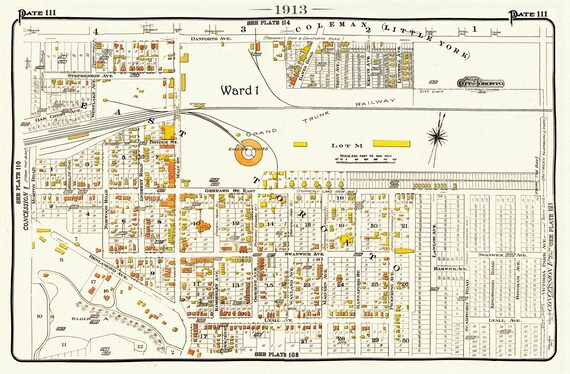 Plate 111, Toronto East, Danforth& Main, Little York, 1913, map on heavy cotton canvas, 20 x 30" or 50 x 75cm. approx.
$33.98
Plate 111, Toronto East, Danforth& Main, Little York, 1913, map on heavy cotton canvas, 20 x 30" or 50 x 75cm. approx.
$33.98
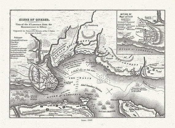 Smith, Siege of Quebec Plan of the St. Lawrence from the Montmorenci to Sillery, 1849 , map on heavy cotton canvas, 20 x 25" approx.
$33.98
Smith, Siege of Quebec Plan of the St. Lawrence from the Montmorenci to Sillery, 1849 , map on heavy cotton canvas, 20 x 25" approx.
$33.98
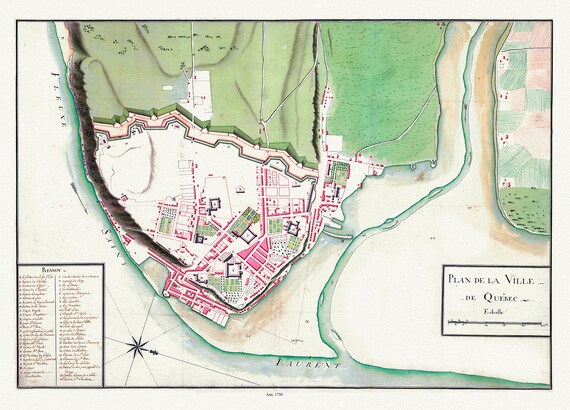 Plan de la ville de Québec, 1750 , map on heavy cotton canvas, 20 x 25" approx.
$33.98
Plan de la ville de Québec, 1750 , map on heavy cotton canvas, 20 x 25" approx.
$33.98
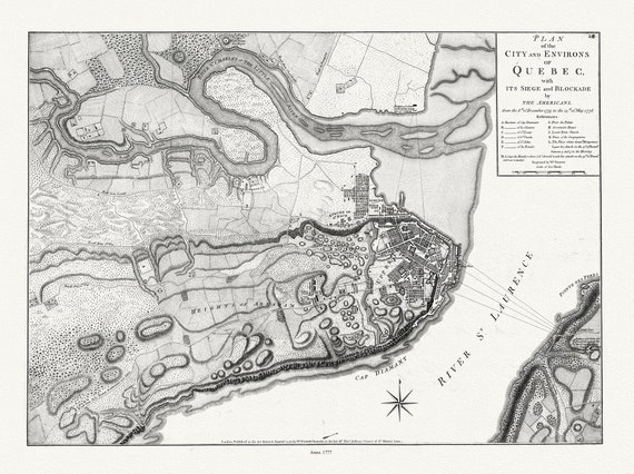 Plan of the city and environs of Quebec with its siege and blockade by the Americans, from 1775 to 1776 Ver. I, 22x27" canvas
$33.98
Plan of the city and environs of Quebec with its siege and blockade by the Americans, from 1775 to 1776 Ver. I, 22x27" canvas
$33.98
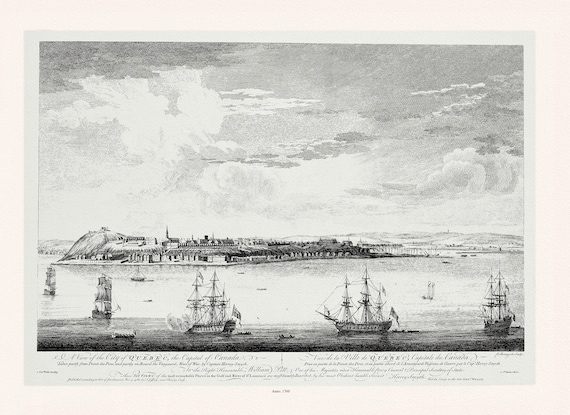 Pitt, Vue de la ville du Québec, capitale du Canada, 1760, map on heavy cotton canvas, 20x27" approx.
$33.98
Pitt, Vue de la ville du Québec, capitale du Canada, 1760, map on heavy cotton canvas, 20x27" approx.
$33.98
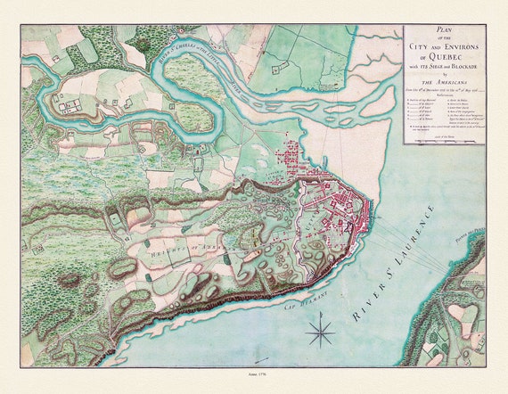 Plan of the city and environs of Quebec, with its siege and blockade by the Americans from 1775-1776,, map on cotton canvas, 20x27" approx.
$33.98
Plan of the city and environs of Quebec, with its siege and blockade by the Americans from 1775-1776,, map on cotton canvas, 20x27" approx.
$33.98
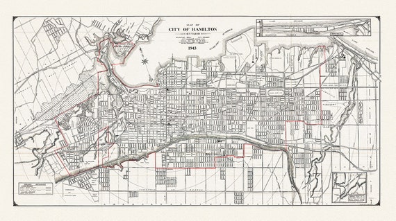 Map of the City of Hamilton, Ontario, 1943, on heavy cotton canvas, 22x27" approx.
$33.98
Map of the City of Hamilton, Ontario, 1943, on heavy cotton canvas, 22x27" approx.
$33.98