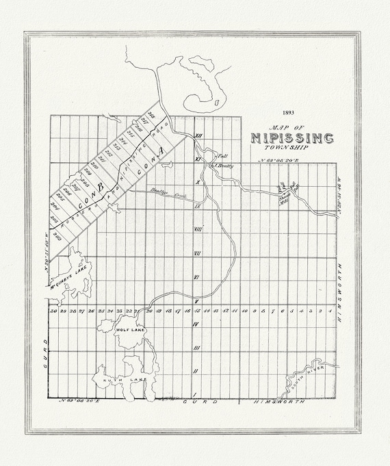
 Muskoka-Haliburton, Nipissing Township, 1893, map on heavy cotton canvas, 20 x 25" approx.
$40.18
Muskoka-Haliburton, Nipissing Township, 1893, map on heavy cotton canvas, 20 x 25" approx.
$40.18
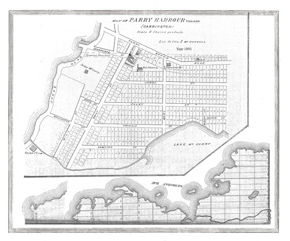 Muskoka-Haliburton, Parry Harbour Village, 1893, map on heavy cotton canvas, 20 x 25" approx.
$40.18
Muskoka-Haliburton, Parry Harbour Village, 1893, map on heavy cotton canvas, 20 x 25" approx.
$40.18
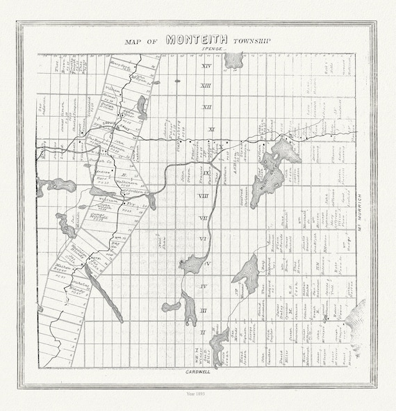 Muskoka-Haliburton, Monteith Township, 1893 , map on heavy cotton canvas, 20 x 25" approx.
$40.18
Muskoka-Haliburton, Monteith Township, 1893 , map on heavy cotton canvas, 20 x 25" approx.
$40.18
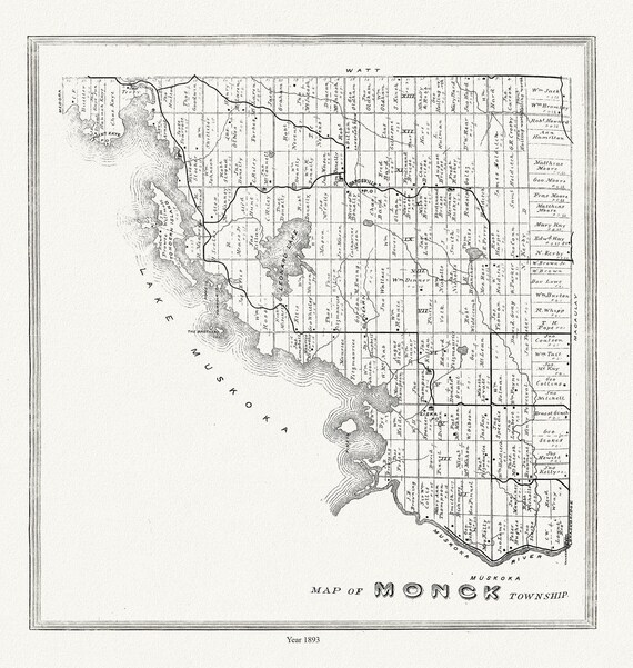 Muskoka-Haliburton, Monck Township, 1893, map on heavy cotton canvas, 20 x 25" approx.
$40.18
Muskoka-Haliburton, Monck Township, 1893, map on heavy cotton canvas, 20 x 25" approx.
$40.18
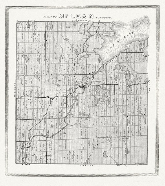 Muskoka-Haliburton, McLean Township, 1893, map on heavy cotton canvas, 20 x 25" approx.
$40.18
Muskoka-Haliburton, McLean Township, 1893, map on heavy cotton canvas, 20 x 25" approx.
$40.18
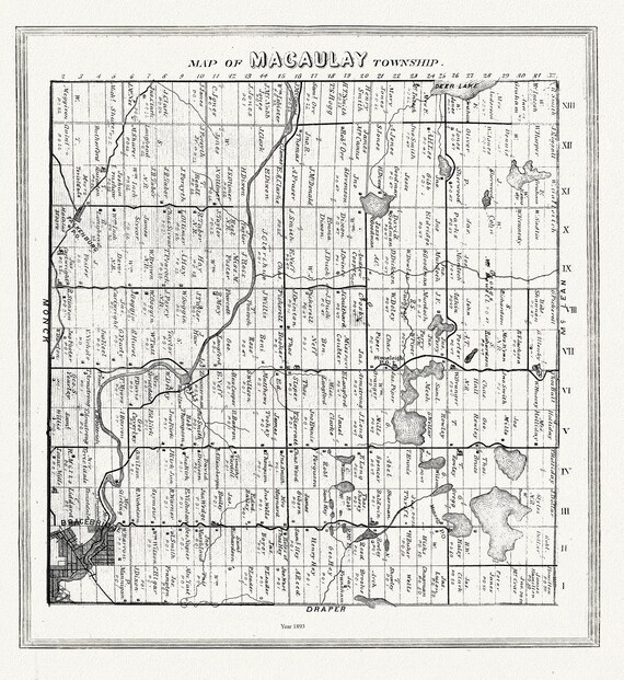 Muskoka-Haliburton, Macauley Township, 1893, map on heavy cotton canvas, 20 x 25" approx.
$40.18
Muskoka-Haliburton, Macauley Township, 1893, map on heavy cotton canvas, 20 x 25" approx.
$40.18
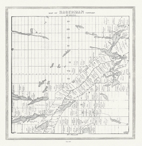 Muskoka-Haliburton, Hagerman Township, 1893, map on heavy cotton canvas, 20 x 25" approx.
$40.18
Muskoka-Haliburton, Hagerman Township, 1893, map on heavy cotton canvas, 20 x 25" approx.
$40.18
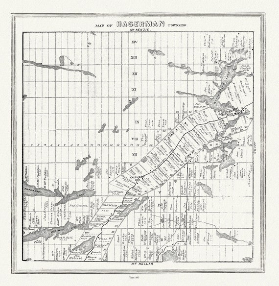 Muskoka-Haliburton, Hagerman Township, 1893 , map on heavy cotton canvas, 20 x 25" approx.
$40.18
Muskoka-Haliburton, Hagerman Township, 1893 , map on heavy cotton canvas, 20 x 25" approx.
$40.18
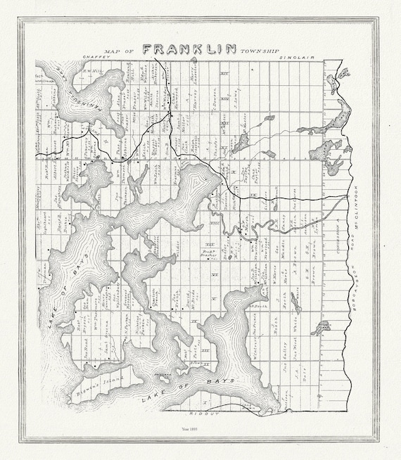 Muskoka-Haliburton, Franklin Township, 1893, map on heavy cotton canvas, 20 x 25" approx.
$40.18
Muskoka-Haliburton, Franklin Township, 1893, map on heavy cotton canvas, 20 x 25" approx.
$40.18
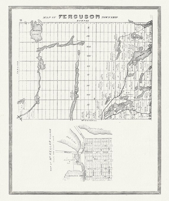 Muskoka-Haliburton, Ferguson Township, 1893, map on heavy cotton canvas, 20 x 25" approx.
$40.18
Muskoka-Haliburton, Ferguson Township, 1893, map on heavy cotton canvas, 20 x 25" approx.
$40.18
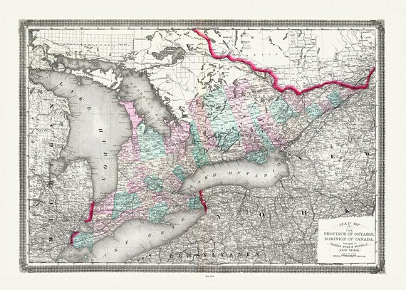 Ontario, Canada, Taintor Brothers & Merrill auth., 1874
$40.18
Ontario, Canada, Taintor Brothers & Merrill auth., 1874
$40.18
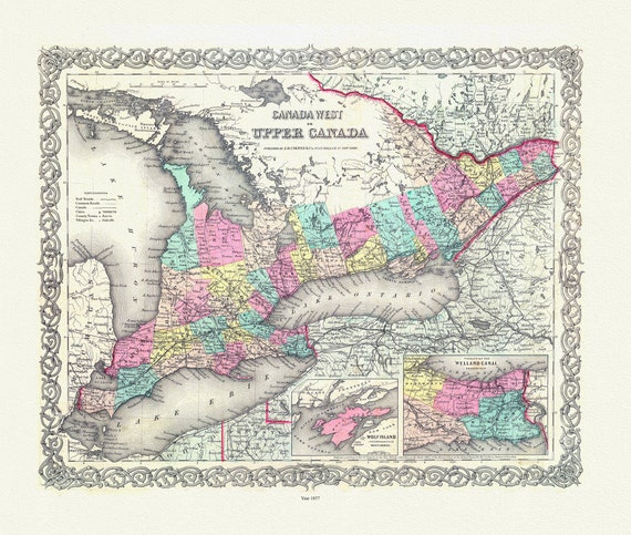 EOntario: Upper Canada. 1857
$40.18
EOntario: Upper Canada. 1857
$40.18
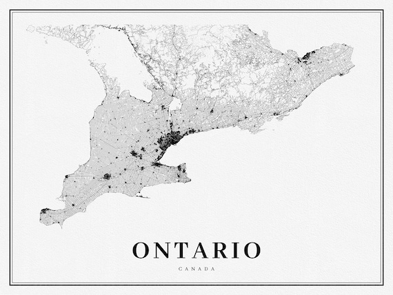 Southern Ontario, A Modern Map, on heavy cotton canvas, 50 x 70 cm, 20 x 25" approx.
$40.18
Southern Ontario, A Modern Map, on heavy cotton canvas, 50 x 70 cm, 20 x 25" approx.
$40.18
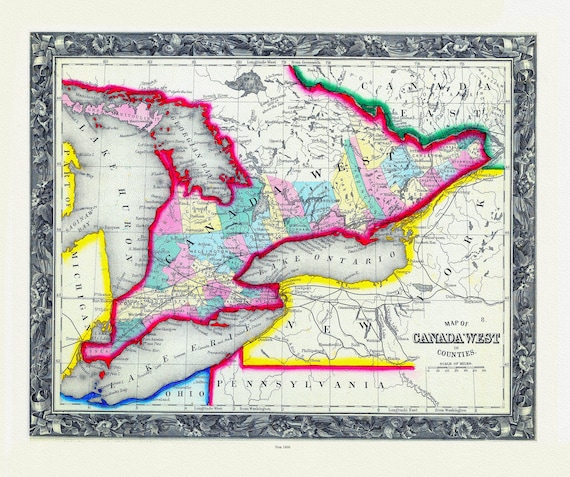 Map Of Canada West, In Counties, 1860
$40.18
Map Of Canada West, In Counties, 1860
$40.18
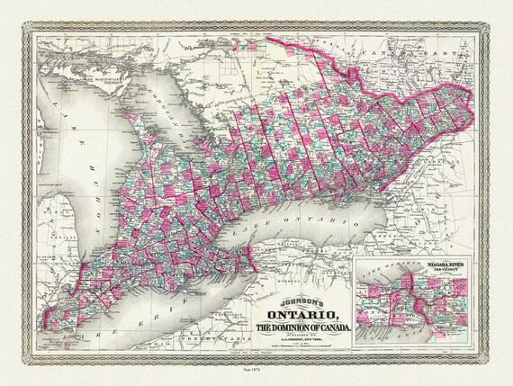 Ontario of the Dominion of Canada, Johnson auth., 1874 , map on heavy cotton canvas, 50 x 70 cm, 20 x 25" approx.
$40.18
Ontario of the Dominion of Canada, Johnson auth., 1874 , map on heavy cotton canvas, 50 x 70 cm, 20 x 25" approx.
$40.18
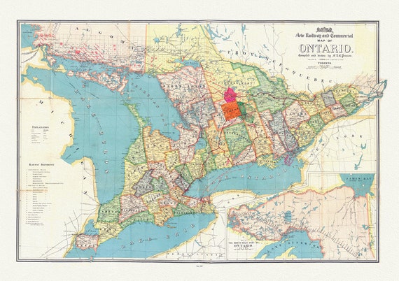 Penson, A New Railway and Commercial Map of Ontario,1887 Ver. II , map on heavy cotton canvas, 50 x 70 cm, 20 x 25" approx.
$40.18
Penson, A New Railway and Commercial Map of Ontario,1887 Ver. II , map on heavy cotton canvas, 50 x 70 cm, 20 x 25" approx.
$40.18
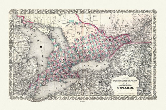 Colton, The Dominion of Canada No. 2., The Province of Ontario, Colton, 1880, map on heavy cotton canvas, 50 x 70 cm, 20 x 25" approx.
$40.18
Colton, The Dominion of Canada No. 2., The Province of Ontario, Colton, 1880, map on heavy cotton canvas, 50 x 70 cm, 20 x 25" approx.
$40.18
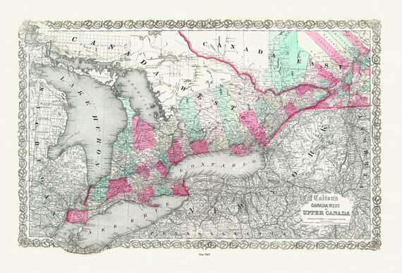 Ontario: Canada West or Upper Canada, Colton auth., 1865 , map on heavy cotton canvas, 50 x 70 cm, 20 x 25" approx.
$40.18
Ontario: Canada West or Upper Canada, Colton auth., 1865 , map on heavy cotton canvas, 50 x 70 cm, 20 x 25" approx.
$40.18
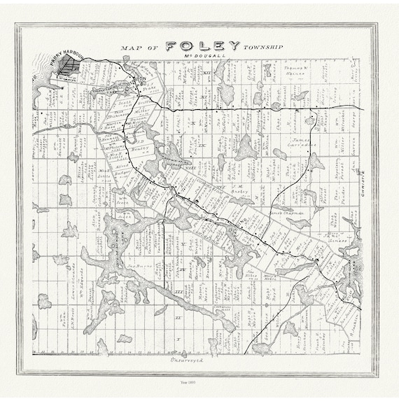 Muskoka-Haliburton, Foley Township, 1893, map on heavy cotton canvas, 20 x 25" approx.
$40.18
Muskoka-Haliburton, Foley Township, 1893, map on heavy cotton canvas, 20 x 25" approx.
$40.18
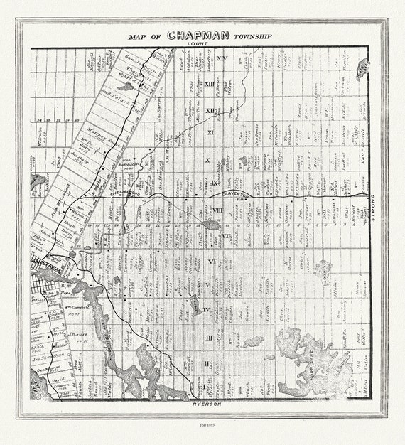 Muskoka-Haliburton, Chapman Township, 1893 , map on heavy cotton canvas, 20 x 25" approx.
$40.18
Muskoka-Haliburton, Chapman Township, 1893 , map on heavy cotton canvas, 20 x 25" approx.
$40.18